


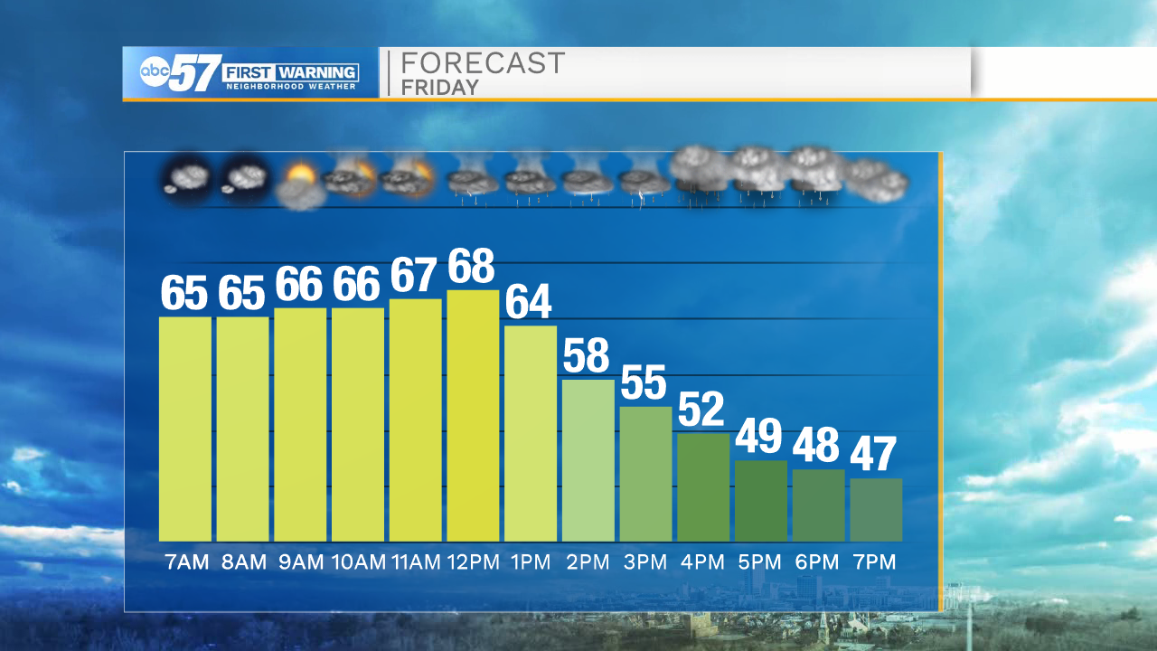
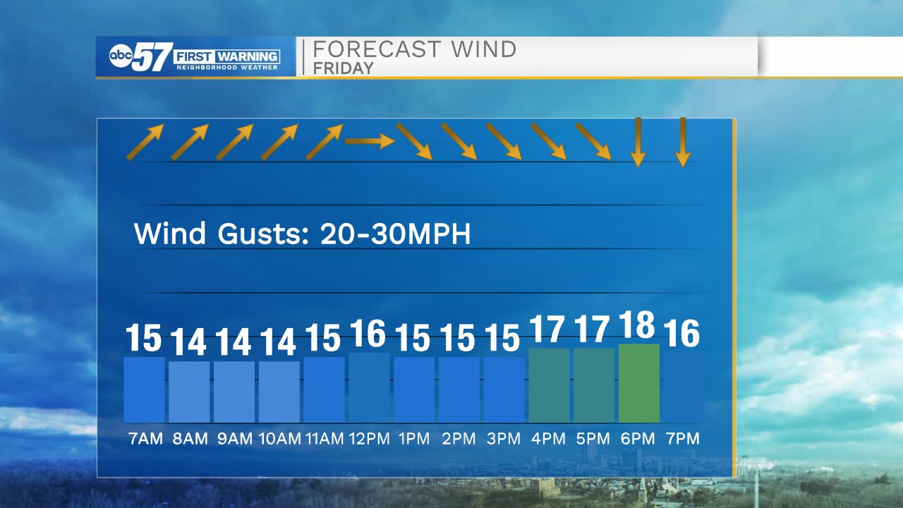
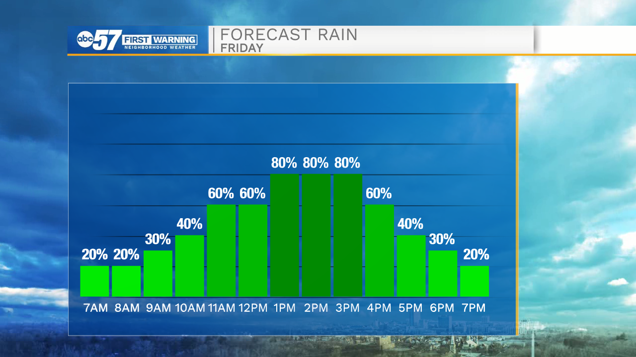
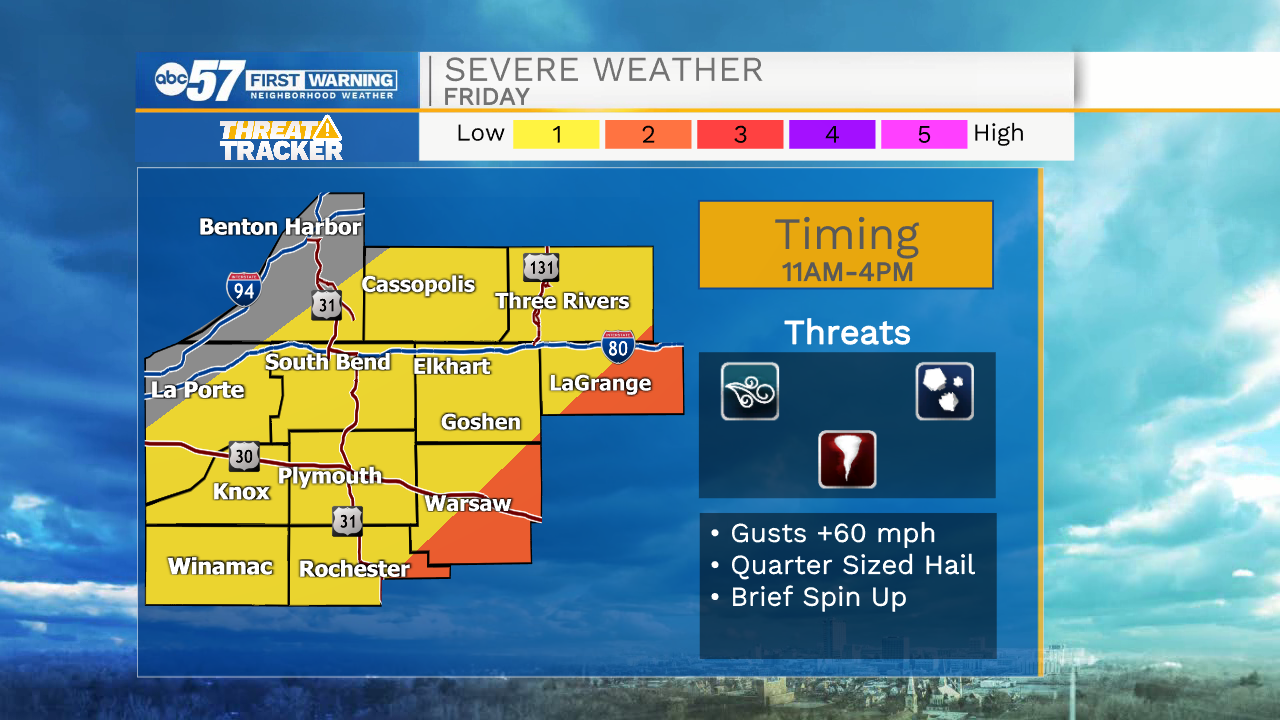
A cold front will move in around lunchtime today bringing rain and storm chances along with it. A few of those storms could be on the strong to low end severe side with the primary threats of quarter sized hail and wind gusts up to 60mph. There is a very low tornado potential, primarily for counties in eastern Michiana. After the front moves through wind gusts up to 30mph will be possible this afternoon. Temperatures will drop into the lower 50s by 4pm. Tonight a few isolated lake effect rain showers are possible, but Saturday is looking mostly dry throughout, with even a little sunshine by the afternoon. Highs tomorrow will be in the lower 50s.
Sunday through the middle part of next week, rain chances remain in the forecast with mostly cloudy skies. High temperatures next week will be in the upper 40s and lower 50s.
Today: Scattered showers and storms. High 68.
Tonight: Cloudy. Low 38.
Tomorrow: Partly cloudy. High 52.
Sunday: Mostly cloudy. High 51.