Strong system spawns severe weather and blizzard


The fall is a time when strong low pressure systems move across the United States as last gasps of warmth collide with arctic air that tries invading from Canada. These strong lows are famous for bringing strong winds, snow, warmth, and thunderstorms to those east of the Rocky Mountains. That is exactly what is happening Monday.
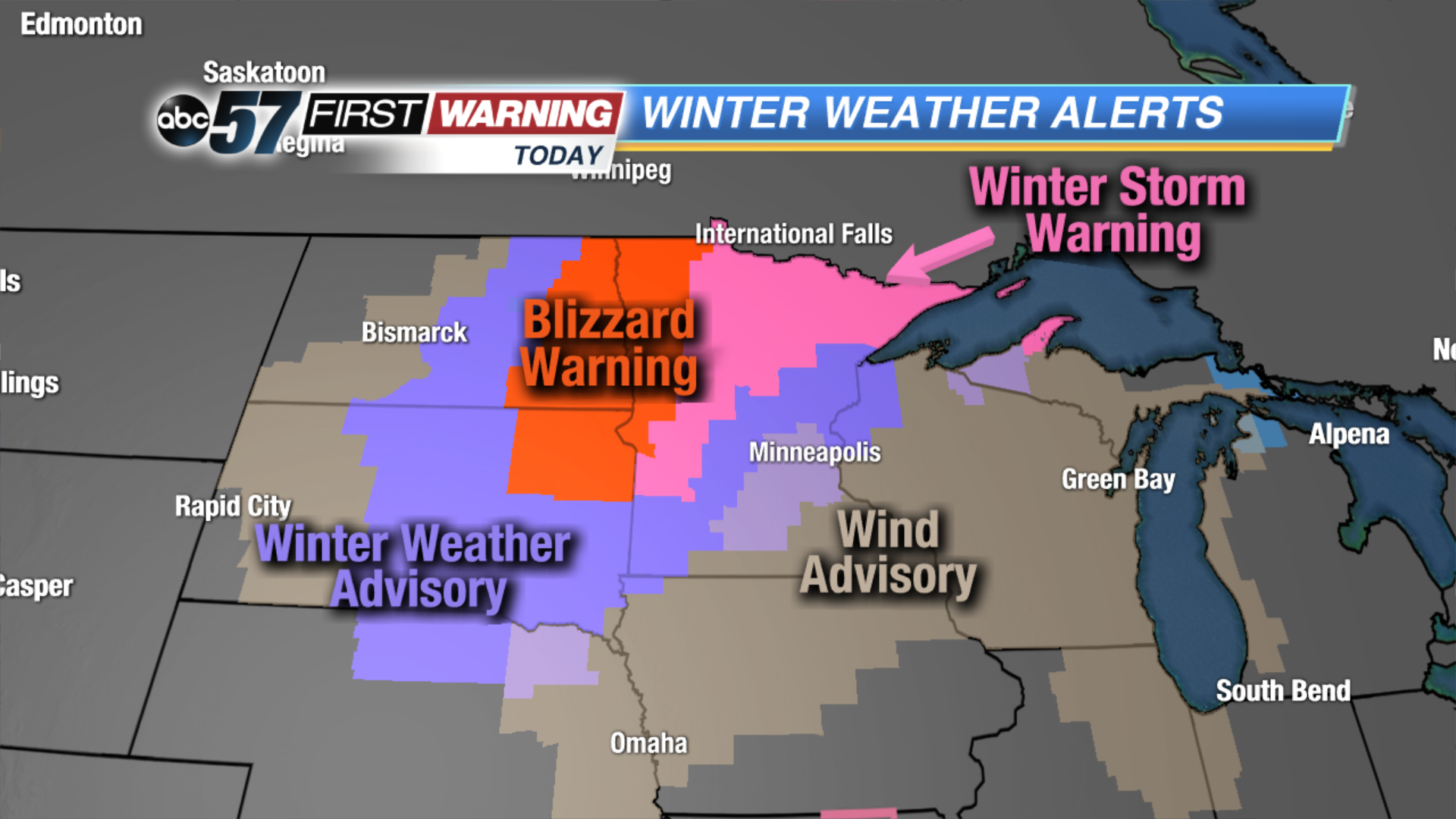
An area of low pressure and an associated cold front are swinging across the Midwest and Plains Monday afternoon. The low is very strong, which is leading to an expansive area of strong winds and associated Wind Advisories from the Dakotas to Michigan and Indiana. For Michiana, wind gusts of 40-45 MPH are distinctly possible. Not only that, but this strong low has a snowy and cold side, as well as a warm and stormy side. In fact, Blizzard Warnings and Winter Storm Warnings are up through Monday evening for portions of the Dakotas, Minnesota and the U.P. of Michigan. Not a lot of snow is expected to fall, but when you combine 2-5" with very strong winds, you get treacherous wintry conditions. As a result, you get the aforementioned winter headlines.
In the warm sector of the system you have temperatures approaching record highs in parts of Wisconsin, Iowa, Illinois, Indiana, Kansas, Missouri, Kentucky, Ohio, and Arkansas. That warmth is being brought north courtesy of strong southerly winds. Not only that, but these are the states that will see rain and even thunderstorms as the potent cold front swings by Monday evening into Monday night.
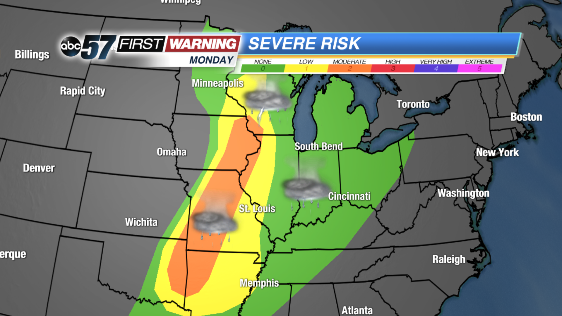
Even more, there are millions who could see strong to severe thunderstorms Monday evening. The areas in yellow and orange are under a risk for seeing damaging winds, isolated hail and perhaps a tornado or two. What's even more remarkable is the fact that there is a threat of severe weather in southeastern Minnesota while a blizzard is occurring in northwestern Minnesota! That is what these strong fall storms can do: bring two different weather extremes to areas that are close to one another. Sometimes these potent systems can lead to Blizzard Warnings being in effect at the same time as Severe Thunderstorm or Tornado Watches.
Michiana will dodge the wintry and severe threat, but we won't escape unscathed. We will continue to see strong wind gusts through the day Tuesday, in addition to a round of rain and isolated thunderstorms Monday evening and Monday night. Again, we don't expect severe weather, but a wind gust to 50 MPH cannot be ruled out due to the dynamics and overall strength of the storm system.