Summertime stormy pattern continues through most the week
By:
Tom Coomes
Posted: Jun 13, 2017 4:48 PM EDT

-
0:52

A slight warm-up but chilly weather still dominates
-
1:09

Bitterly cold out the door
-
3:03

Looking to younger generations to keep Dyngus Day thriving
-
3:06

Even as rivers recede, Marshall County still dealing with flooding
-
3:29

Michigan fans gather in Indianapolis ahead of National Championship...
-
3:22

Hamlet local and tow truck driver describes US 30 crash site...
-
4:28

Dyngus Day celebrations highlight voter turnout, transparency
-
4:54

Now-disbanded St. Joseph County Metro Homicide Unit investigator...
-
0:52

Shots fired on Sunnymede Avenue Saturday, cars and homes struck
-
1:18

Clouds returning and drizzle possible in the afternoon
-
0:57

The cold front passed us, the rain is done for now, and the chill...
-
0:31

Crash following police chase shuts down intersection in downtown...

The summertime weather pattern continues, hot and humid with scattered showers and storms. A round of storms is possible early Wednesday with a second around by the evening. That second round could be strong or severe with gusty wind, heavy rain and hail. Little change in this patter through Saturday.
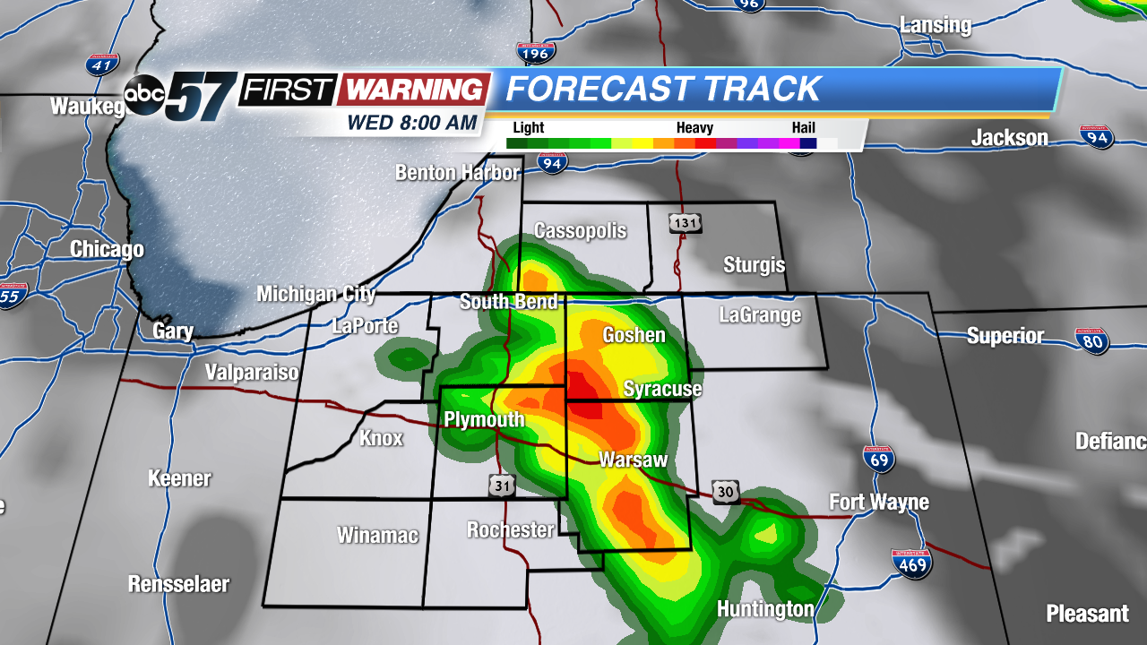 Forecast Track shows a chance of storms Wednesday morning. These are not expected to be strong / severe.
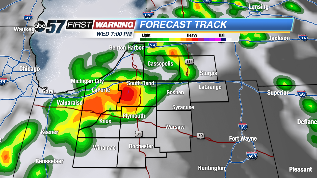 Forecast Track shows a second round of storms Wednesday evening. These could be strong to severe.
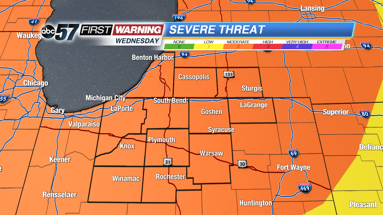 Severe threat is a 2 out of 5 for Wednesday. Meaning severe there is moderate confidence severe storms will occur.
Tonight: Partly to mostly cloudy, chance shower, low of 72.
Wednesday: Scattered showers and storms, more widespread by evening, high 90.
Thursday: Partly cloudy, isolated storms, high in the upper 80s.
Friday: Scattered storms, highs in the upper 80s.
Sign up for the ABC 57 Newsletter