


Enjoy a sunny and dry weekend. Both Saturday and Sunday will have highs in the upper 70s.
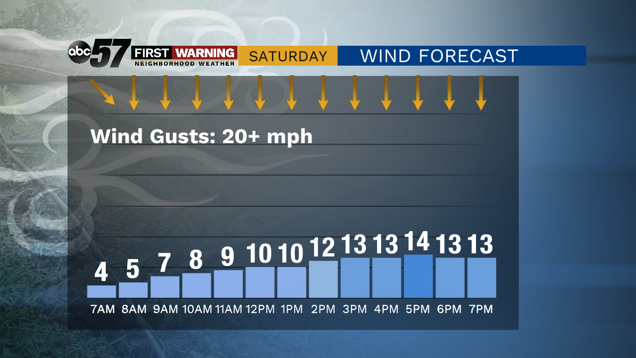
This afternoon, winds could be a little gusty at times. Higher waves are expected on Lake Michigan today-- it could be dangerous swimming condtions.
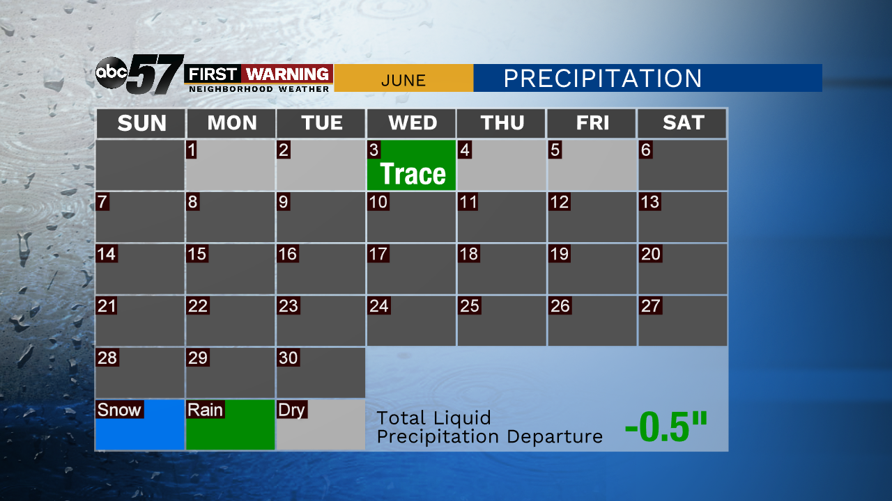
Humidity will be low this weekend. You will want to spend some time watering outdoor plants, as we continue our dry streak.
Heading into the week, a warming trend is in place, with temperatures Monday in the mid 80s and the low 90s by Tuesday. Tropical Storm Cristobal will finally bring rain to Michiana by Tuesday evening.
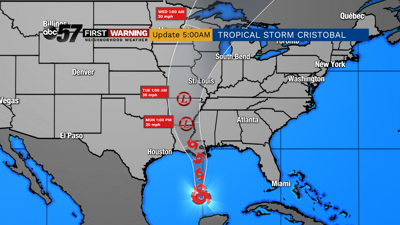
Thunderstorms are possible Tuesday overnight into Wednesday. Showers will likely continue Wednesday. This is expected to bring us around an inch of rain.
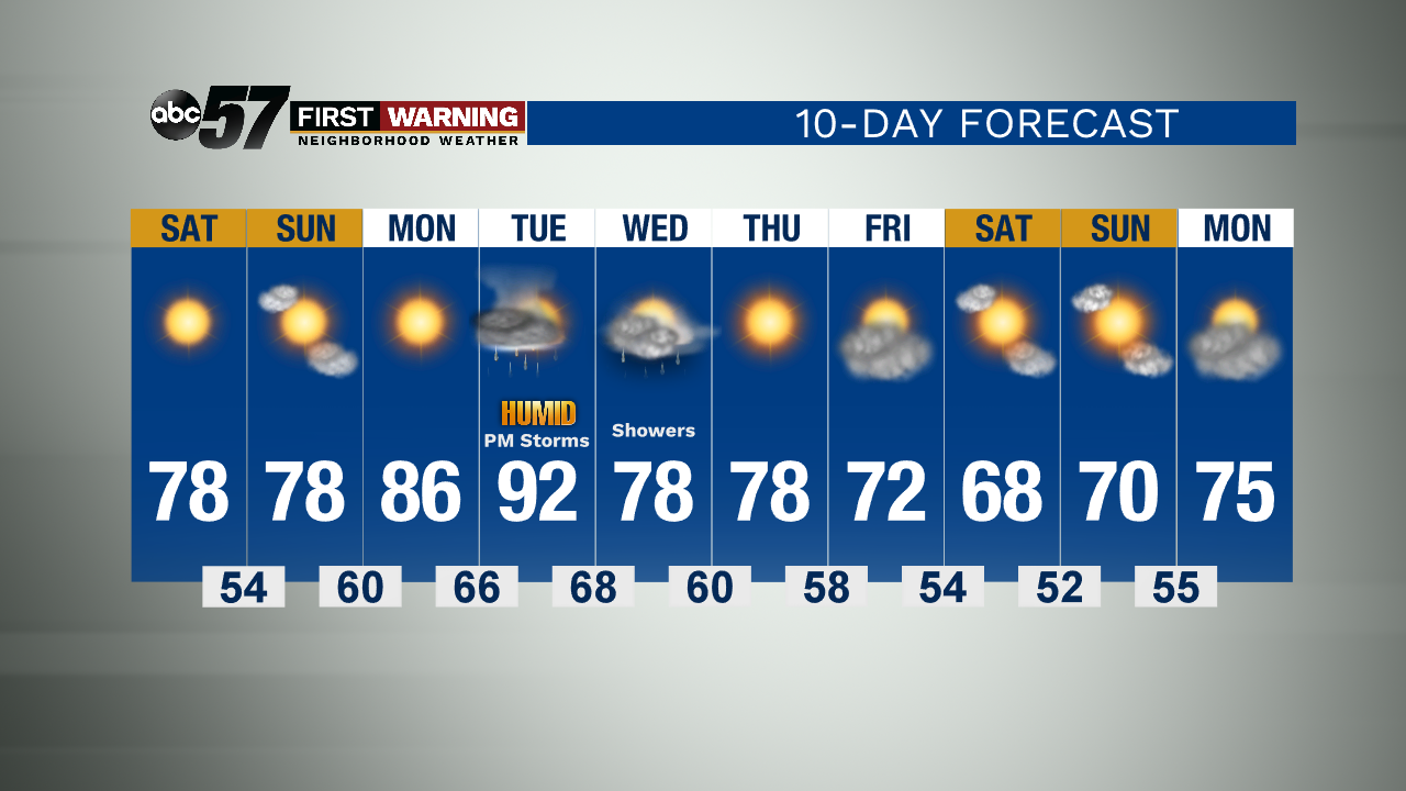
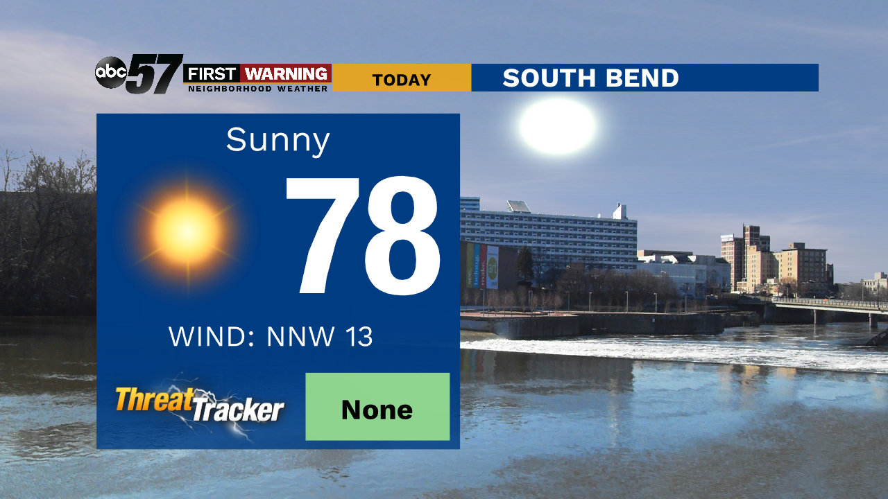
Today: Sunny. Breezy this afternoon. High 78.
Tonight: Mostly clear. Low 54.
Sunday: Mostly sunny. High 78.
Monday: Sunny. High 86.