
-
2:28

Kicking off day two of the Gus Macker Basketball Tournament
-
0:55

Enjoy this weekend
-
0:50

Beautiful weekend starts this morning
-
2:32

Gus Macker Three-on-Three Basketball Tournament is taking over...
-
1:44

Feeling like a sauna next week
-
3:12

How to keep yourself and others protected during firework season
-
0:49

Showers creeping into Michiana
-
1:32

Judge approves $25 million water lawsuit settlement in Benton...
-
1:00

Scattered showers through the day
-
1:53

Hispanic Community Child Safety Meeting: A Call To Action
-
2:51

Obama Presidential Center features work of South Bend company
-
1:54

This week’s ABC57 Cub Reporter is Isaac Knefely

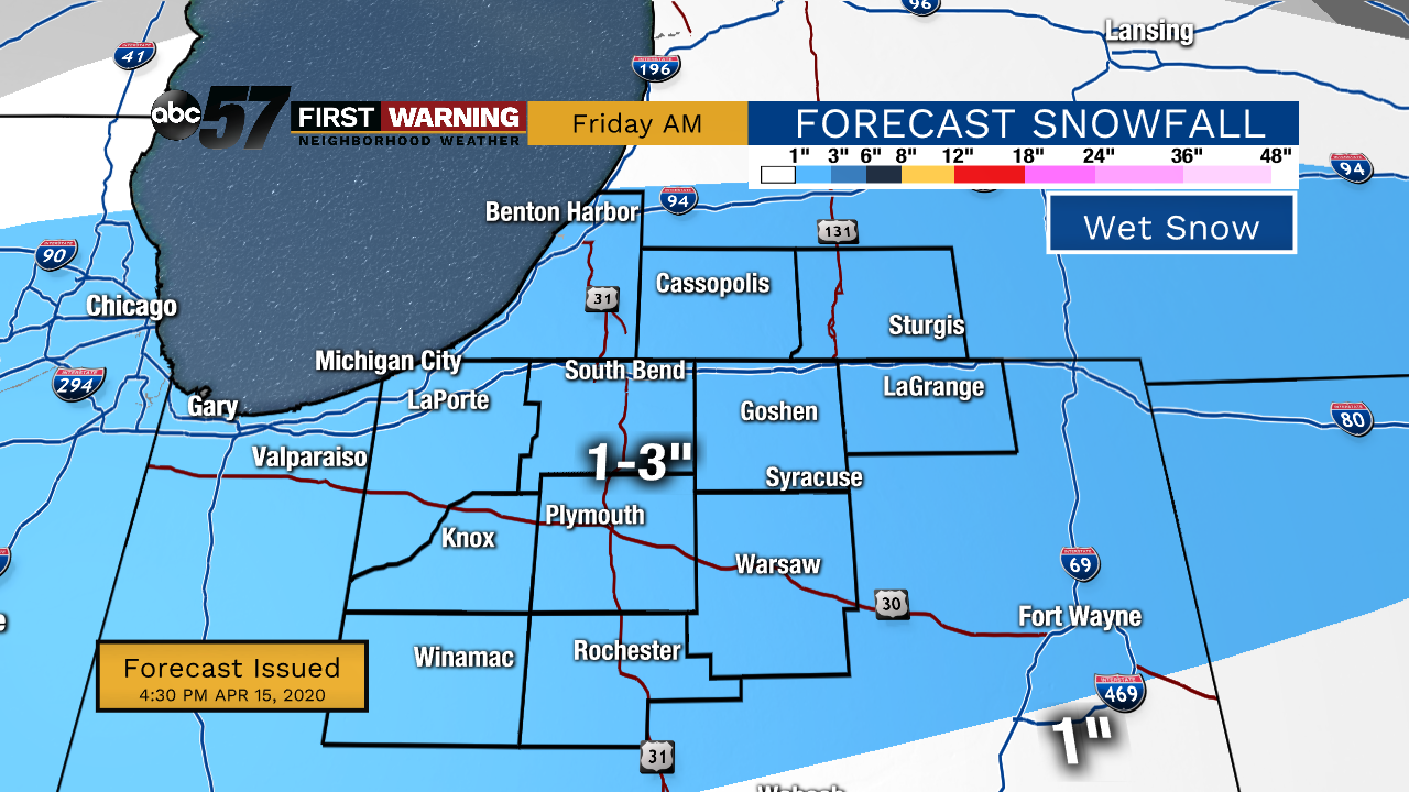
Thursday is sunny, Friday is sloppy, temperatures remain chilly. Thursday is the best weather day of a dismal week of weather. Snow is likely starting early Friday morning and as with most spring snows it's going to be wet, which really plays with totals because of melting and compaction. It's most likely a range of one to three inches falls through Friday morning, accumulating mostly on the grass, decks and roofs, wet on the pavement. There could be a brief period around 7:00 a.m. Friday when snow could coat roads before it starts to melt, the overall impact is low, especially with Stay-At-Home orders. The weekend is fair with highs in the 50s.
Tonight: Partly to mostly clear. Low 26.
Thursday: Mostly Sunny High of 44.
Friday: AM snow/mix, mostly cloudy. High 40.
Saturday: Mostly sunny. High of 50.