


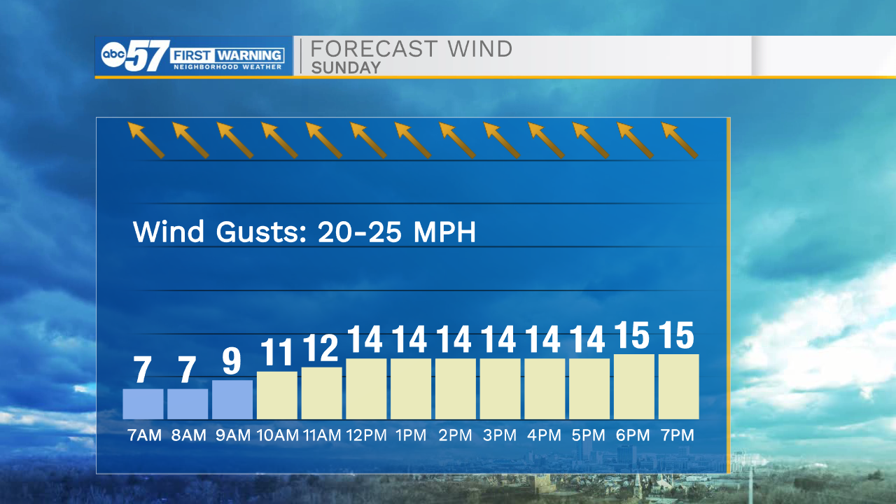
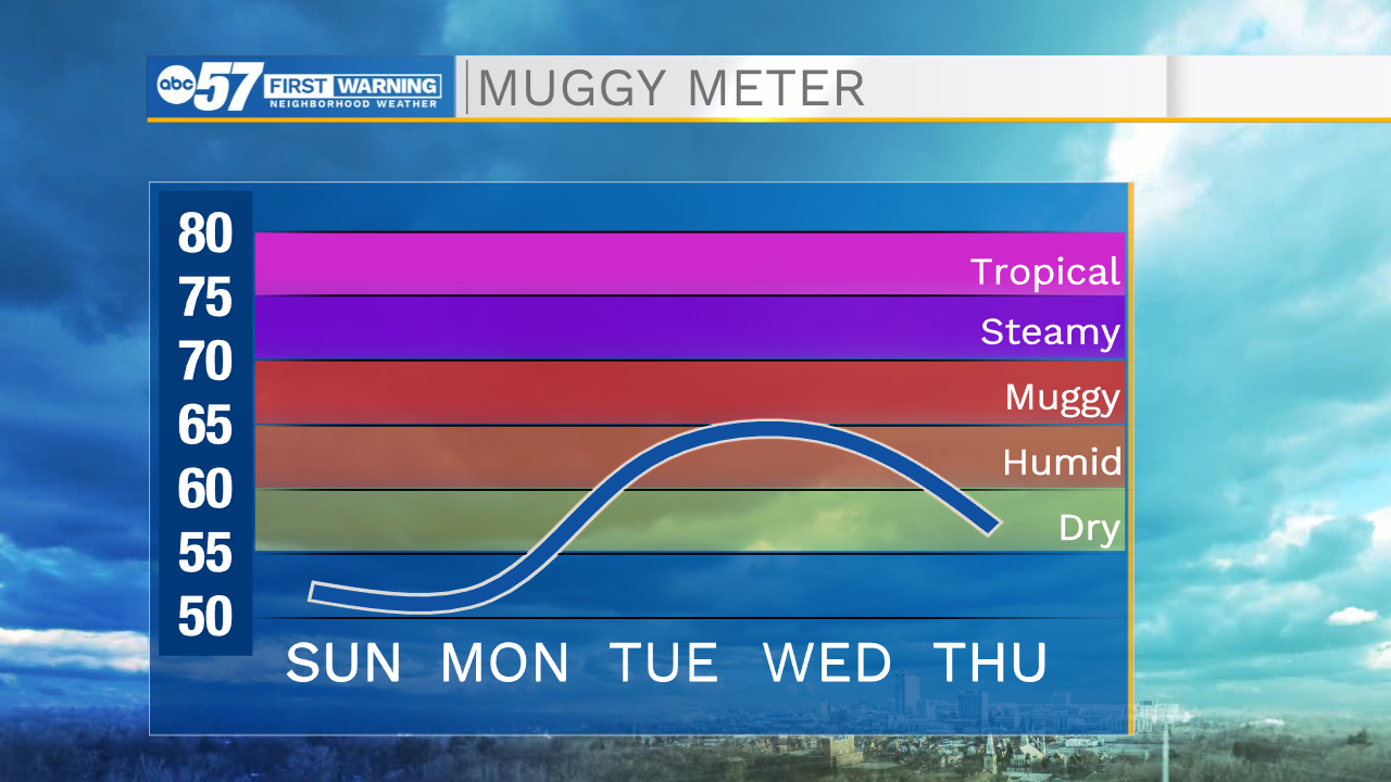
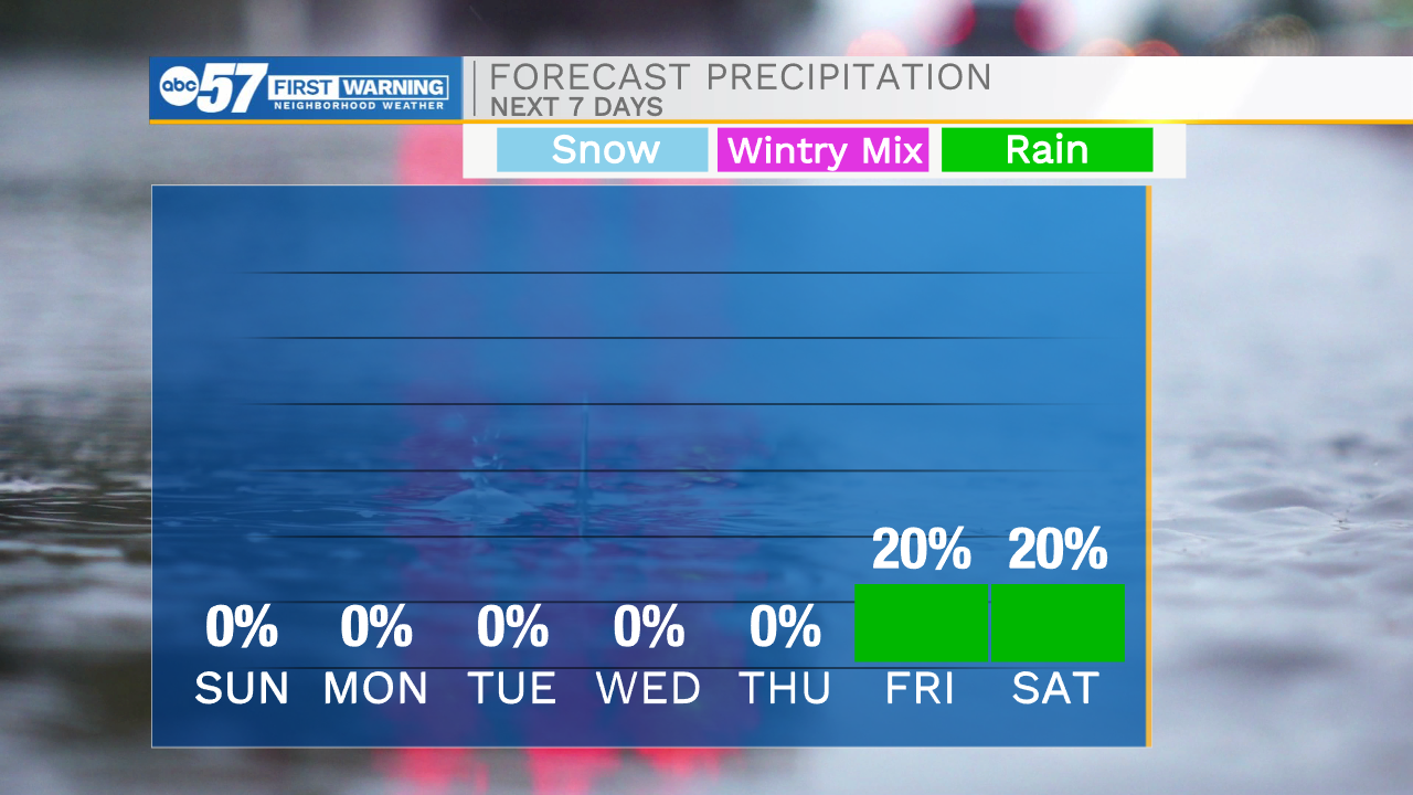
Clear skies remain in the forecast for tonight, which will allow temperatures to drop into the lower 40s tomorrow morning. Mother’s Day looks to be very nice with plenty of sunshine and high temperatures in the lower 70s. We will stay on the warming trend heading into next week with highs on Monday in the upper 70s, then the rest of the week in the low to mid 80s. Monday afternoon winds will increase out of the south to southwest making for very breezy conditions. These winds will move some moisture into the area, which will leave conditions on the muggy side. Right now, most of next week looks to stay dry, but with the heat and humidity, we may have to watch for a few isolated thunderstorms to return for Tuesday and Wednesday afternoon.
Tonight: Mostly clear. Low 42.
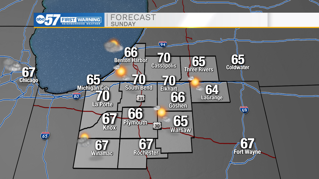
Tomorrow: Mostly sunny. High 70.
Monday: Mostly sunny/breezy. High 78.
Tuesday: Mostly sunny. High 82.