


One of the most common questions I get asked during school visits sounds something like this:
"Why is it sunny and then 5 minutes later it's storming?"
It's a good question, and one that is very important when it comes to understanding and forecasting storm development.
When forecasting storms, meteorologists look at the state of four main ingredients: humidity, instability, lift and shear.
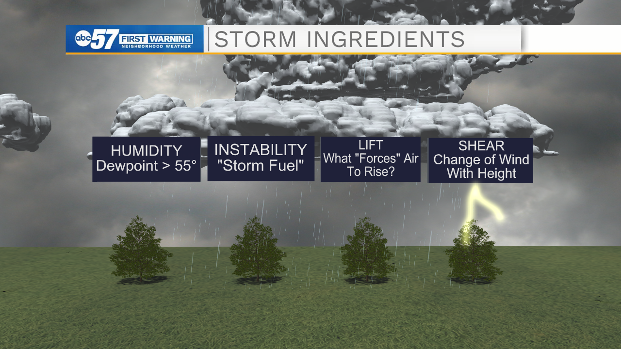
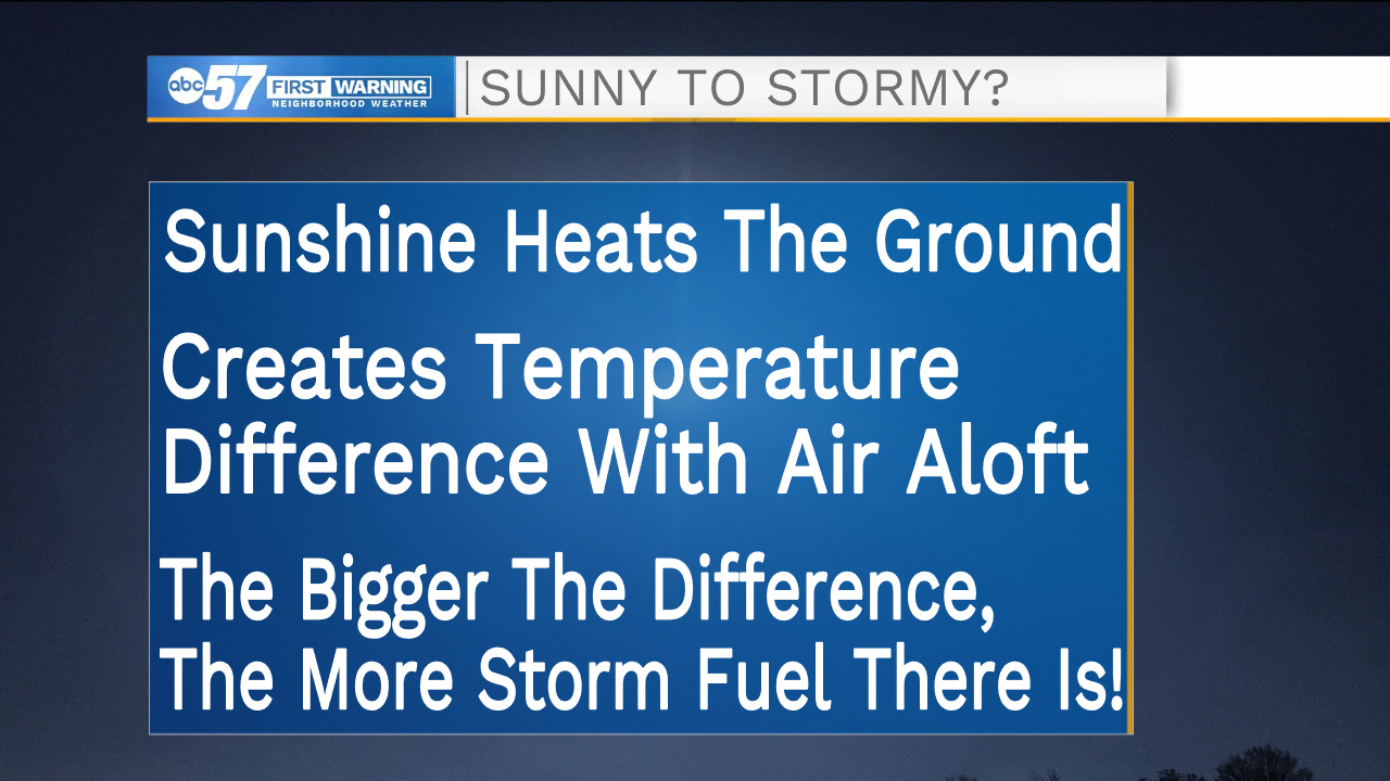
Of these, instability can often be the most fluid, and the most frustrating. The instability of an environment is measuring how likely/fast pockets of air will rise if lifted. "Storm fuel" is generated by a big temperature difference between the air at the ground and the air aloft. The biggest driver of this temperature difference is the sun!
Monday's forecast is a prime example of how clouds can dampen a severe weather setup. While humidity levels and an approaching cold front across Michiana made severe weather at least somewhat possible, clouds kept the area too cool and stable for any widespread thunderstorm development.
A line of showers / storms fizzles this evening, brining rain and a few rumbles of thunder this before midnight. https://t.co/81y0RPEq1H | #inwx #miwx pic.twitter.com/JpF0BlIZnx
— Tom Coomes (@TomCoomes) May 3, 2021
Forecasters focus on two parameters related to instability: CAPE and CIN. CAPE is an acronym for "Convective Available Potential Energy" and CIN stands for "Convective Inhibition."
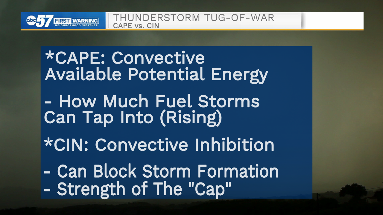
The more CIN an environment has, the greater the CAPE (or energy levels) needed to break through and get strong thunderstorms. The easiest way for an environment to become unstable (or build up large CAPE values) is by prolonged periods of sunny weather.
To sum things up: the sun can actually help create storms (sort of)!
So, the next time you're outside in the spring and summer and see storms spawn seemingly out of nowhere, you'll know why!