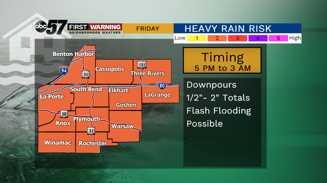
A beautiful fall day with plenty of sunshine and daytime highs topping out near 70F. It’ll be a little breezy at times. Friday starts out dry with scattered showers and storms moving through the second half of the day. A couple of stronger storms are possible with heavy rain likely, especially for Friday night. Those rain showers will linger into Saturday morning with mostly cloudy skies hanging on. There is still an isolated chance of showers Sunday but it looks drier with a more clouds than sunshine.
Temperatures start to warm back up Sunday with highs in the mid 80s Monday and Tuesday. Another system moves in Wednesday, dropping us into the 60s past midweek.
Today: Mostly sunny, breezy. High of 70.
Tonight: Few passing clouds. Low of 52.
Friday: Increasing clouds, PM showers and storms possible. High of 75.
Saturday: Mostly cloudy, a few showers possible. High of 72.