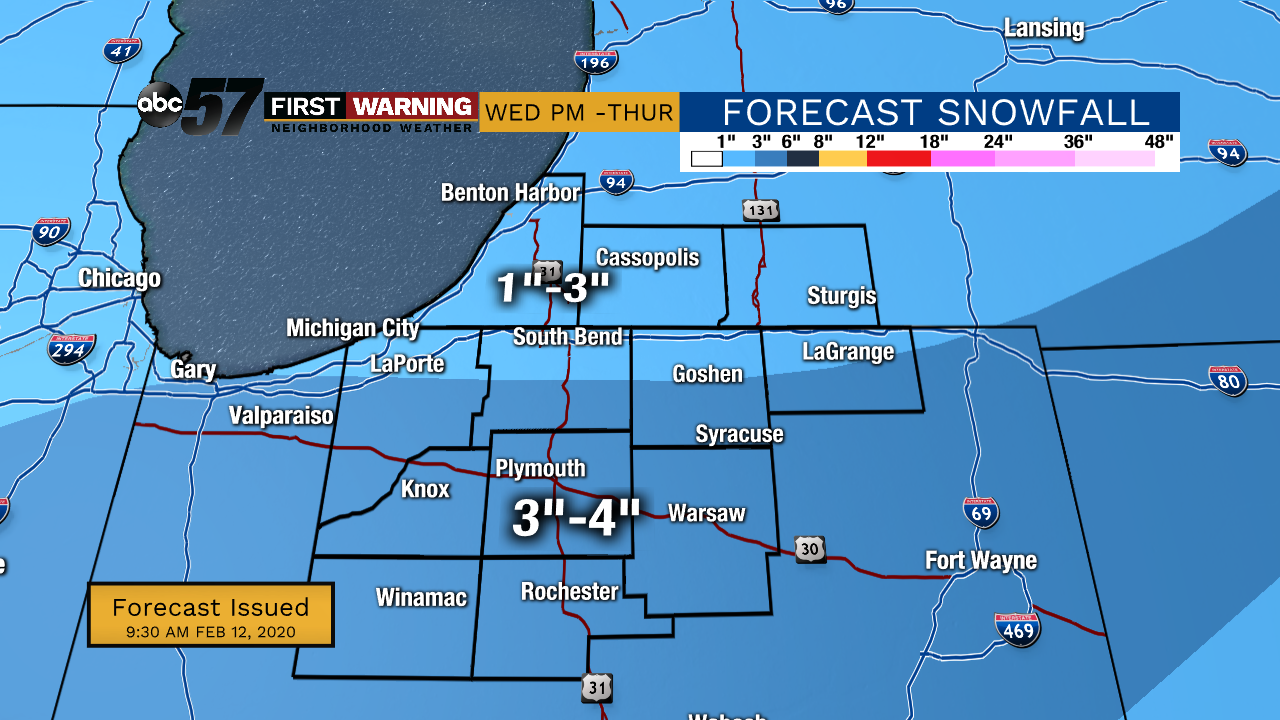
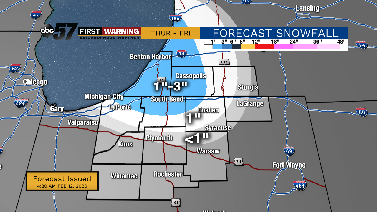
Wednesday, February 12th, 2020
A wintry mix moves in first late this afternoon turning to all snow this evening. It will last into Thursday morning with lake effect snow developing as temperatures drop throughout the day. 3-4” of snow is expected for most with an additional 1-3” of snow in NW Michiana from lake effect. Temperatures crash behind this system, going from the upper 20s around midnight to the single digits by Friday morning. It’s going to feel even colder as winds pick up out of the N/NW. Temperatures do quickly rebound heading into the weekend with a chance of a wintry mix Saturday night.
Today: Increasing cloud cover. Afternoon mix/snow showers, then evening snow. High 36.
Tonight: Snow showers, heavy at times. Low of 29.
Thursday: Lake effect snow showers. Temperatures drop throughout the day from 29 degrees. Low 8.
Friday: A few lingering flurries early. High 18.