
-
0:38

Drying out and warming up
-
1:15

Cold and bleak weather to start off the day
-
3:49

Asking for Accountability: Michiana Elected Officials on on-going...
-
3:37

South Bend Cubs explain weekend washout
-
4:02

Early voting is underway as Indiana prepare for its May 5 primary...
-
3:27

Tax-related scams to watch out for
-
0:09

Crews repair weekend washout under Coloma train track
-
0:58

Chilly and sunny Tuesday ahead
-
0:41

Elkhart police investigating Monday night shooting
-
3:47

Elkhart Police Department accepting applications to Citizens...
-
0:52

A slight warm-up but chilly weather still dominates
-
1:09

Bitterly cold out the door

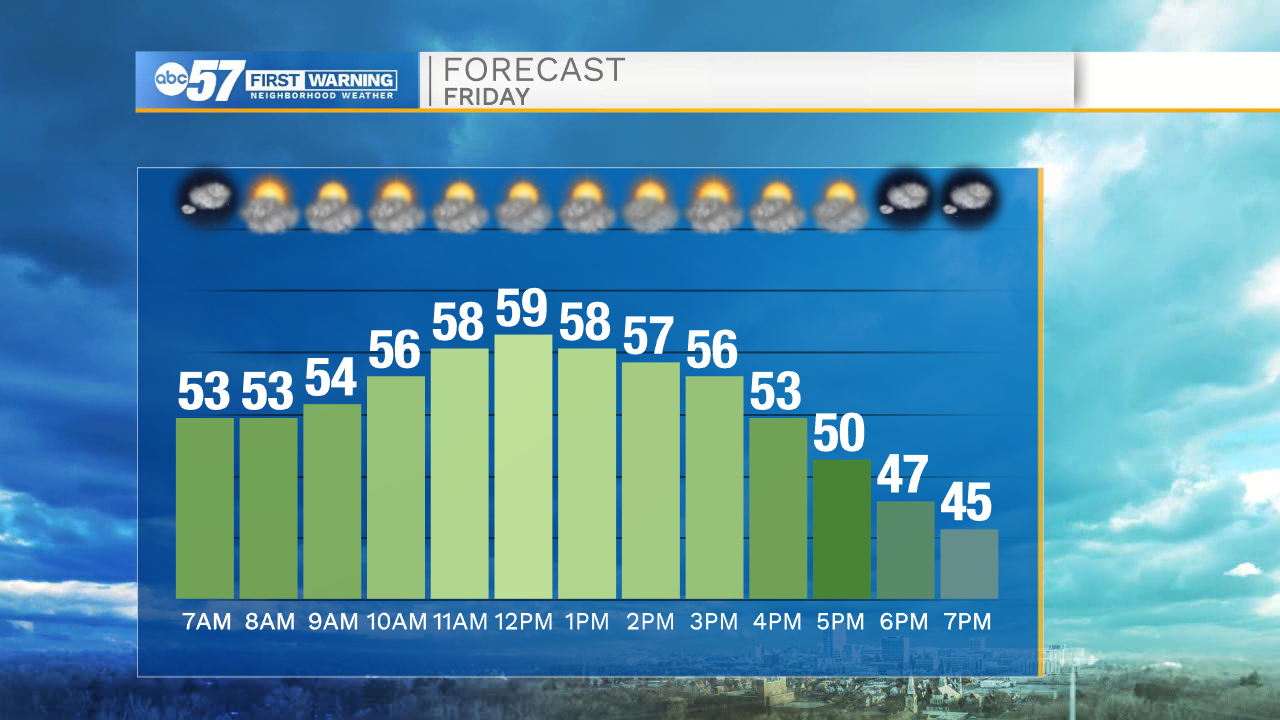
Friday is still mild but not as windy. There will be a change Friday, as a dry front moves through early afternoon. Temperature peak close to 60 around noon then fall to the 40s by early evening. The weekend forecast has improved, slightly. Saturday looks mostly dry but still cool and cloudy. Saturday night into Sunday a rain/snow mix is likely, resulting in chilly, damp conditions. Next week, highs in the 40s with another round of rain Tuesday-Wednesday before clearing for Thanksgiving Day, with highs near 50.
Tonight: Mostly clear, breezy. Low 52.
Friday: Partly cloudy. High near 60 at noon.
Saturday: Cloudy. High 44.
Sunday: Rain/snow showers. High 42.
Sign up for the ABC 57 Newsletter