
-
1:09

The beautiful conditions continue through the evening
-
0:54

Fairly nice morning
-
2:47

6th Annual Juneteenth Celebration held today in Niles
-
3:07

Thousands of people across the country pour into Chicago for...
-
2:28

Local street art murals promote water quality awareness
-
2:51

59th annual Leeper Park Art Fair returns
-
1:39

South Bend Chapter of Indiana Black Expo hosts 27th annual Juneteenth...
-
1:51

Try to beat the rain on Father’s Day
-
0:28

Mother killed after being struck by vehicle Thursday night identified,...
-
1:00

A pleasant day for Juneteenth
-
3:42

Family of 24-year-old Timothy Johnson killed in Cass County hold...
-
2:24

Sun shines on Elkhart Jazz Fest

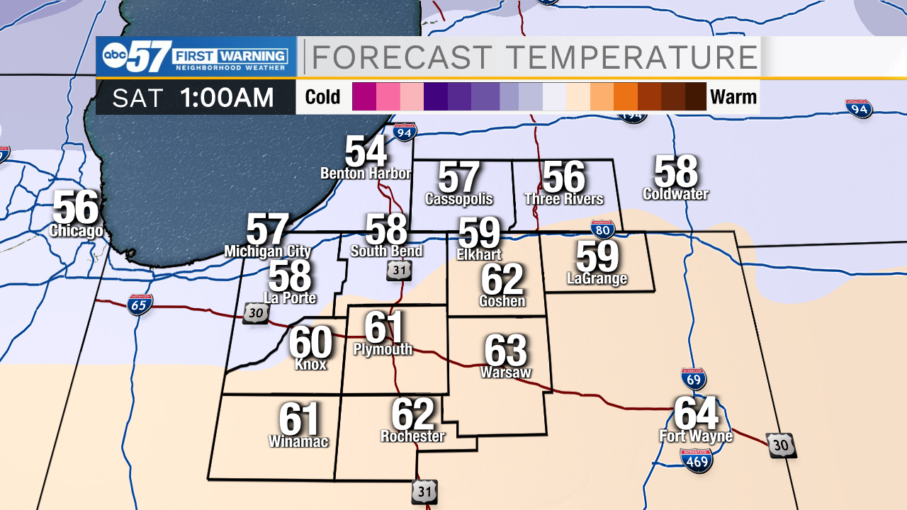
The warm-up begins Wednesday, highs make it just above freezing for a few hours in the afternoon, and the low 40s on Thursday. The focus is on Friday, and temperatures make a run at 60, but there's a hitch. Temperature's spike close to midnight ahead of a cold front, and the high on Saturday is likely just after midnight. So, there may not be many 'useful' hours of mild weather. The front will also bring rain Friday night into early Saturday. Temperatures fall through Saturday, and clouds break into Sunday. Long-range, there is not much cold and zero snow through next week.
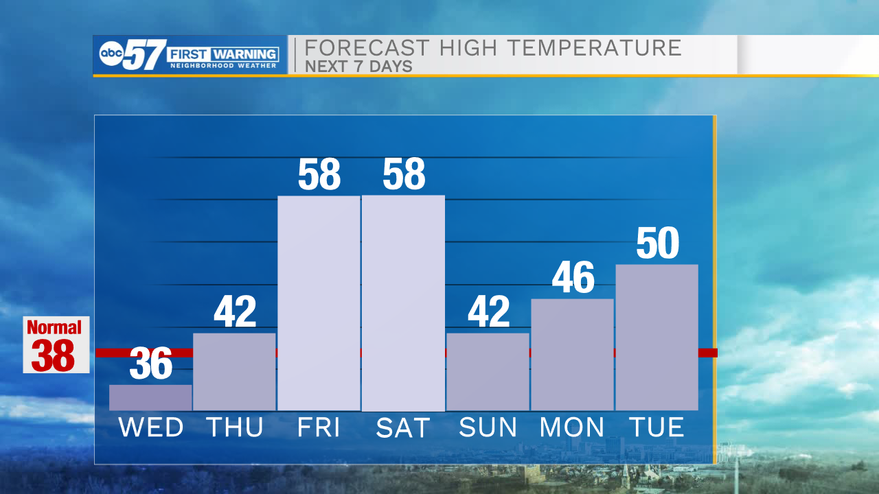
Tonight: Mostly cloudy and cold. Low 20.
Tomorrow: Cloudy in the morning, then decreasing clouds throughout the day. High 36.
Thursday: Mostly cloudy. High 42.
Friday: PM Rain showers. High 58