

-
3:41

Economic impact shapes opposition to St. Joseph County data center...
-
3:00

Red Rock Inn targets demolition for within the next week according...
-
5:39

Celebrando Hispanic Heritage: Amid gaps in Michiana’s Hispanic...
-
2:25

Grassroots organizations speaks on future of data and surveillance...
-
5:14

Celebrando Hispanic Heritage: First generation student shares...
-
21:29
Celebrando Hispanic Heritage: Recognizing the many contributions...
-
5:35

Celebrando Hispanic Heritage: Hispanic media pioneers speak on...
-
1:05

Latin business expo brings unity to Latino businessowners
-
2:36

Rising cost of diesel fuel adds stress to local farmers
-
4:51

Celebrando Hispanic Heritage: Community of Michiana shares in...
-
2:11

Local conference aims to help seniors thrive, plan for their...
-
11:20

ABC57 sits down with local immigration attorney to discuss the...

A chance of rain Thursday evening with temperatures near 40, then crashing after midnight to the teens. A few snow showers may mix in. Little accumulation or icing is expected.
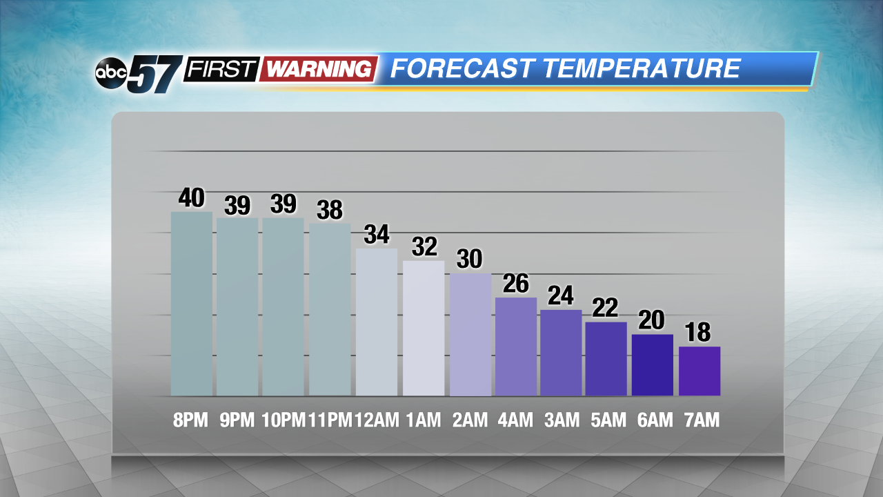
The week ends cold and breezy, as temperatures hold in the low 20s and a blustery wind gusts to 25 mph, Friday. The weekend starts fair Saturday and will end with snow Sunday afternoon. A range of one to three inches is the early estimate for snowfall. Temperatures stay cold, below normal, near 30.
Tonight: Temperatures fall after midnight, light rain changing to light snow, low 19.
Friday: Partly cloudy, high of 22.
Saturday: Partly cloudy, high of 32.
Sunday: Afternoon snow showers, high of 32.
Sign up for the ABC 57 Newsletter