
-
1:53

Hispanic Community Child Safety Meeting: A Call To Action
-
2:51

Obama Presidential Center features work of South Bend company
-
1:54

This week’s ABC57 Cub Reporter is Isaac Knefely
-
1:16

Real summer heat returns next week
-
2:28

South Bend storm drain mural project complete
-
5:17

Three local students return as national powerlifting champions
-
1:09

Rain showers to end the work week
-
5:36

Benefit Car Show supporting Berrien County’s first responders...
-
2:51

Governor Whitmer appeals FEMA federal aid denial for Southwest...
-
3:17

Benton Harbor leaders weigh Jean Klock Park upgrades amid debate...
-
1:40

Pollinator Playpath, a trail for kids, now open at Corson Riverwoods...
-
0:32

Ryan Newman racing Saturday at Plymouth Motor Speedway

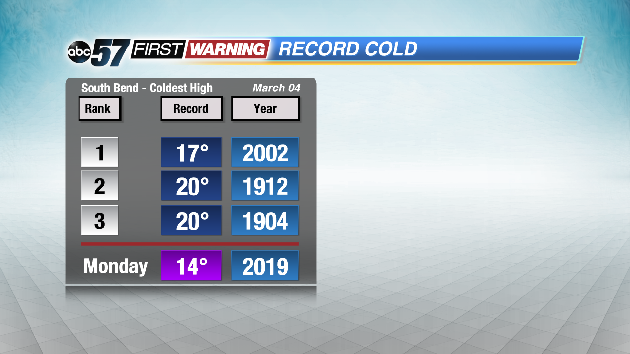
Cold air slams back into Michiana this weekend. Temperatures peak in the mid-30s Saturday, then fall steadily through Tuesday of next week. A few chances for snow but total accumulation through the weekend looks minimal. The chance of snow continues through Tuesday. Near record lows are still possible Monday and Tuesday morning. There is a slow warm-up through the rest of the week but temperatures remain below normal.
Tonight: Mostly cloudy, chance late of snow late, low of 26.
Saturday: Mostly cloudy, early morning snow showers, high of 34.
Sunday: Light snow, high of 28.
Monday: Cold, chance of snow, high of 14.

Sign up for the ABC 57 Newsletter