The heat breaks but not the humidity, heavy rain and storms.
By:
Tom Coomes
Posted: Jun 18, 2018 4:32 PM EDT

-
2:23

La Porte community rallies for Sammy Strong Benefit, raising...
-
1:57

The Potawatomi Zoo opens its gates to Zoo Nights Live
-
2:50

Carson Kvapil wins his first O’Reilly Auto Parts Series win...
-
1:10

William Tuffs honored as the only Indiana man who took part of...
-
0:50

Beacon Health held a Health and Wellness fair for the community
-
1:03

Warm conditions start overnight
-
1:02

Another pleasant day
-
0:42

Still cooler out the door
-
2:00

New Carlisle celebrates annual Hometown Days
-
1:40

Ross Chastain leads NASCAR O’Reilly Auto Parts Series practice...
-
2:27

Backpacks for Berrien hosts their Stuff-a-Bus event, ultimate...
-
2:59

Ludacris Opens Elkhart County 4-H Fair Concert Series Amid Ticket...

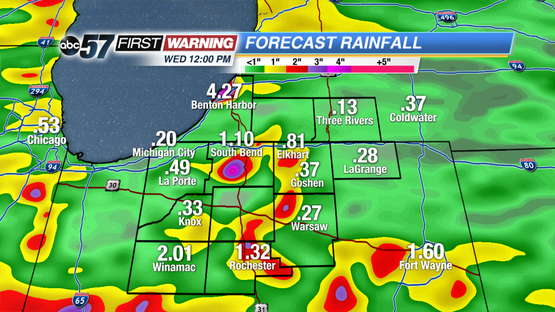
Scattered showers and thunderstorms Monday night will bring heavy downpours and break the heat but not the humidity.
The heat breaks Tuesday, as temps only warm into the low 80s but the mugginess persists for another day. Showers and storms stay in the forecast, the greatest threat being heavy rain and flooding. More than two inches of rain is possible through Wednesday. The forecast turns drier and milder midweek as skies clear Wednesday afternoon into Thursday.
Tonight: Scattered showers and storms, low 70.
Tuesday: Partly to mostly cloudy, scattered showers and storms, high of 80.
Wednesday: Morning showers and storms, high of 78.
Thursday: Mostly sunny, high of 80.
Sign up for the ABC 57 Newsletter