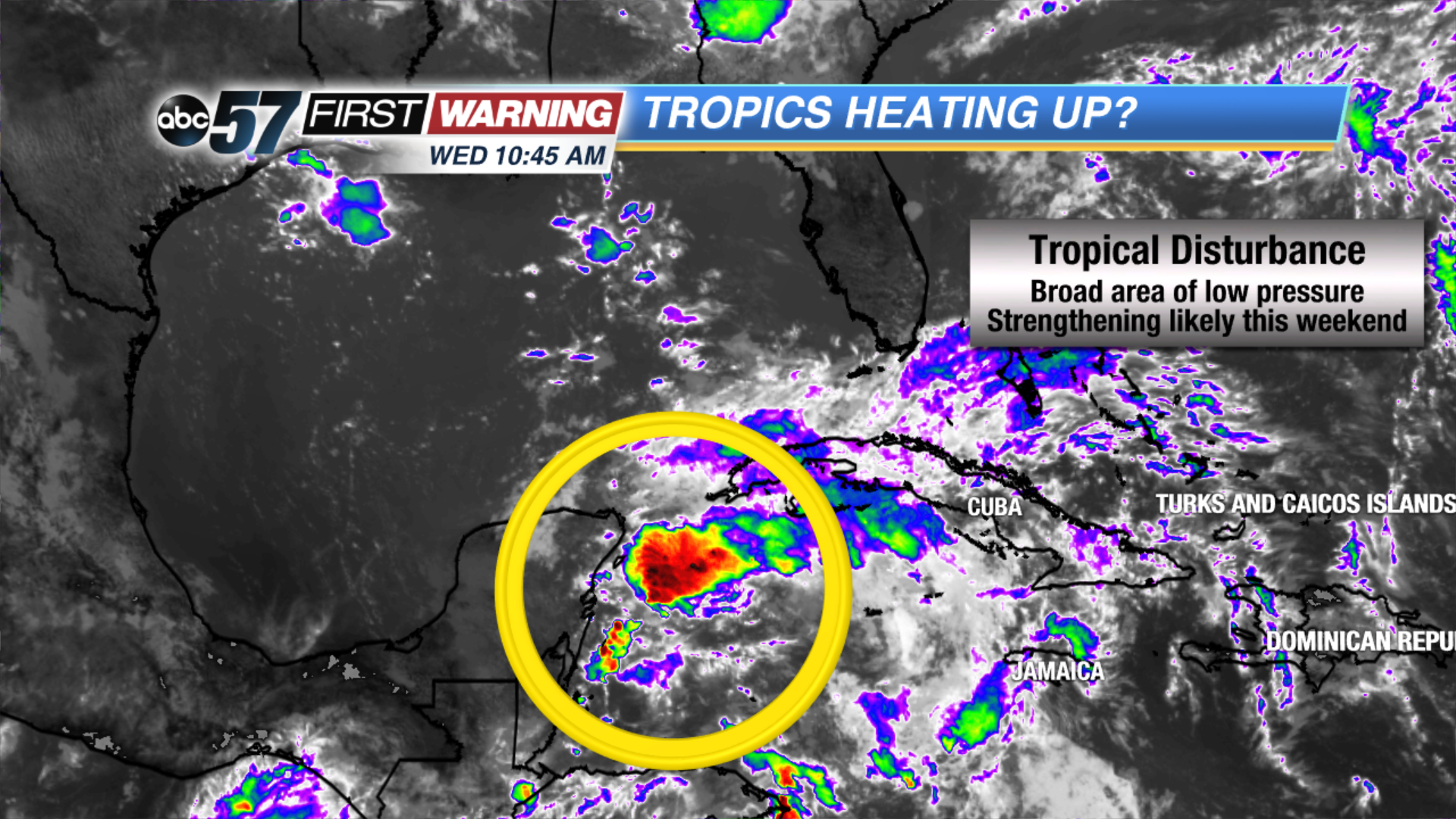
Hurricane season doesn't start until June 1st, but we are on our way to likely having our first named storm of the year several days before that. A broad area of low pressure and associated showers and thunderstorms has been spinning around for a few days southwest of Cuba in the western Caribbean. Originally, the chances of it evolving into a tropical or subtropical system were very low. Now, the chances of getting a named system in the next five days are up to 60%.
That is a significant number this early in the year. In all likelihood, the system will organize and strengthen once it clears Cuba and enters the east-central Gulf of Mexico. That's where warm waters and more favorable wind conditions will exist. Development into a named storm will occur sometime over the holiday weekend. It could happen as early as late Friday if the system strengthens quicker than anticipated.
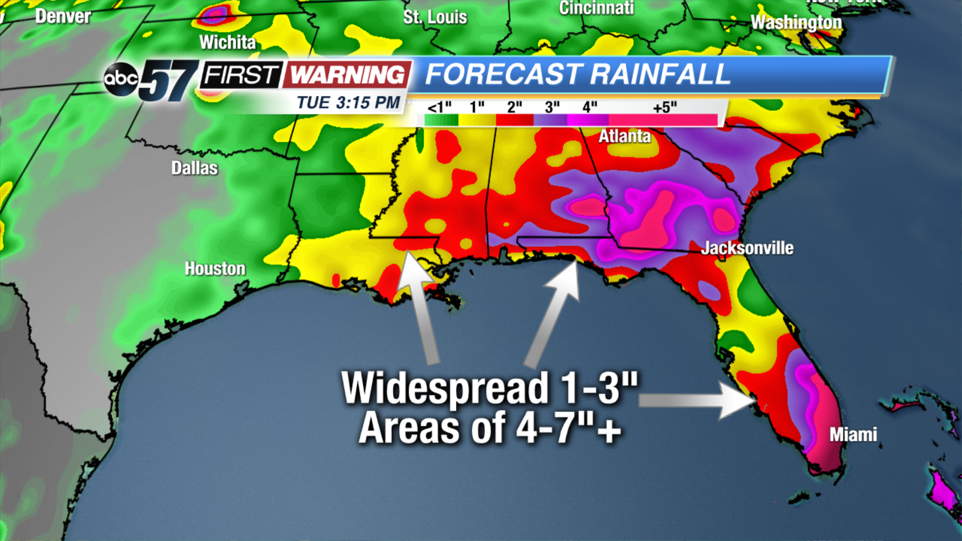
If it does develop into a tropical or subtropical storm, it would be named Alberto. Regardless of whether or not it becomes named, very heavy rain and flooding will be the biggest concern for those along the Gulf Coast. Folks who live in or plan on visiting Louisiana, Mississippi, Alabama, Georgia, South Carolina, or Florida for Memorial Day weekend should expect plenty of rain as this system slowly pushes northward into the Gulf of Mexico. The rain will amount to 1-3" for pretty much all locations in those states. However, there
will be areas that see 4-7" of rain, if not more than that over the next week or so. Flooding will be a big-time hazard for any location that sees more than four inches of rain from this system. Fortunately, it will not have any impact on our weather here in Michiana. If anything, its presence to our southeast will lower our rain and thunderstorm chances even further throughout the holiday weekend!