The warm-up continues, chance of storms later this week
By:
Tom Coomes
Posted: May 14, 2019 4:47 PM EDT

-
2:23

La Porte community rallies for Sammy Strong Benefit, raising...
-
1:57

The Potawatomi Zoo opens its gates to Zoo Nights Live
-
2:50

Carson Kvapil wins his first O’Reilly Auto Parts Series win...
-
1:10

William Tuffs honored as the only Indiana man who took part of...
-
0:50

Beacon Health held a Health and Wellness fair for the community
-
1:03

Warm conditions start overnight
-
1:02

Another pleasant day
-
0:42

Still cooler out the door
-
2:00

New Carlisle celebrates annual Hometown Days
-
1:40

Ross Chastain leads NASCAR O’Reilly Auto Parts Series practice...
-
2:27

Backpacks for Berrien hosts their Stuff-a-Bus event, ultimate...
-
2:59

Ludacris Opens Elkhart County 4-H Fair Concert Series Amid Ticket...

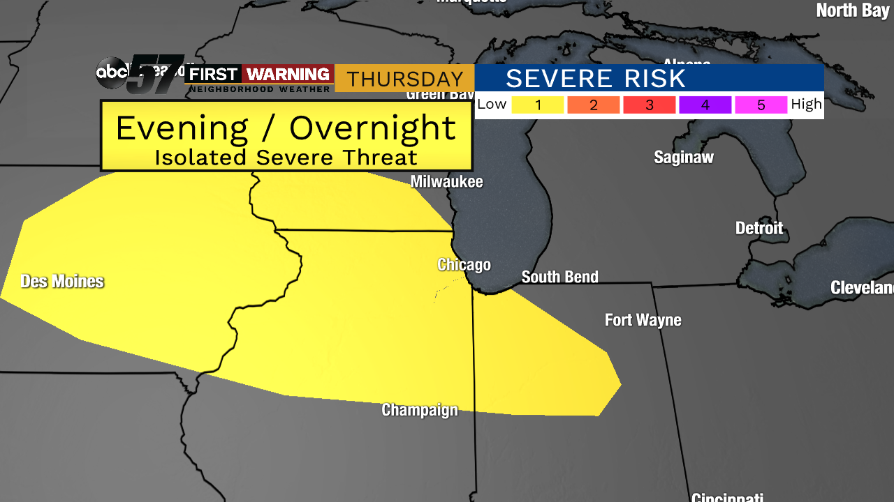
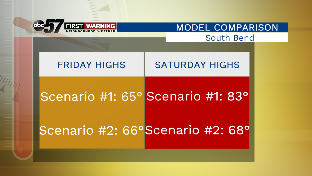
Clouds increase Wednesday but the rain chance remains low. Temperatures rise Thursday and some mugginess will fuel thunderstorms Thursday night. Michiana will be very close to a wavering front this weekend with warm air on one side and milder air on the other. Temperatures look to dip Friday the surge back towards 80 on Saturday. A small change in the position of the front could shift temps up or down significantly. The overall trend though is much milder, 70s and possibly 80s.
Tonight: Mostly to partly clear, low of 48.
Wednesday: Partly cloudy, isolated shower, high of 68.
Thursday: Partly cloudy, high of 76, chance of storms late.
Friday: Partly cloudy, chance of rain early, high of 68.
Sign up for the ABC 57 Newsletter