
-
1:38

Weather delay doesn’t stop Lakeville’s Fourth of July celebration...
-
1:41

Rain is ending, Fireworks are just beginning
-
2:01

6th annual Pickle Festival concludes in Berrien Springs
-
2:15

Localized flooding possible tonight
-
1:59

Storms to impact Chicagoland race and local Fireworks
-
1:54

Lightning may be the only thing lighting up the sky tonight
-
2:02

More storms this evening
-
0:57

Michigan family turns backyard into enormous slip ’n’ slide...
-
1:53

America’s Birthday Celebration at Howard Park
-
2:03

More storms tonight
-
3:39

RedBud Weekend, America 250 Edition
-
49:01

An ABC57 News special

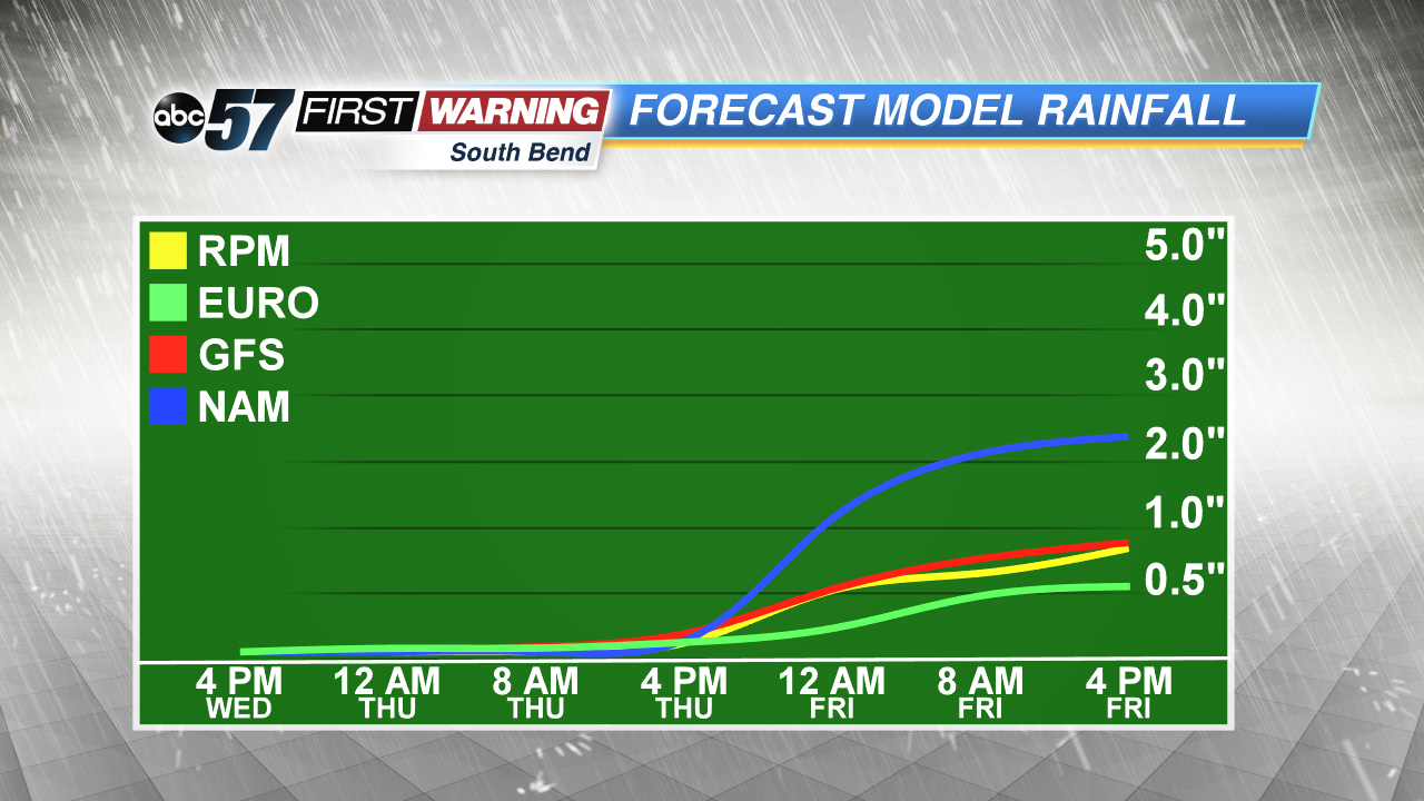
The wet weather pattern continues this week with more showers and storms Thursday, Friday and early Saturday. A slow-moving low pressure system crawls across the Midwest to end the week, keeping the threat of heavy rain and flooding in the forecast. High temperatures will be cooler than normal in the 70s but with the dewpoint in the mid-60s it will still feel damp/muggy. We clear and dry gradually through the weekend.
Tonight: Mostly cloudy, low of 62.
Thursday: Scattered showers and storms high of 76.
Friday: Scattered showers and storms, high of 74.
Saturday: AM showers, high of 72.
Sign up for the ABC 57 Newsletter