Threat for flooding & strong thunderstorms
Posted: Jun 19, 2018 12:22 PM EDT
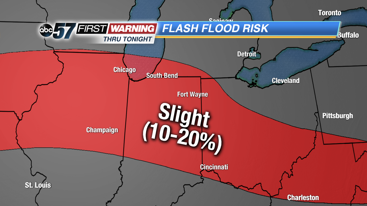
Once again, we have a muggy and soupy air mass overhead across northern Indiana and southern Michigan. Temperatures won't rise into the 90s, but dew points will stay above 70°. This kind of environment is supportive of very heavy rain and the threat of flash flooding. It's the same type of environment that was in place across northern Illinois on Monday, which led to extreme flash flooding and numerous water rescues in the City of Rockford. By no means is it possible to say whether or not Michiana will experience flash flooding to that degree, but the threat is there through the first half of Tuesday night.
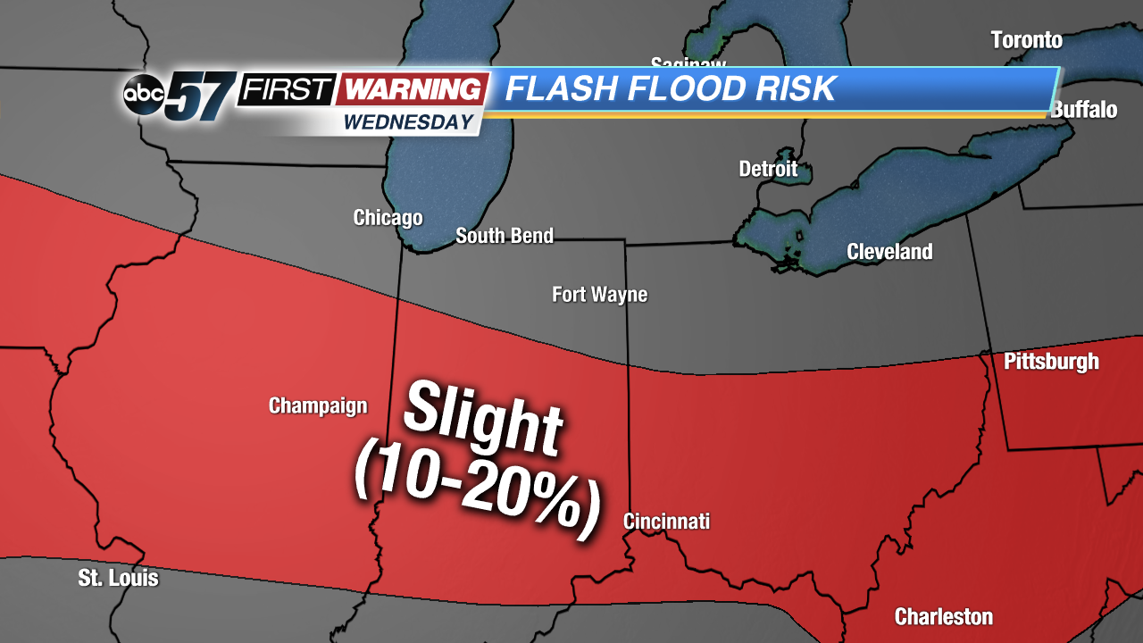
By Wednesday morning, the frontal boundary responsible for the heavy rain and thunderstorms will shift south of Michiana. That will take the heavy rain and strong thunderstorm threat with it. The break in the rain and storm chances will not last long, though, as additional rain becomes likely by Thursday night and Friday. The rain associated with that system will have the potential to be moderate to heavy as the air mass becomes saturated and very moist once again.
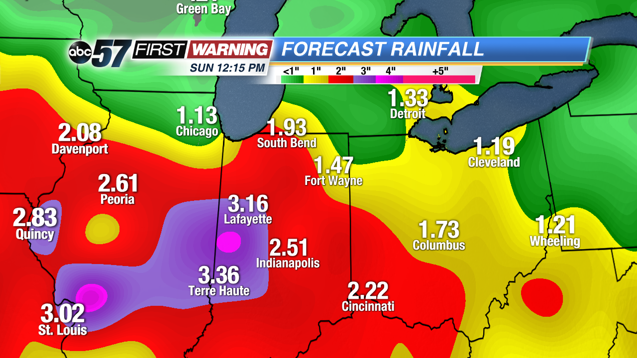
By the time we get to Sunday morning, conditions will likely improve to a great extent in both the humidity and rainfall department. Until then, the potential exists for 1-3" of rainfall. And, depending on where the heaviest rain sets up, a few locations could certainly see 4-5" of rain. Of course, that includes the rain expected Tuesday into Tuesday night, in addition to the rain expected Friday into Saturday. Regardless, plenty of rain is in the cards over the next 96 hours or so.
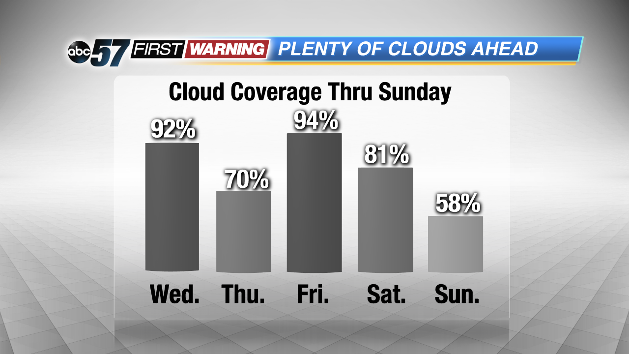
And, with the rain in the forecast, that also means there will be plenty of cloud cover to go around in Michiana. There will be many more cloudy hours through Sunday than sunny ones. There is a high probability that the overall cloud cover percentage will stay at or above 70% through Sunday morning. In other words, there won't be much in the way of sunshine over the next several days. That changes by late Sunday as a quieter and drier pattern establishes itself.


