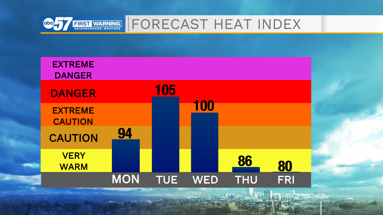
Today will bring partly sunny skies with a chance for light scattered showers in the late morning and early afternoon. Any accumulation will be in trace amounts and most areas will stay dry throughout the day. Rain clouds will clear out by this evening allowing for partly cloudy skies overnight and lows near 60. Tomorrow will bring the potential for scattered showers and thunderstorms to form during the afternoon. Conditions will be hot and humid with daytime temperatures into the upper 80’s. All of next week will be unseasonably hot and humid with feels-like temperatures exceeding 105. Multiple days next week look likely to set new record high temperatures.
Today: Partly sunny, scattered showers possible in the morning and early afternoon. High 80.
Tonight: Partly cloudy. Low 60.
Monday: Hot and humid, PM scattered showers and thunderstorms. High 88.
Tuesday: Mostly sunny, very hot and humid. High 97. Heat index 105+.