It was just about a year ago when Hurricane Laura was churning in the Caribbean, eventually devastating southwest Louisiana during the heart of a record-breaking 2020 hurricane season.
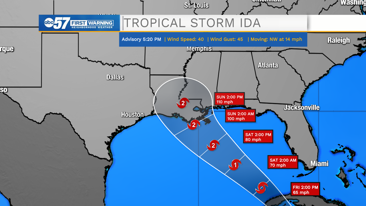
Ida was upgraded to a tropical storm early Thursday evening, as it moves to the northwest toward Cuba.
520 PM EDT Update: Air Force hurricane hunters find depression has strengthened into Tropical Storm #Ida. https://t.co/4LIsgbp8uT pic.twitter.com/WkPVKhOmKd
— National Hurricane Center (@NHC_Atlantic) August 26, 2021
Coincidentally, Ida's cone has an eerily similar look compared to Hurricane Laura's cone.
Left image: Laura forecast on Aug. 24, 2020 (5a ET)
— Jonathan Erdman (@wxjerdman) August 26, 2021
Right image: #Ida forecast on Aug. 26, 2021 (5:20p ET)
Dear atmosphere:
Please leave Louisiana alone, for once. pic.twitter.com/9we6ryGTjY
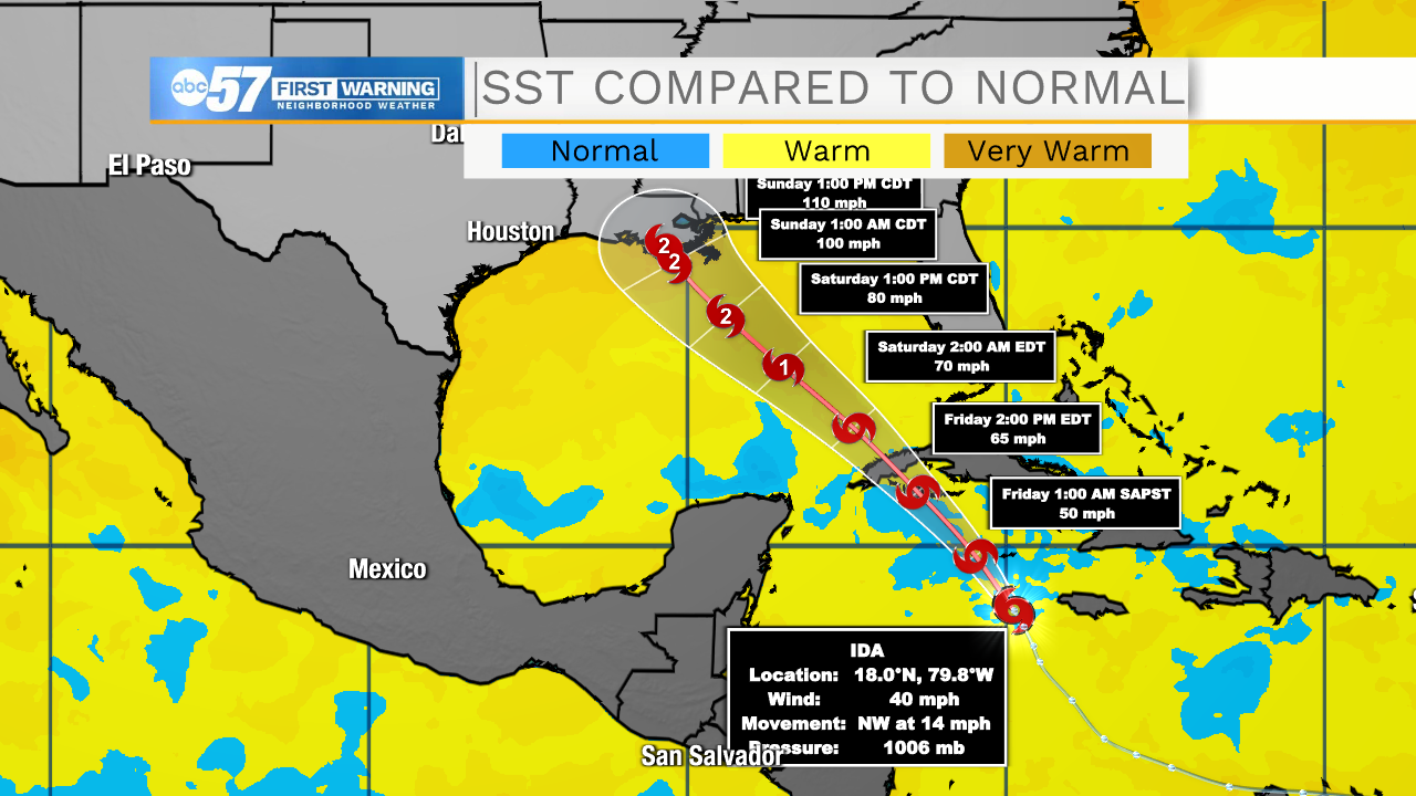
This time around, New Orleans could see major impacts by the start of next week. The current forecast is for Ida to make landfall as a high-end Category 2 hurricane with winds of 110 mph sometime on Sunday.
Why is Ida such a concern, considering it's only a tropical storm as of Thursday? The main factor is just how warm the Gulf of Mexico is. A steering high pressure system over the East Coast will bring Ida right over waters that are much warmer than normal.
Forecasters at the National Hurricane Center anticipate rapid intensification on Saturday, potentially bringing Ida up to major hurricane (Cat 3+) strength by the time it makes landfall.
While a Louisiana landfall is anticipated as of Thursday evening, much of the Gulf Coast could see major impacts from Ida, including storm surge, damaging wind and heavy rain.


