
-
2:32

Gus Macker Three-on-Three Basketball Tournament is taking over...
-
1:44

Feeling like a sauna next week
-
3:12

How to keep yourself and others protected during firework season
-
0:49

Showers creeping into Michiana
-
1:32

Judge approves $25 million water lawsuit settlement in Benton...
-
1:00

Scattered showers through the day
-
1:53

Hispanic Community Child Safety Meeting: A Call To Action
-
2:51

Obama Presidential Center features work of South Bend company
-
1:54

This week’s ABC57 Cub Reporter is Isaac Knefely
-
1:16

Real summer heat returns next week
-
2:28

South Bend storm drain mural project complete
-
5:17

Three local students return as national powerlifting champions

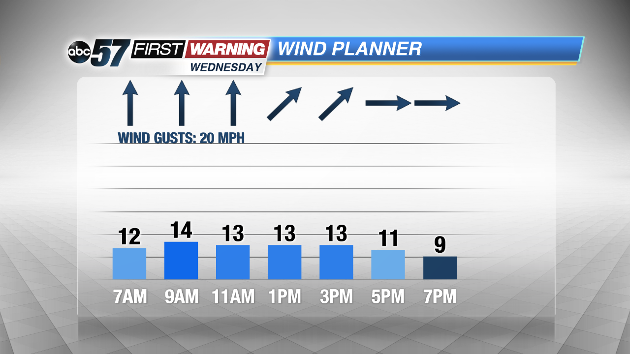
Active weather pattern the rest of the week with two storm systems. Storm number one will roll through Michiana quickly Wednesday, bringing moderate to heavy rain through midday. There’s a short break Thursday and most of Friday, before storm number two Saturday. The weekend storm will be the stronger of the two, bringing rain and gusty wind that could top 40 mph. Temperatures drop into Sunday and lake effect snow showers will develop.
Tonight: Mostly cloudy, low of 40.
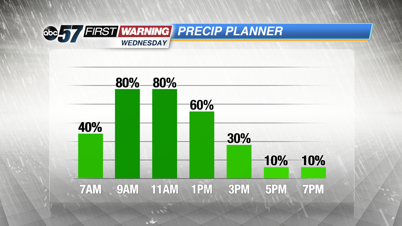
Wednesday: Morning showers, rainy and breezy midday then ending by midafternoon, high 50
Thursday: Partly cloudy to mostly sunny, high 42.
Friday: Increasing clouds, chance of rain late, highs near 50.
Sign up for the ABC 57 Newsletter