
-
1:16

No shortage of sunshine today
-
1:37

Memorial Day parade forecast
-
4:51

Local band ’The Erly’ stops by ABC57 ahead of June 3 performance
-
1:17

VERY foggy first few hours of the morning
-
1:57

A local taste brings New Carlisle community together on race...
-
0:45

Pancakes help raise funds to support the Alzheimer’s Association
-
1:03

Lighter rain expected into the afternoon
-
1:04

Non-severe storms expected
-
1:16

Showers start this morning
-
1:59

Mac & Cheese festival turns Four Winds Field into a kitchen
-
0:45

Michiana Spring Clay tour encourages people to try and take a...
-
2:56

Fresh Cuts, Fresh Starts: Re-Entry Program Gives Back in Elkhart

Falling temperatures after a cold front passes Monday evening, most will drop below freezing just after midnight. Light rain showers transition to light snow but accumulation will be negligible. There could be a few slick spots given the quick cooldown.
The next two days will be below freezing, bitter cold with highs in the mid-20s. The snow impact remain very low, with up to an inch possible in the lake effect zones through Wednesday. The pattern then moderates again to end the week, returning to the 40s by Friday and Saturday.
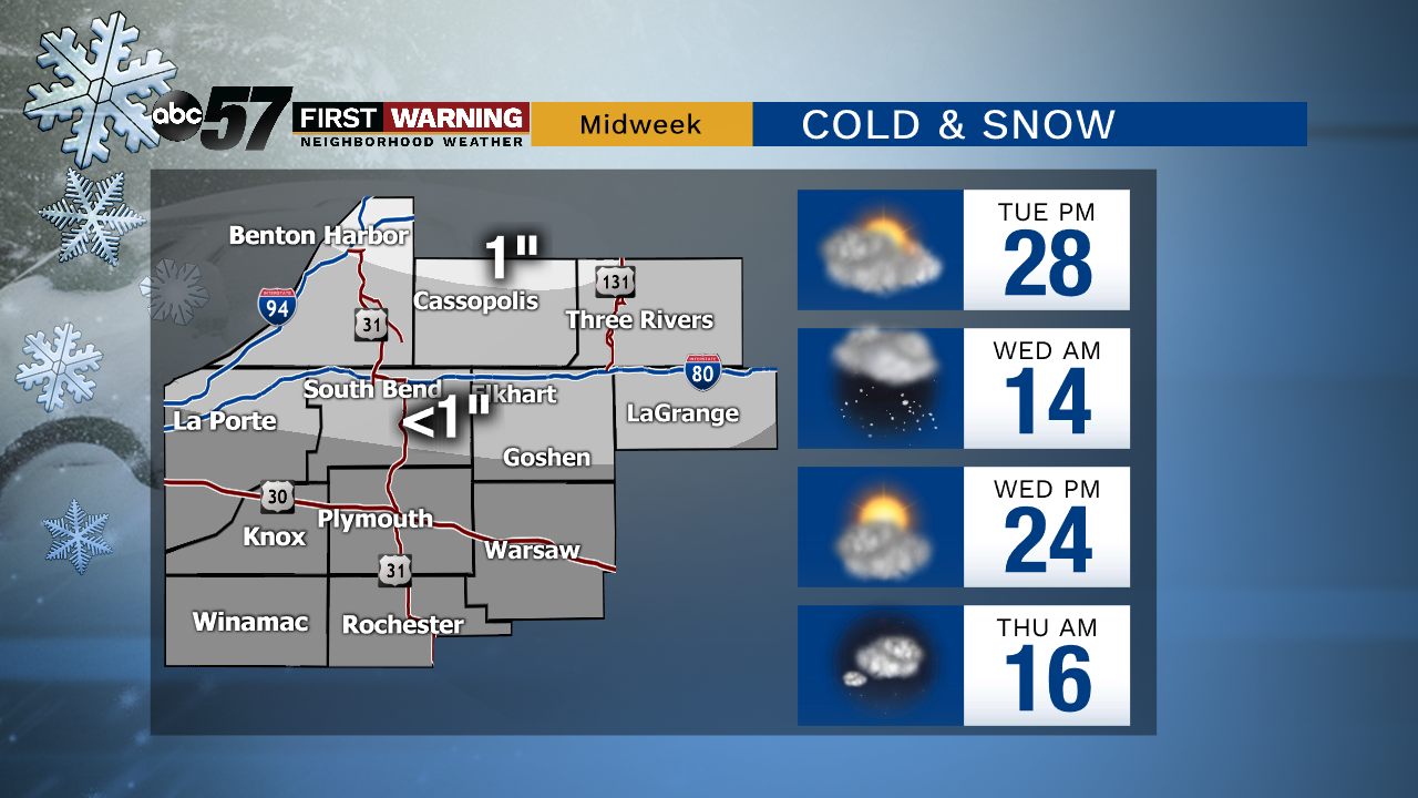
Tonight: Light rain to light snow. Low of 26
Tuesday: Mostly cloudy, light lake effect snow showers, breezy. Temperatures hold in the mid-20s.
Wednesday: Partly sunny. Chance of flurries. High of 24.
Thursday: Partly cloudy. High of 34.