Dangerous waves eye Lake Michigan shore
Posted: Aug 20, 2018 8:53 PM EDT
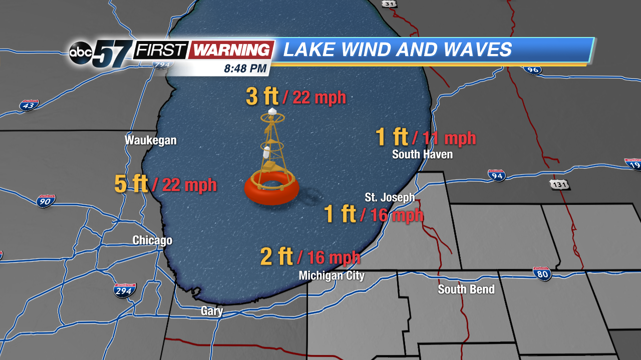
Most days during the summer feature waves around one foot along the shores of La Porte and Berrien Counties. Occasionally, Lake Michigan will churn a bit more thanks to breezier days. The result can be waves of two to four feet, if not a little larger. It's quite rare to see wave heights on Lake Michigan reach or exceed five feet during June, July and August. That changes significantly as we push into September and the fall as we get larger, more potent storm systems across the Midwest and Great Lakes. These "fall-like" systems bring quite a bit of wind energy with them, which can lead to very large waves and highly dangerous currents. That will be the case Tuesday and Wednesday from Gary to Michigan City, New Buffalo, St. Joseph, and South Haven.
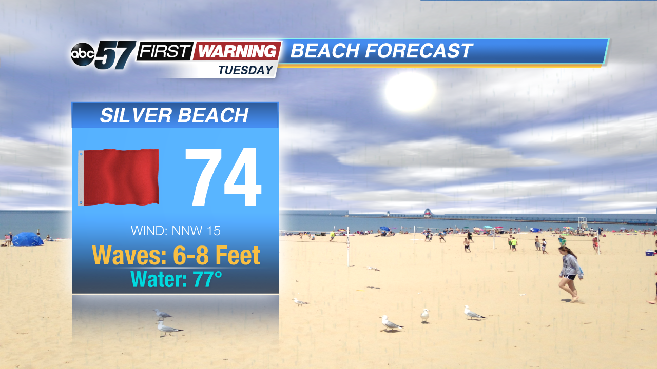
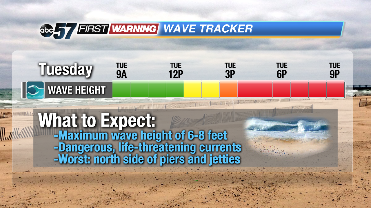
An unusual system for August standards will pass by Tuesday morning, leaving breezy north winds in its wake. That will lead to building waves throughout the afternoon on Tuesday. By the late afternoon and evening hours, waves will likely reach 6-8 feet at times. That will last through late Wednesday morning before waves start to subside.
The combination of breezy winds and very large waves will have the red flags flying at all beaches in the area. Swimming will be extremely dangerous and life-threatening. Swimming is highly discouraged and could result in severe bodily injury or death with conditions like the ones expected between 4 PM Tuesday and 12 PM Wednesday. Very strong, shifting currents will also develop without warning, especially on the north side of piers and jetties. Be sure to heed all warnings and signage at local beaches, and check back for additional details.


