
-
2:00

South Bend Police Department honors the fallen
-
0:52

St. Joe/Benton Harbor Rotary holds ribbon-cutting ceremony for...
-
2:25

Irish lacrosse head to NCAA quarterfinals with Johns Hopkins...
-
3:09

Cubs, White Sox open first Crosstown Classic series of summer...
-
3:45

South Bend Cubs dedicate plaque to Indiana born composer of ’Take...
-
1:52

Concord fourth graders launch weather balloon following months...
-
4:55

Gus Macker 3-on-3 basketball tournament returns to Benton Harbor
-
4:38

Discon at the Carousel 2026
-
2:28

Registration open for ’Gus Macker on The River’
-
3:01

Makers Collective Market features local small businesses
-
1:01

Breezy but warming up today
-
1:18

Cloudy with hit-or-miss showers early

Warm and very humid weather will be the forecast the rest of the week. The head index will be 90 or above each afternoon with dewpoints in the 70s. This will likely be the muggiest air so far this season. The extreme mugginess will fuel the day-night cycle of thunderstorms. Storms could once again produce heavy downpours along with the possibility of flooding. The patter does not break until next week.
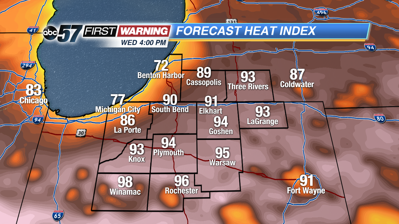 Heat index Wednesday afternoon well into the 90s for most the area.
Tonight: Mostly to partly cloudy, low 66.
Wednesday: Partly cloudy, high 87, isolated showers/storms.
Thursday: Very humid, partly cloudy, afternoon thunderstorms, high 90.
Friday: Very humid, partly cloudy, afternoon thunderstorms, high 88.
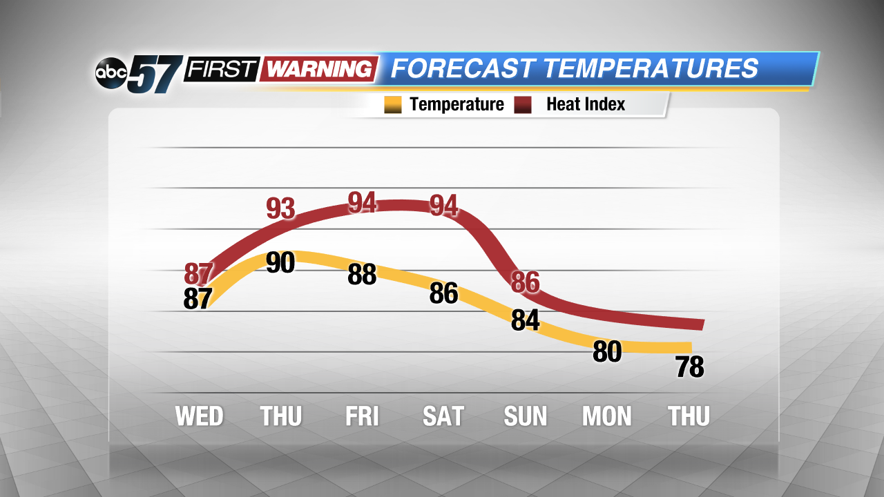 Extremely steamy through the weekend, no relief until early next week.
Sign up for the ABC 57 Newsletter