


ABC57 First Warning Neighborhood Weather Forecast
Tuesday, March 9th, 2021
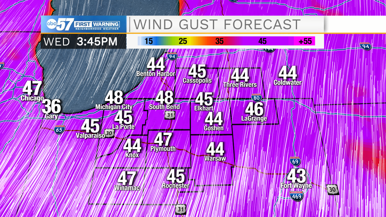
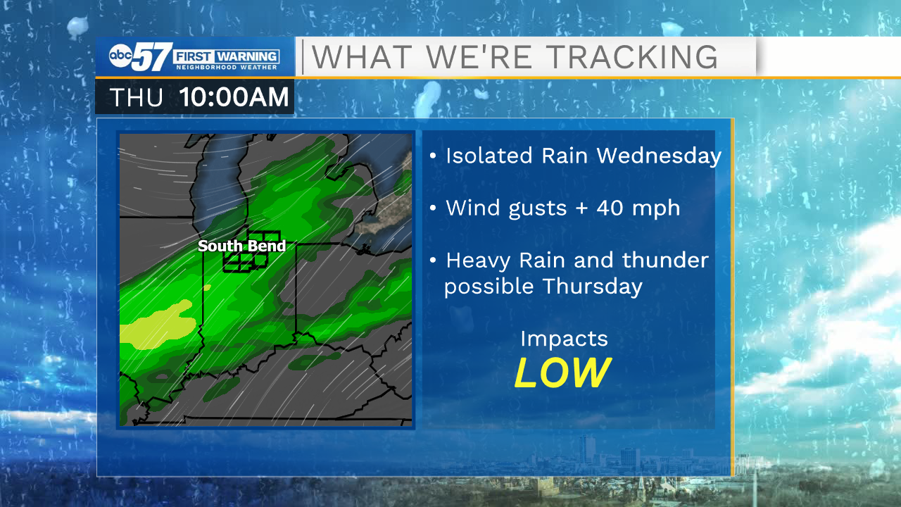
Another gorgeous day to enjoy outside! Daytime high climbs near 70F. It's a bit windier today but the wind really starts to pick up on Wednesday with gusts up to 40 mph possible. Isolated showers move in first Wednesday but the rain becomes widespread Wednesday night and lasts through Thursday. Showers could be heavy at times on Thursday with rumbles of thunder possible.
The system moves out early Friday morning with clearing skies the rest of the day. The weekend is quiet, just colder. Daytime highs will be in the 40s instead. The next system moves in on Monday with rain possible.
Today: Partly sunny, breezy and very warm. High 69.
Tonight: Partly to mostly cloudy, breezy. Low 50.
Wednesday: Mostly cloudy and windy with afternoon showers possible. High 66.
Thursday: Rainy, rumbles of thunder possible. High 62.