


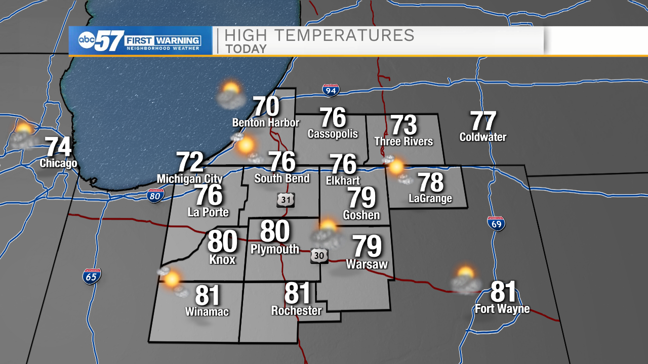
Today looks dry and quiet with mostly sunny skies. High temperatures this afternoon will top out in the mid to upper 70s. There will be a slight increase in cloud cover this evening as a cold front moves through Michiana. Behind the cold front will be a left over boundary that could spark a few isolated light rain showers in our northern Michiana counties. Most should expect to stay rain free through the overnight hours. Tomorrow afternoon partly cloudy skies will remain, and temperatures will be in the lower 70s.
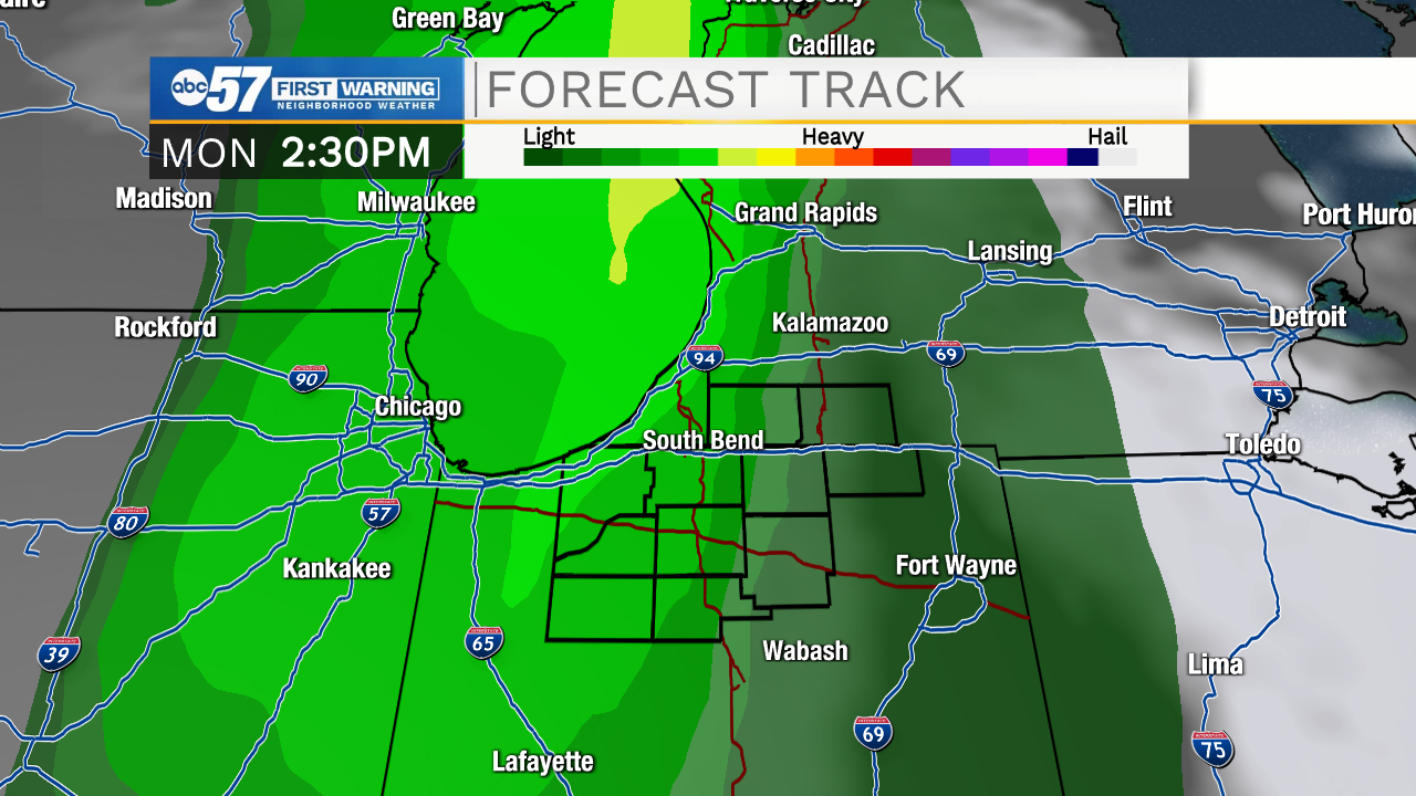
Monday looks to be our next best chance for scattered showers and isolated thunderstorms here in Michiana. Those will move in by early afternoon and clear out during the evening hours. Next week temperatures will fall into the mid 60s by Wednesday and the mid 50s by Friday. Low rain chances are also in the forecast for the middle and ending part of next week.
Today: Mostly sunny. High 76.
Tonight: Mostly cloudy. Low 56.
Tomorrow: Partly cloudy. High 72.
Monday: Scattered showers. High 72.