
-
1:26

Amidst several rounds of storms, some could be severe today
-
0:34

South Bend Community Review Board hosts open discussion on youth...
-
2:19

INDOT walks through a proposed diverging diamond intersection...
-
1:08

Notre Dame’s Leonard Moore highlights student success and raises...
-
1:05

Mayflower Bridge set to close beginning April 6
-
0:21

Colfax Avenue eastbound lane closed for water and sewer work
-
0:46

Madison Street closed for lifestyle district project
-
4:11

Non-profit organization provides deep dive into Blackstone, a...
-
1:52

Storms possible overnight, strong storms by Tuesday evening
-
3:48

New partnership aims to help fight food insecurity across Elkhart...
-
2:00

A sunny Monday ahead, rainy almost every other day this week
-
2:59

Dusty May leads Michigan back to Final Four with dominant win...

ABC57 First Warning Neighborhood Weather Forecast
Monday, April 5th, 2021
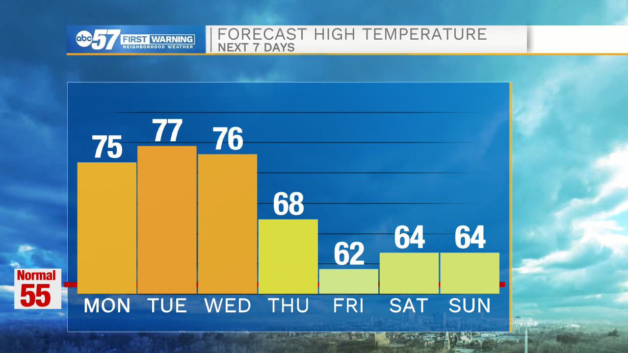
The stretch of warmth with daytime highs in the 70s continues through mid-week! Isolated t-storms are possible today and Tuesday with storms arriving late Wednesday evening. Showers become more widespread for Thursday as daytime highs drop into the upper 60s. A few showers could linger into Friday morning. Daytime highs remain in the 60s through the weekend with more sunshine.
Today: Mix of sun and clouds. Isolated t-storms and breezy. High 75.
Tonight: Partly cloudy. Low 56.
Tuesday: Partly cloudy. Isolated t-storms. High 77.
Wednesday: Increasing clouds. Storms late. High 76.
Sign up for the ABC 57 Newsletter