Warming trend this week; dry through Friday
By: Maci Tetrick
Posted: Jun 14, 2020 6:38 AM EDT

-
2:14

Why summer travel prices may spike due to the ongoing war in...
-
1:49

Heavy rain, high winds, and hail are main severe concerns today
-
1:26

Amidst several rounds of storms, some could be severe today
-
0:34

South Bend Community Review Board hosts open discussion on youth...
-
2:19

INDOT walks through a proposed diverging diamond intersection...
-
1:08

Notre Dame’s Leonard Moore highlights student success and raises...
-
1:05

Mayflower Bridge set to close beginning April 6
-
0:21

Colfax Avenue eastbound lane closed for water and sewer work
-
0:46

Madison Street closed for lifestyle district project
-
4:11

Non-profit organization provides deep dive into Blackstone, a...
-
1:52

Storms possible overnight, strong storms by Tuesday evening
-
3:48

New partnership aims to help fight food insecurity across Elkhart...

Temperatures stay below normal to end our weekend. Sunday morning early temperatures are in the low 50s. We reach the 60s by noon, and an afternoon high of 73. It will be another sunny day.
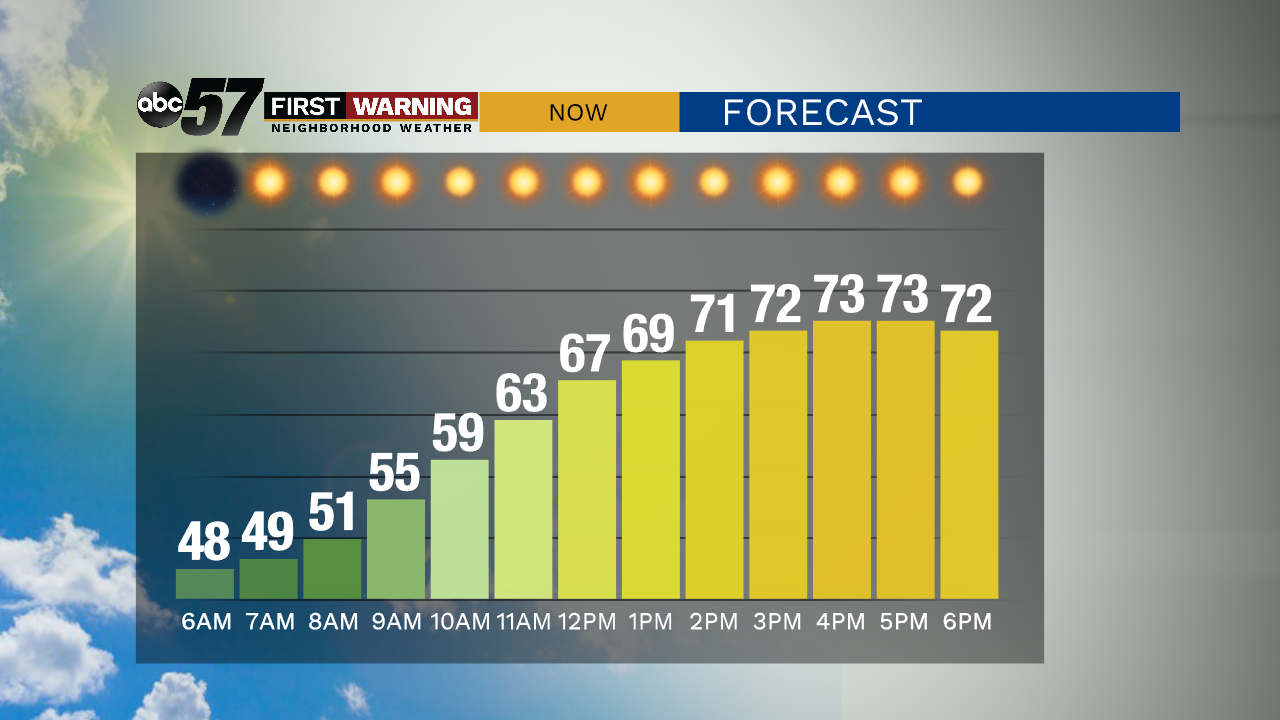
Overnight, temperatures will fall to a low around 50 with clear skies.
The dry, sunny streak continues this week. There is a slight chance for an afternoon or evening shower Monday, but likely the day is dry.
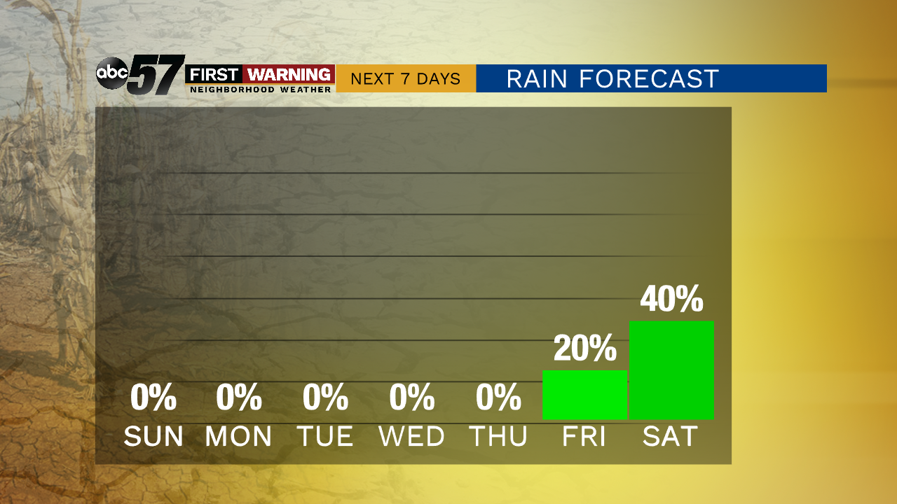
Temperatures warm slightly each day of the week, reaching the upper 80s by Thursday and Friday. Friday evening there is a chance for evening thunderstorms or showers. Showers and thunderstorms will likely continue next weekend.
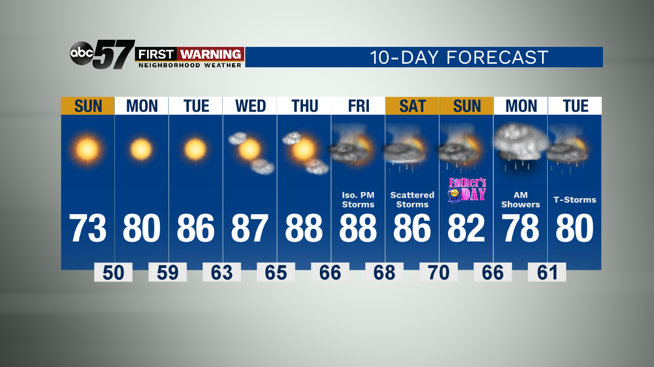
Today: Sunny. High 73.
Tonight: Clear skies, cool. Low 50.
Monday: Sunny. High 80.
Tuesday: Sunny, warmer. High 86.
Sign up for the ABC 57 Newsletter