
-
2:23

La Porte community rallies for Sammy Strong Benefit, raising...
-
1:57

The Potawatomi Zoo opens its gates to Zoo Nights Live
-
2:50

Carson Kvapil wins his first O’Reilly Auto Parts Series win...
-
1:10

William Tuffs honored as the only Indiana man who took part of...
-
0:50

Beacon Health held a Health and Wellness fair for the community
-
1:03

Warm conditions start overnight
-
1:02

Another pleasant day
-
0:42

Still cooler out the door
-
2:00

New Carlisle celebrates annual Hometown Days
-
1:40

Ross Chastain leads NASCAR O’Reilly Auto Parts Series practice...
-
2:27

Backpacks for Berrien hosts their Stuff-a-Bus event, ultimate...
-
2:59

Ludacris Opens Elkhart County 4-H Fair Concert Series Amid Ticket...

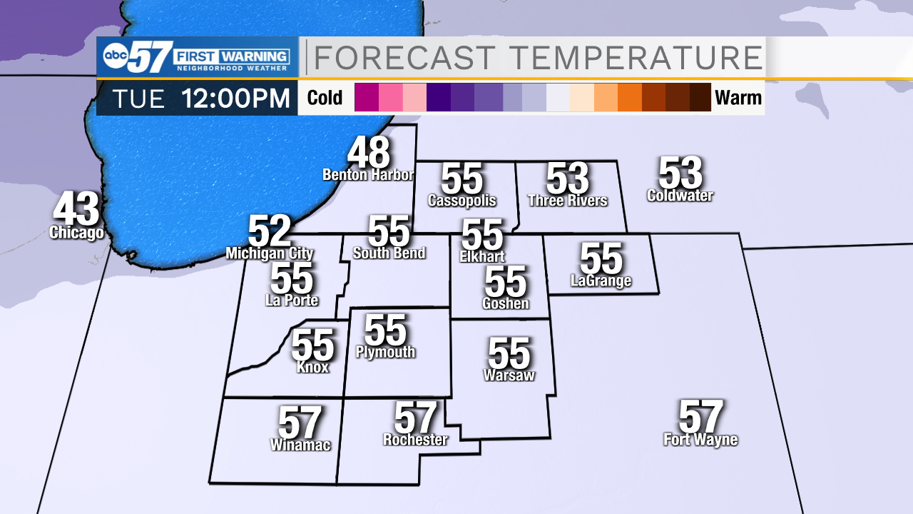
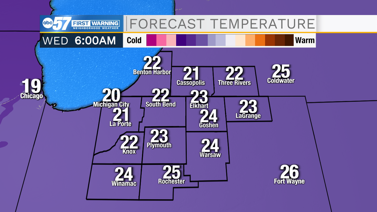
Temperatures swing sharply this weekend for spring, quickly back to winter. Tuesday feels like spring, highs in the 50s and rainy, then temperatures free-fall into Wednesday. The end of the week is cold. The next round of snow is Thursday, early estimates of one to three inches, enough to bring caution to the Friday morning drive. The weather is cold but quiet through the weekend.
Tonight: Rain after midnight. Low 48.
Tomorrow: Rain in the morning tapers to showers in the afternoon. High 56.
Wednesday. Cloudy and much colder. High 26.
Thursday: PM snow showers. High 30.
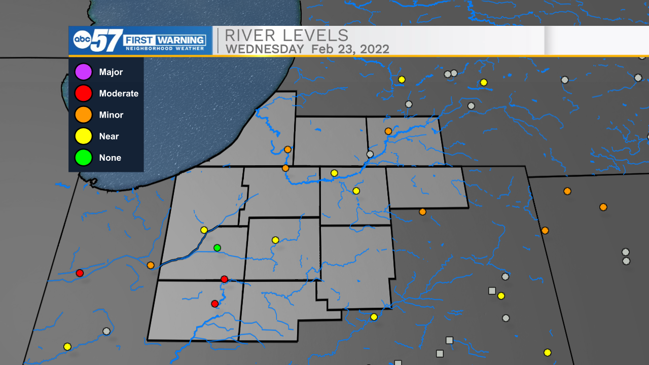
River will rise with more melting and added rainfall, areas will standing water will get wetter through Friday. This is far below the record levels in FEB 2018.
Sign up for the ABC 57 Newsletter