Winter Storm: Snow begins Tuesday night, lasting through Wednesday


Overnight rain lingers into early Tuesday morning. A bit of a break during the day Tuesday, then rain returns late afternoon. As temperatures drop, rain will turn into a wintry mix, mostly snow by midnight. Snow continues throughout the day on Wednesday. Most areas will see 3-6 inches of snow but more than 6 inches is possible.
Up to 6" of snow is most likely at this point
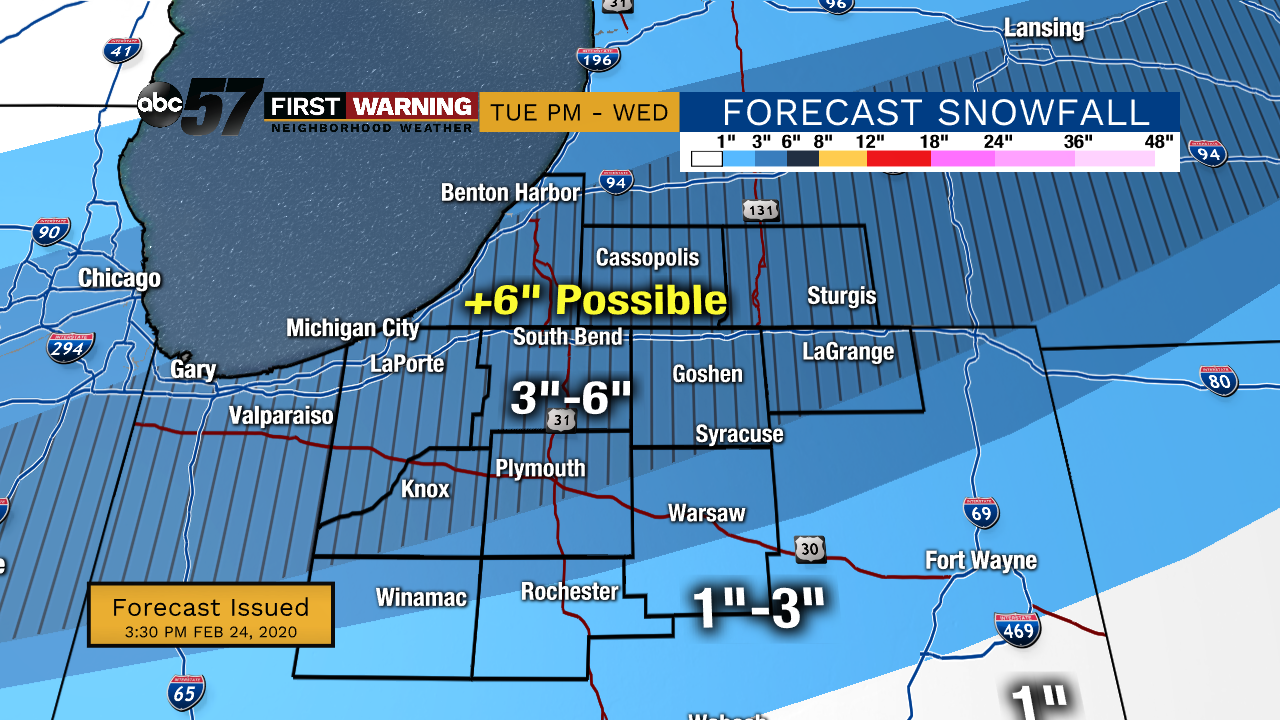
Heaviest snow / impact is Wednesday morning
Some snow showers could linger into Thursday morning. Although the system moves out, lake effect snow is also possible Thursday and Friday. Colder temperatures in the 20s and 30s remain Wednesday through the weekend.
Tonight: Rain showers overnight. Low 34.
Tuesday: A few early morning showers. Rain/wintry mix around 5 PM, then snow around midnight. High 39.
Wednesday: Snow throughout the day. 3-6 inches possible. High 33.
Thursday: Cloudy with a few morning snow showers. High 23.