
-
1:00

Warming up this weekend before more storms next week
-
1:46

A chilly and calm start to the weekend
-
1:00

NIPSCO workers rally in South Bend for new contract
-
1:53

Severe weather threat is over, MUCH colder Friday
-
3:43

South Bend Mayor James Mueller delivers 2026 State of the City...
-
0:52

Family and friends of Adrian Cruz voice frustration in sentencing...
-
2:13

Potawatomi Zoo prepares for opening day with new attractions
-
2:54

Local expert weighs in on landmark social media trials
-
1:33

Round one of storms moving east, Round two arriving soon
-
2:38

Bourbon residents recall tornado as severe weather strikes again
-
1:34

Tornado threat decreasing, but severe weather still expected...
-
1:42

Damaging winds and hail move in this evening

The warm-up continues, highs will make it above freezing Friday and into the 40s this weekend. Most of the snow will be melted by the end of Saturday thanks to all the sunshine. Clouds return Sunday along with a chance of rain showers, widespread soaking rain is expected Sunday night and Monday. Temperatures dip again, with a chance of snow next Tuesday.
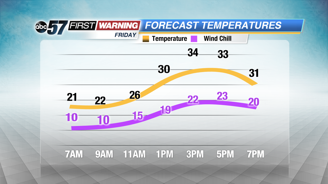
Tonight: Clear, low of 20.
Friday: Sunny, high of 36.
Saturday: Mostly sunny, high of 40.
Sunday: Mostly cloudy, rain by late afternoon, highs in the mid-40s.
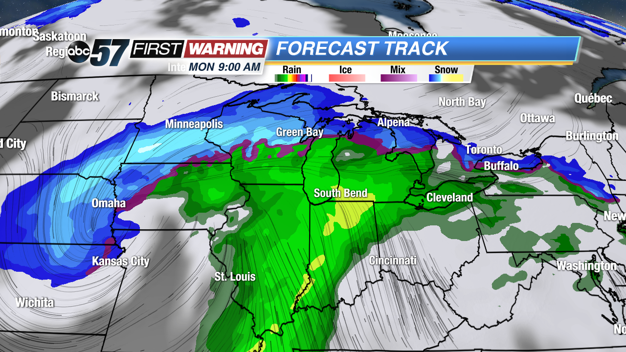 Projected radar Monday
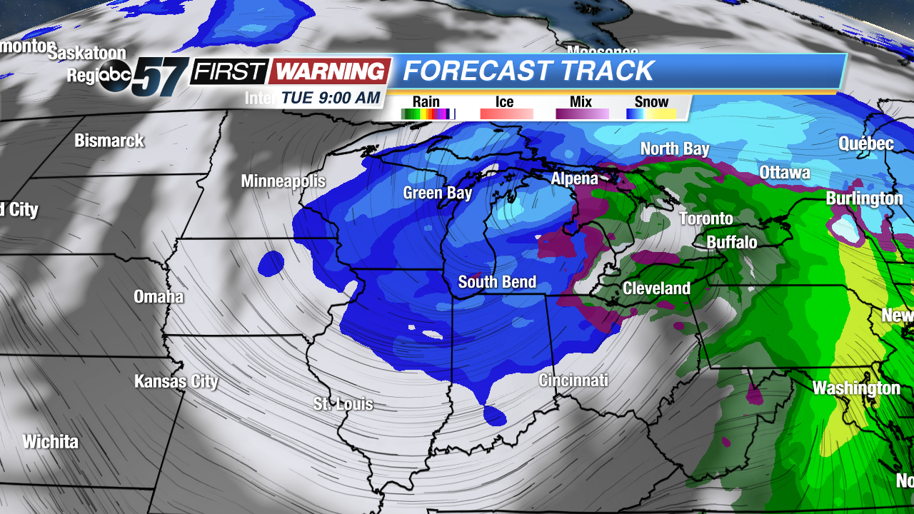 Projected radar Sunday
Sign up for the ABC 57 Newsletter