Weekend Winter Storm: what we know as of Wednesday evening
Posted: Jan 16, 2019 12:59 PM EDT
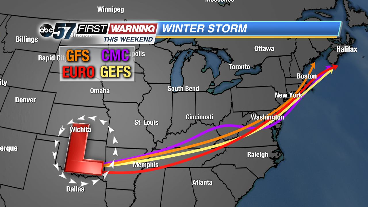
As you're probably aware, a winter storm is heading for the Midwest, Great Lakes, Ohio Valley, and Northeast. Its effects will begin to be felt across the Midwest on Friday with the storm departing New England by late Sunday. As is always the case with winter storms, there are multiple moving parts and those parts continue changing as new data come in. The storm itself is still over the open waters of the East Pacific Ocean as of Wednesday afternoon, and won't come onshore until Thursday. It's at that point that forecast models will be able to sample it and grasp it better.
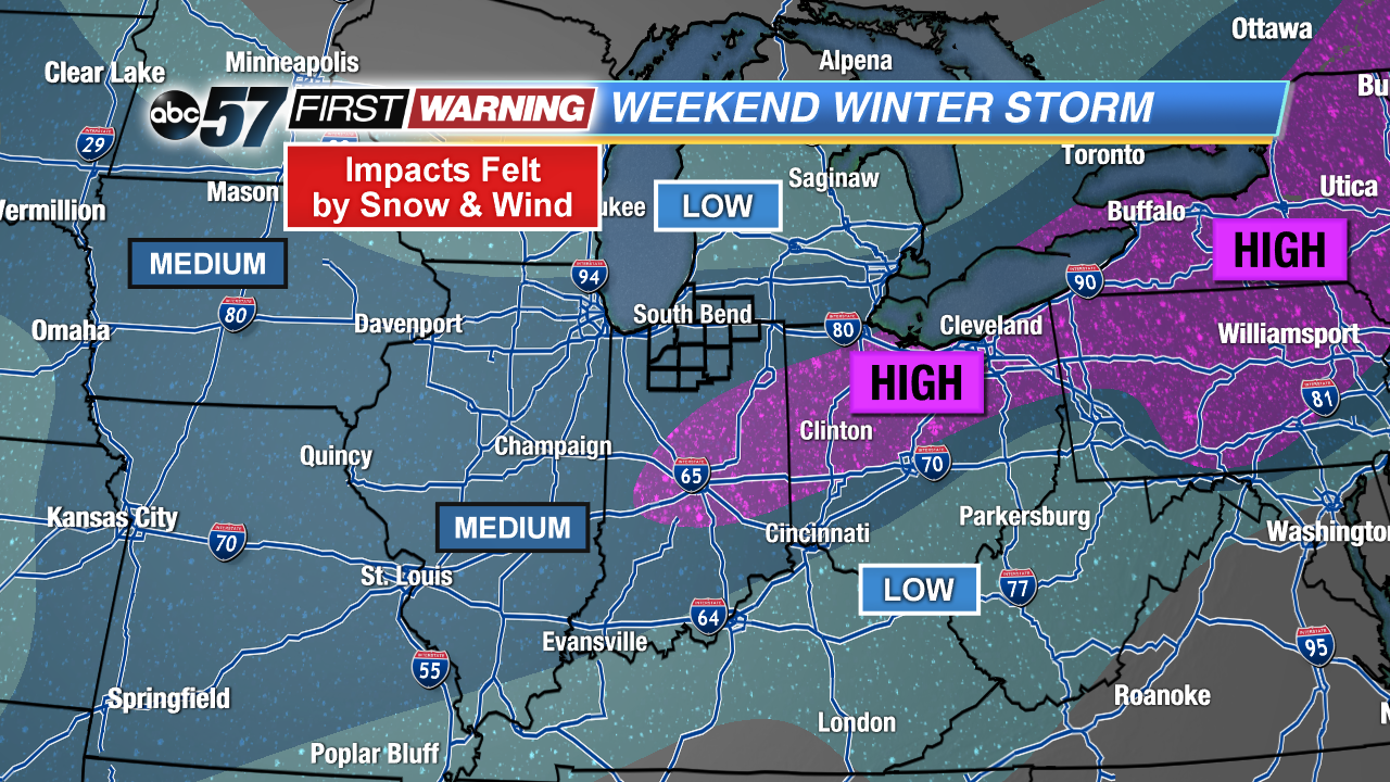
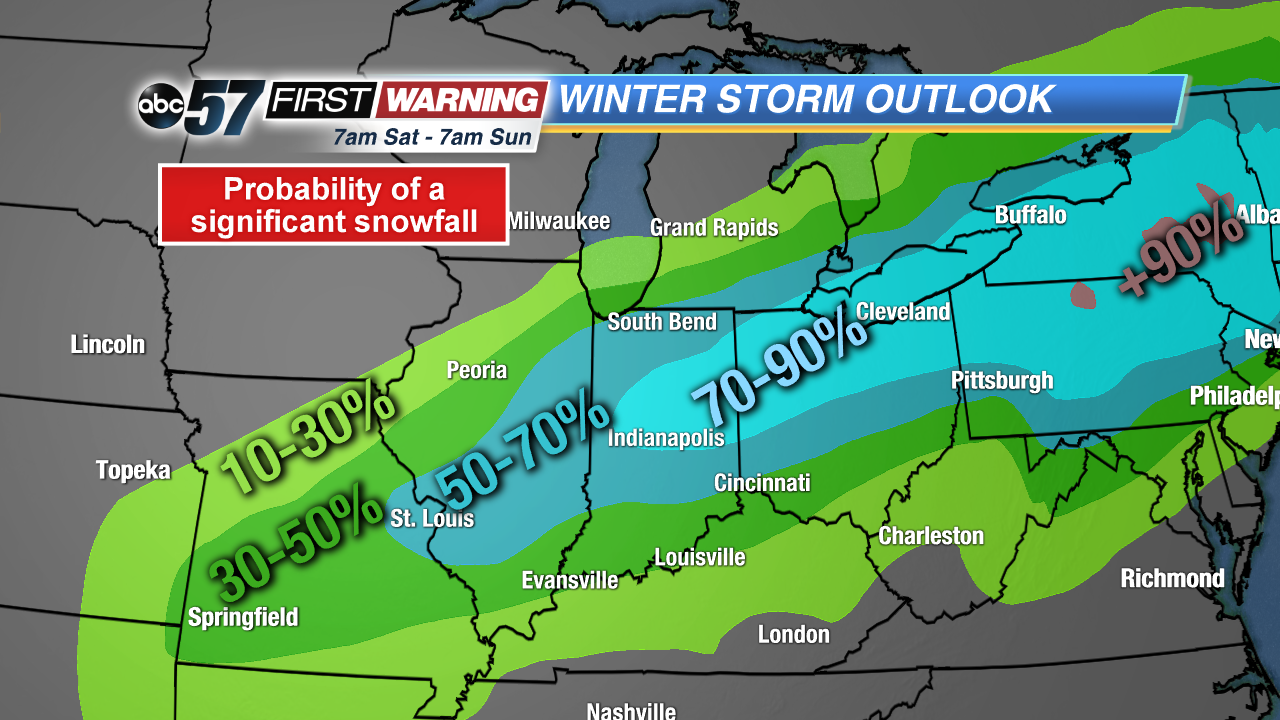
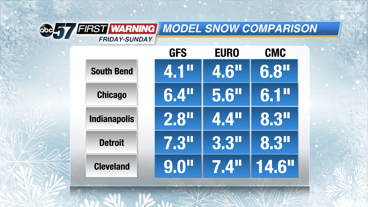
So, in short, if you want a much better idea of what will fall in Michiana, wait until Thursday afternoon. Still, it is with high confidence that we can say snow will fall on Saturday across the area. Confidence is not as high in amounts or impacts as a matter of 25 miles or less will be the difference between a big-time snowfall and less than 4 inches. At this juncture, the greatest impacts and highest snowfall totals look to be setting up south of U.S. 24 across Central Indiana. That zone then extends into the northern half of Ohio. In that zone, a highly impactful snow of more than 6" is likely.
The peak of the snow will occur from Saturday early morning until Saturday evening. In that window, the snow will fall steadily at a light to moderate clip. Visibility will be reduced and gusty winds will make travel even more difficult for all of Michiana and surrounding areas. If you have travel plans Saturday or even Sunday, plan on adjusting them or allowing a significant amount of extra allotted time. That will be especially true for those traveling south or east.
I-80, I-90, I-94, I-70, I-74, I-65, I-69, I-71, and I-75 will all see impacts from the snow and wind. In addition, U.S. 31, U.S. 20, U.S. 6, U.S. 24, U.S. 30, U.S. 40, U.S. 52, U.S. 27, and U.S. 33 will be greatly impacted. Again, it's still a little bit too early to discuss exact totals, but models are honing in on a solid event for most of Michiana. Of course, as mentioned above, areas with the absolute best chance of seeing more than 6" of snow include Kokomo, Indianapolis, Muncie, and Fort Wayne in Indiana. Be sure to stick with ABC 57 News through Saturday for continuing coverage and new details about the impending winter storm.


