
-
2:51

Obama Presidential Center features work of South Bend company
-
1:54

This week’s ABC57 Cub Reporter is Isaac Knefely
-
1:16

Real summer heat returns next week
-
2:28

South Bend storm drain mural project complete
-
5:17

Three local students return as national powerlifting champions
-
1:09

Rain showers to end the work week
-
5:36

Benefit Car Show supporting Berrien County’s first responders...
-
2:51

Governor Whitmer appeals FEMA federal aid denial for Southwest...
-
3:17

Benton Harbor leaders weigh Jean Klock Park upgrades amid debate...
-
1:40

Pollinator Playpath, a trail for kids, now open at Corson Riverwoods...
-
0:32

Ryan Newman racing Saturday at Plymouth Motor Speedway
-
3:08

Officials recover body of missing teenager in Lake Michigan off...

Cool temperatures continued on Wednesday, but they will rise into the 50s by Thursday morning. Rain will become likely this evening into the overnight as well with a rumble of thunder possible.
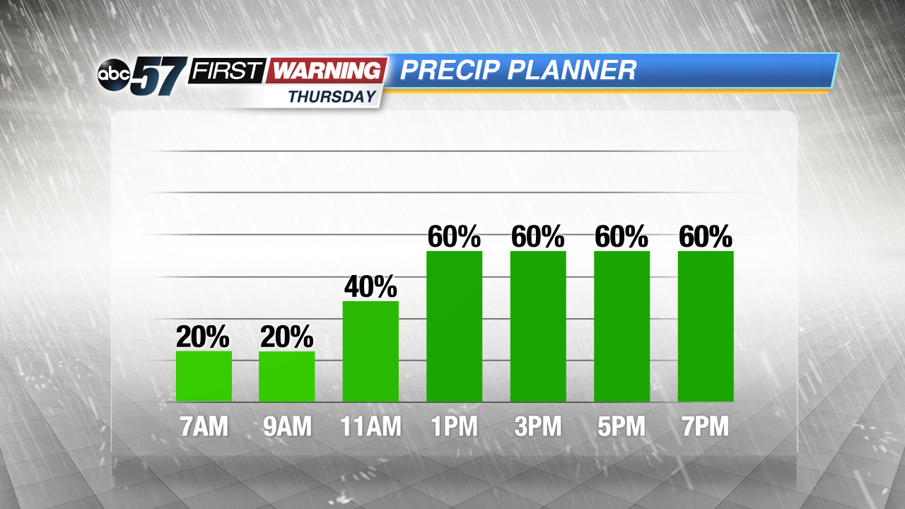
Thursday afternoon will be quite mild with temps approaching 60 as skies remain mainly cloudy. A few showers are possible throughout the day, but the best threat of rain on Thursday will be during the late afternoon and evening hours.
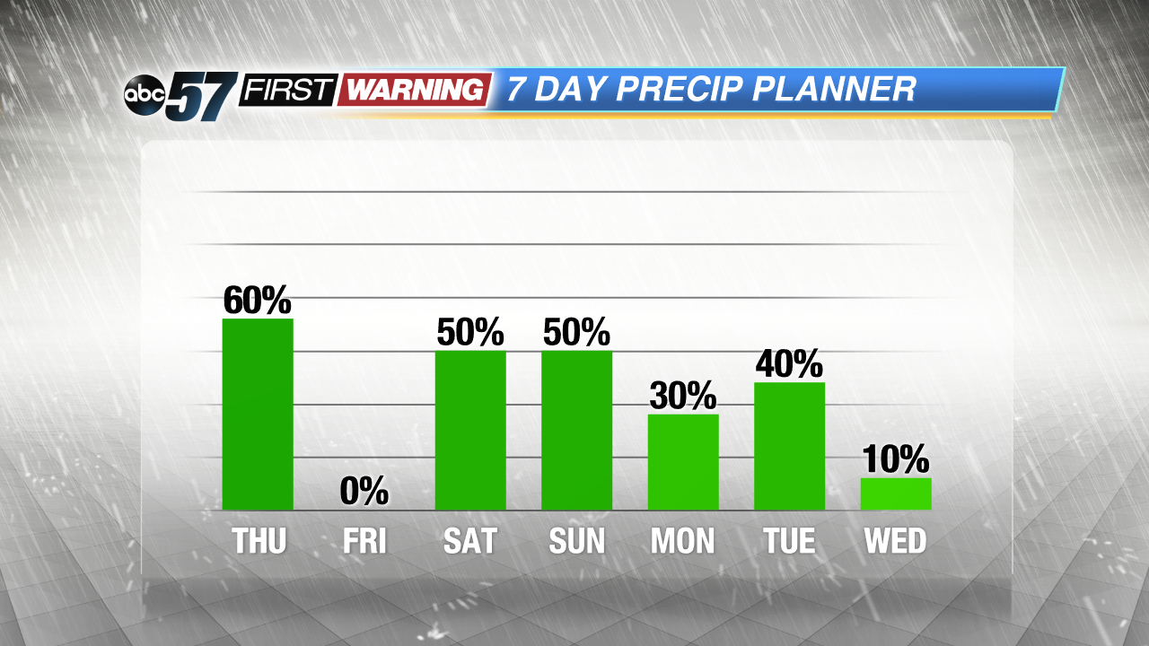
Friday looks dry with plenty of sunshine, but rain showers are once again possible this weekend as another area of low pressure and cold front approach the region. Temperatures will range from the lower 50s Friday and Saturday to the middle 60s on Sunday before slipping back into the 40s early next week.
Tonight: Few showers, cloudy, low 46.
Thursday: Rain showers, high of 60.
Friday: Mostly sunny, highs in the low 50s.