Wet snow starts Wednesday evening, lasting through Thursday morning
By:
Tom Coomes
Posted: Feb 4, 2020 4:35 PM EDT

-
2:05

JobSpark helps inspire career exploration for middle school students
-
2:01

MPHPL launches new bookmobile to extend library access
-
2:17

Will Pauling shines, Jadarian Price shows versatility at Notre...
-
2:55

Notre Dame’s Pro Day gives 16 seniors one more shot to impress...
-
2:57

South Bend residents voice concerns over proposed pedestrian...
-
3:03

Prices at the pump continue to rise across Michiana
-
1:35

Warming up before storms arrive Thursday
-
2:06

Staying sunny until Thursday
-
0:58

Goshen City Council amends DORA rules amid community concerns
-
1:20

SB Common Council adopts Downtown 2045 Plan
-
2:39

Friends and family celebrate life of Jamecia Moffitt
-
1:15

St. Joseph County Council updates residents on Affordability...

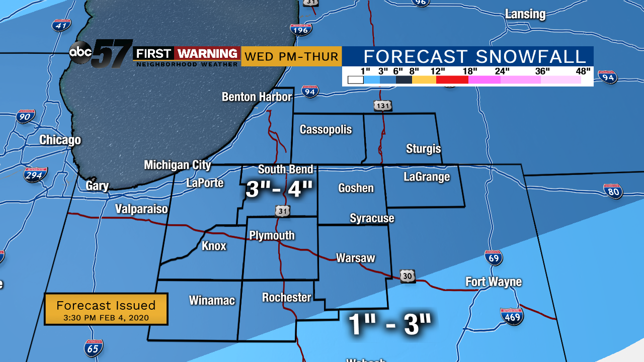
Wednesday will be cloudy but snow-free until the evening. The greatest chance of snow is Wednesday evening until midday Thursday. We could see more than three inches of wet snow. Allow extra time for the Thursday morning commute. There is a chance for lighter snow showers Thursday evening into Friday morning but will less of an impact. The rest of Friday is mostly cloudy. Temperatures this week stay in the low 30s each day and drop to the low or mid 20s each night.
Tonight: Cloudy. Low 29.
Wednesday: Cloudy day, PM snow. High 33.
Thursday: AM snow, PM flurries. High 30.
Friday: AM flurries then mostly cloudy day. High 30.
Sign up for the ABC 57 Newsletter