Scattered showers and storms last on and off today from the remnants of Barry. Rain could be heavy at times leading to ponding on the roads and localized flooding. The chance of rain lingers into the early overnight hours. Wednesday still has an isolated shower/storm possible otherwise it’s drier and our last day before the big warm up.
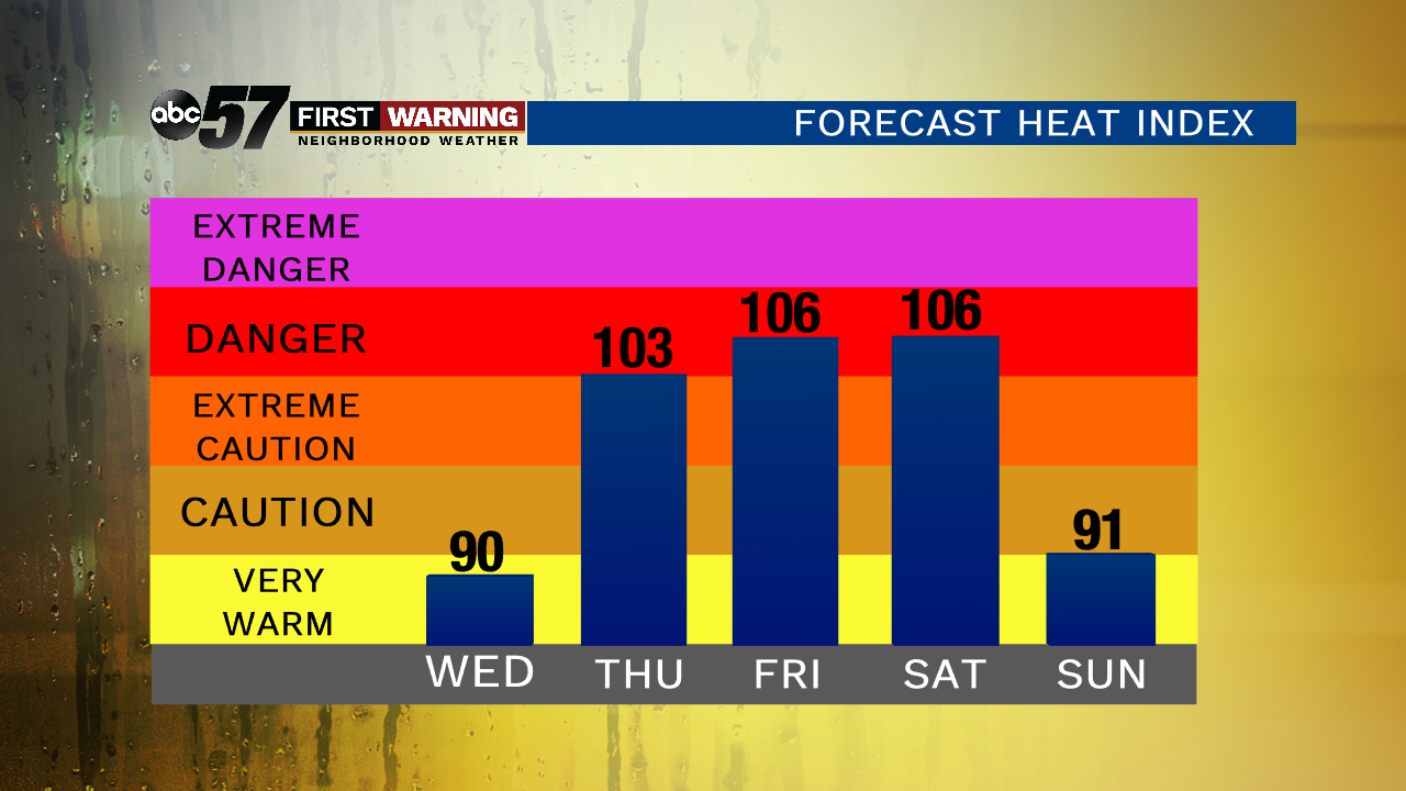
Thursday through Sunday is hot and humid! It is going to feel even hotter as heat indices will be over 100 degrees. This kind of heat can be dangerous, so make sure you’re staying hydrated and takes breaks from the heat. Relief from the heat comes Sunday evening as a cold front swings through, bringing showers and storms.
Today: Scattered showers and storms, heavy rain possible, high of 82.
Tonight: Mostly cloudy, chance of rain/storms, low of 70.
Wednesday: Partly to mostly cloudy, slight chance of a shower, high of 86.
Thursday: Hot and very humid, chance of storms, high of 93.