
-
3:41

Present Pillars to host “Dad Strong 5K“ to support fathers...
-
1:44

Warming up through Wednesday
-
2:34

From Niles to South Bend: Jays 2 Keeps the Spirit Alive for basketball...
-
0:46

44th annual Tri Kappa Antique Show boosts charities and scholarships
-
1:48

Scattered showers this evening, Much cooler overnight
-
1:50

Showers and storms this afternoon
-
0:20

One person injured in shooting
-
0:36

Eddies Circuit Robotics holds competition Saturday
-
0:32

21st annual Nappanee Model Train Show
-
0:38

Local boys basketball team headed to IHSAA state finals
-
3:49

Midwest Meowfest brings kitten advocacy to attendees, new homes...
-
1:52

Mild tonight, showers tomorrow

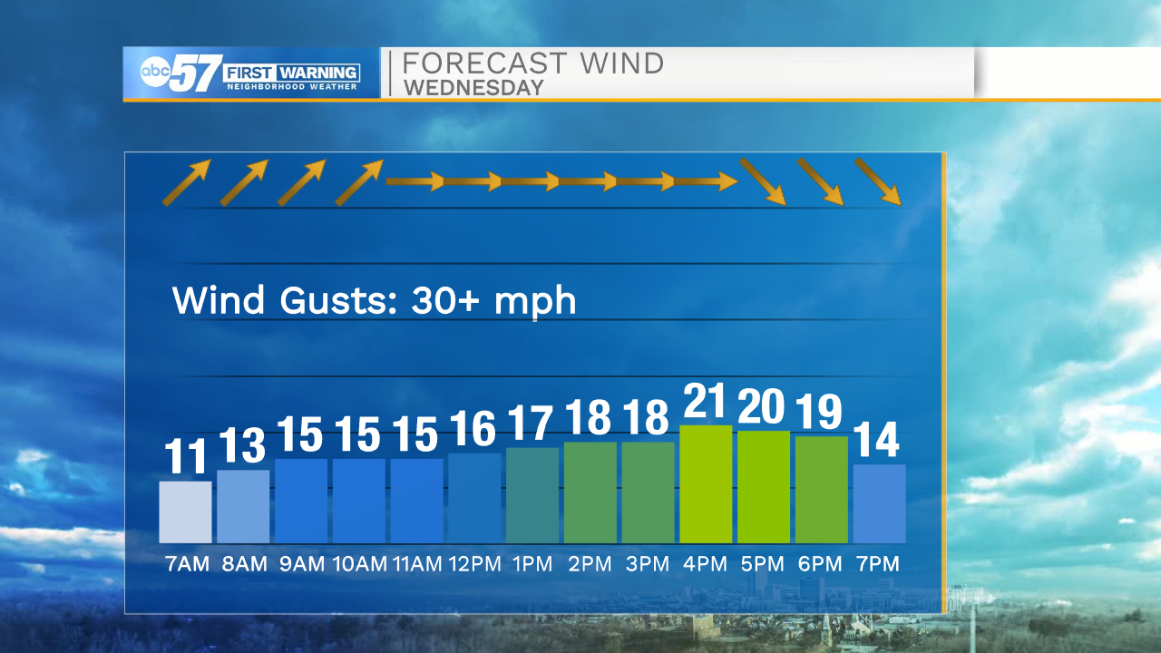
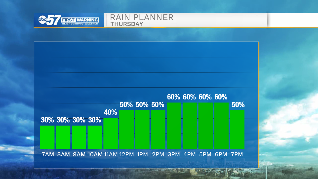
Thursday is calmer and wetter. The wind will not be as strong ahead of the second cold front, but rain is more likely and could last most the day, with a frequent scattering of showers. After the front, the wind turns northerly Thursday evening into Friday. The temperature difference between the warm lake water and cool air will produce lake effect rain showers and drizzle into early Friday. Clouds break into the weekend. Saturday is fair before another around of rain Sunday. Temperatures rise steadily next week.
Tonight: Partly cloudy, a few showers early. Low 46.
Thursday: Scattered showers. High 58.
Friday: Mostly cloudy. High 52.
Saturday: Partly cloudy. High 57.
Sign up for the ABC 57 Newsletter