What's ahead: minor flooding on rivers
Posted: May 15, 2018 1:18 PM EDT
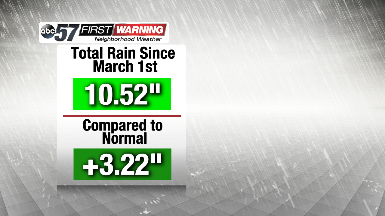
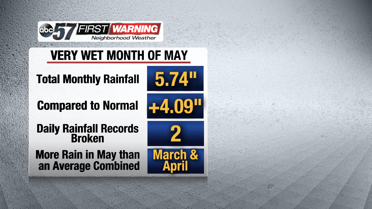
Rain, rain go away! That is probably a common phrase being said across Michiana this week. That's because we have seen quite a bit in the way of rainfall over the last couple of weeks. Dating back to the beginning of Meteorological Spring, which begins on March 1st, the City of South Bend has recorded over ten inches of rain. That is more than three inches above normal for the span March 1st - May 14th! Believe it or not, both March and April featured below normal precipitation totals! So, how are we so far above normal in the rainfall department? The answer is the month of May. May has been extremely active and rainy with four days featuring more than a half-inch of rain!
Nearly a half-foot of rain fell between May 1st and 14th. That puts South Bend at more than four inches above normal for the month thus far. Additionally, South Bend has broken two daily rainfall records already this month. Both May 2nd and May 14th recorded more rain than any other May 2nd or May 14th in South Bend's weather history! Those two days alone saw a combined 3.98" of rain!
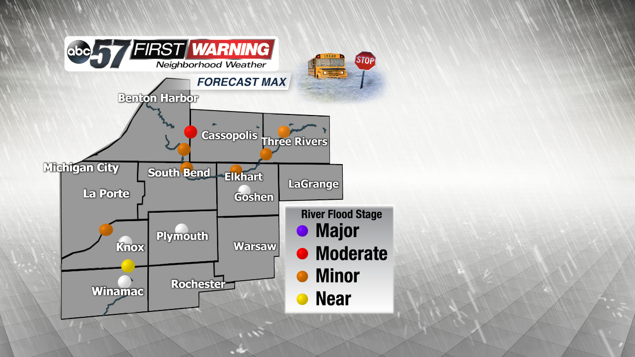
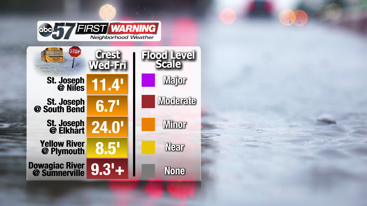
For perspective, the first 14 days of May brought more rain to South Bend than what the city would normally see during all of March and April combined! In other words, it has been quite rainy! And, of course, that rain has to go somewhere. Some is evaporated. Some is absorbed into the ground. Some, though, runs off into area streams, tributaries, creeks, and rivers. The result is rising river levels into "Flood Stage." At least for some. The St. Joseph River at Niles, South Bend, Elkhart, Mottville, and Three Rivers will likely push into Minor Flood Stage. It could come close to Moderate Flood Stage in spots as well. The Yellow River in Plymouth is likely to remain just below Minor Flood Stage. The Kankakee River at Davis will likely rise into Minor Flood Stage. The highest rise is expected along the Dowagiac River at Sumnerville. Moderate Flood Stage has been reached as of 12 PM Tuesday.
It's important to remember that a river entering Minor Flood Stage means there could be locally high water along the river. It's also important to remember that any given river entering "Flood Stage" does not mean it will resemble what happened in February with Michiana's historical flood event. Conditions are NOT expected to reach anywhere near what was seen in February. Still, high water and some flooding is possible along our local rivers. And, as always, the rivers can rise a little more than what is originally forecast. Thus, it is certainly possible that some high-end Minor Flood levels are reached. There could even be a river location that reaches low-end Moderate Flood Stage despite the forecast calling for Minor Flood Stage. All rivers will crest between Wednesday afternoon and Friday night.


