
-
2:12

South Bend City Council passes resolution urging pause on Midwest...
-
0:46

Niles City Council vote yes on putting marijuana question on...
-
0:29

Multiple Fire Departments battle residential fire in Berrien...
-
2:10

Notre Dame men’s basketball embracing urgency as Shrewsberry...
-
2:37

Local Beef-A-Roo employees still owed paychecks as private equity...
-
1:42

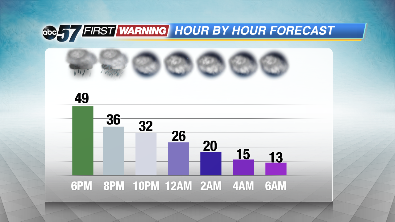
More storms through 8:00 p.m.
-
1:06

2nd annual Inclusive Art Fair
-
2:20

Tracking severe weather through the mid-afternoon
-
3:17

Applications open for Fall Citizens Police Academy in South Bend
-
2:23

Elkhart County 4H Fair food vendors celebrate 50th year of business
-
2:16

Young football athletes learn about protecting their bodies,...
-
1:24

Storm track timing could be shifting

Temperatures start to free-fall after 5 PM Thursday, plummeting from the 50s into the lower teens by Friday morning. The wind will howl, gusts of 45 to 50 mph. A flash freeze is possible with some wet areas turning icy by morning.
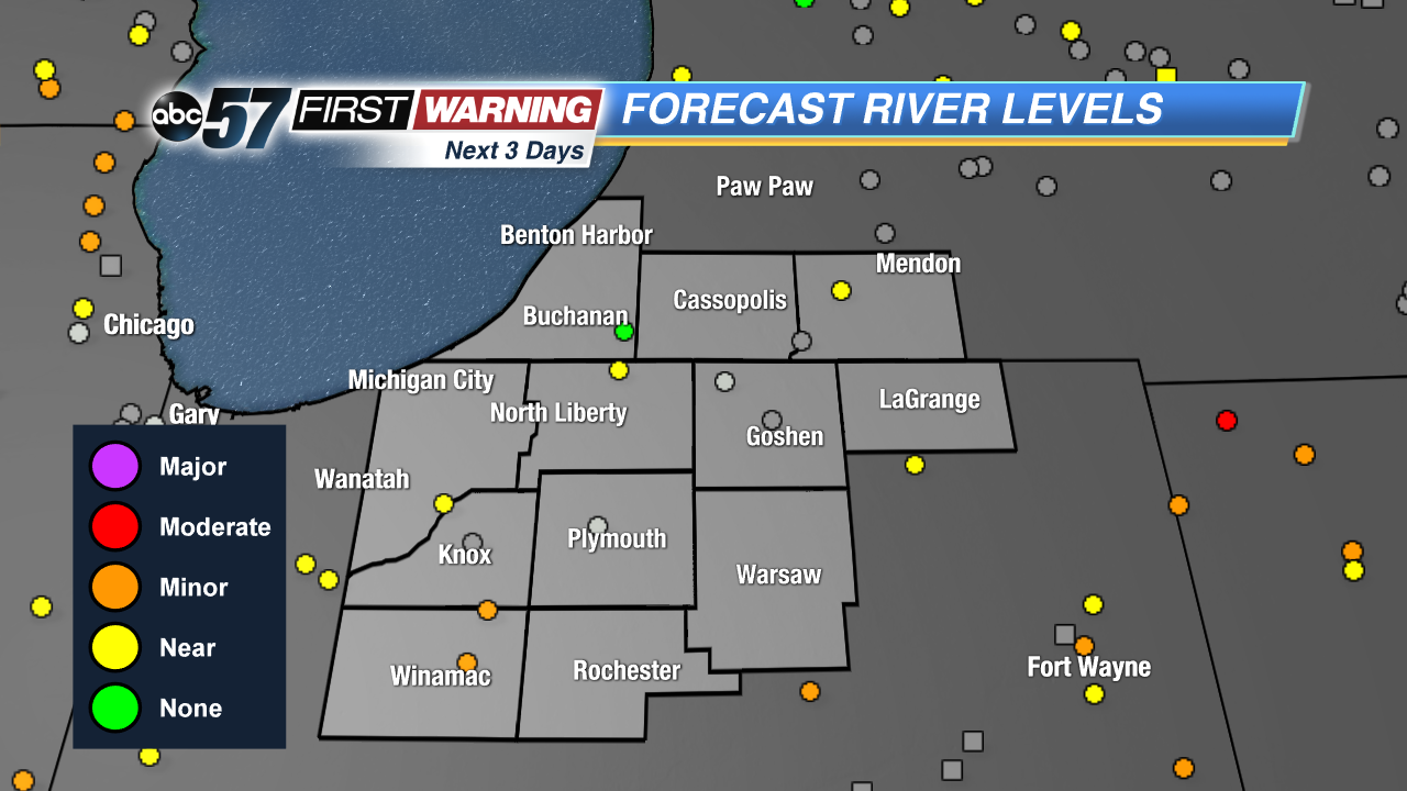
Friday is a shock to the system as winter comes barreling back into Michiana. Temperatures will struggle to break 15 degrees and areas of standing water from flooding may freeze. Rivers remain high through Saturday before waters start to recede. The most significant flooding along the Kankakee and Tippecanoe rivers. The next chance of snow is Sunday afternoon.
Tonight: Falling temps, windy, chance of flurries, low of 12.
Friday: Cold and breezy, partly cloudy, high of 15.
Saturday: Cold and sunny, high of 24.
Sunday: Snow showers by the afternoon, high of 32.