Michiana seeing 3rd-most "extreme" start to winter season since 1999
Posted: Dec 4, 2018 1:49 PM EDT
There's no easy way to measure how "intense" any given winter season is. We can say it was snowy, cold, gray, frigid, etc. However, courtesy of the National Weather Service and the Midwestern Regional Climate Center, there's a way to objectively rank how bad a winter season truly is. It's still in its research phase, but it's called the Accumulated Winter Season Severity Index (AWSSI). Essentially, it's an index that's broken down into five categories used to describe the intensity and severity of the winter season. It incorporates data such as maximum and minimum temperatures, snowfall, snow depth, and precipitation. It does not include things like wind chills, blowing snow, mixed precipitation, or freezing rain. These are deemed limitations in the overall effectiveness of the index.
The index can have a numerical value from 0 all the way to well over 1,000. Based on that number and what a given city typically sees in a winter season, a category is assigned. The five categories used to describe the severity of any given winter season from not-so-bad to very bad are:
•Mild (red)
•Moderate (orange)
•Average (yellow)
•Severe (blue)
•Extreme (purple)
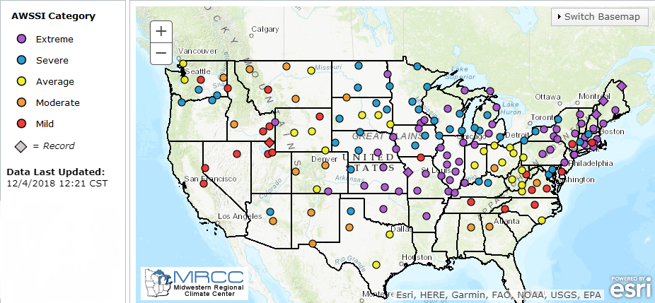
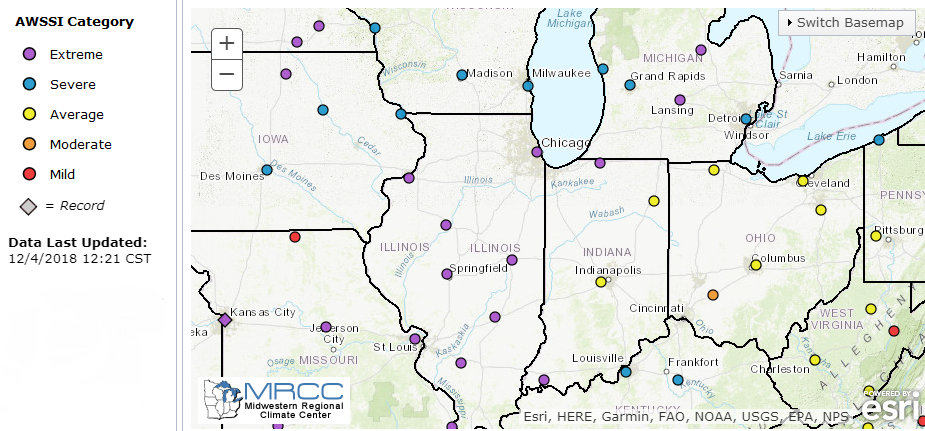
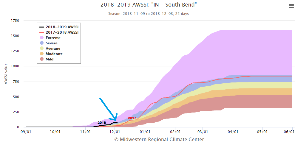
Thru December 4th, numerous cities have seen "extreme" winter seasons. That includes Kansas City, Oklahoma City, St. Louis, Chicago, Marquette, and right here in Michiana! South Bend, up until December 4th, is in the "Extreme" category with a score of 77. That means our winter season, which started on November 9th, has been significantly worse than what it should be up until this point. And, based off what November brought us, who could argue?
For December 4th, the index has been as high as 176 and as low as 0. Thru this point last winter, the index was a measly 25. Going back to 1999, this is the third-most extreme start to a winter season in South Bend! Something to keep in mind is this does not mean the rest of the winter season will be snowy and cold.


