Winter storm or winter hype?
Social media has already begun to chatter about a ‘major winter storm’ by the end of this week ( Jan 12th-13th). It is true there is the potential for a big snow, somewhere in our region. However, that big snow could be from South Bend to Cleveland.
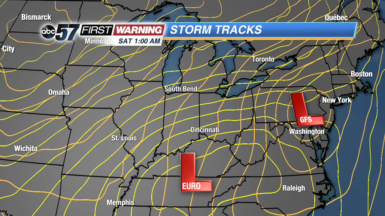
Storm tracks are a key historic guide to the impacts of winter weather. All things being equal, a winter storm with the low track moving from Bowling Green, KY to Cincinnati to Sandusky, OH is the ‘boom’ scenario for a big snow storm in Michiana. A small change in that course, 10 to 20 miles east or west can change things significantly.
As of Monday, our two long range models have two very different solutions. The EURO is close to that ‘boom’ scenario while the GFS is much farther east. We are still four to five days away from this event so we will wait and see what solution actually plays out.
Besides storm track there are many other factors at play, like the speed of the system. A slower moving system will dump more snow in one location while a quick mover is gone before much of the snow falls.
There’s also the factor of temperatures preceding the snow. If temps hang above freezing long enough much of the snow may fall as rain or sleet before it turns to all snow.
These are factors we’ll watch closely this week. Don’t be duped by a strange social media account posting about a ‘Mega Snow Storm’, especially more than a few days out. Winter weather has many nuances and just posting about one model’s solution is often misleading.
Stay with the First Warning Neighborhood Weather Team as we take you through this week’s ups and downs.


