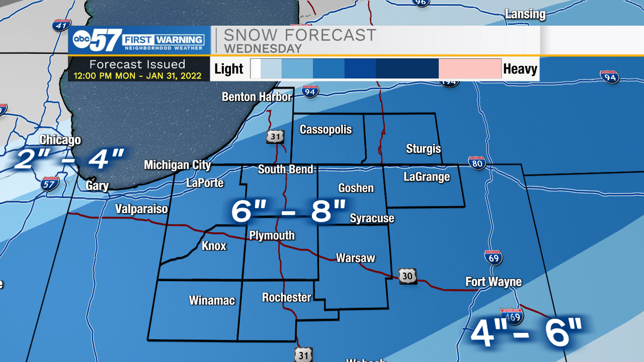
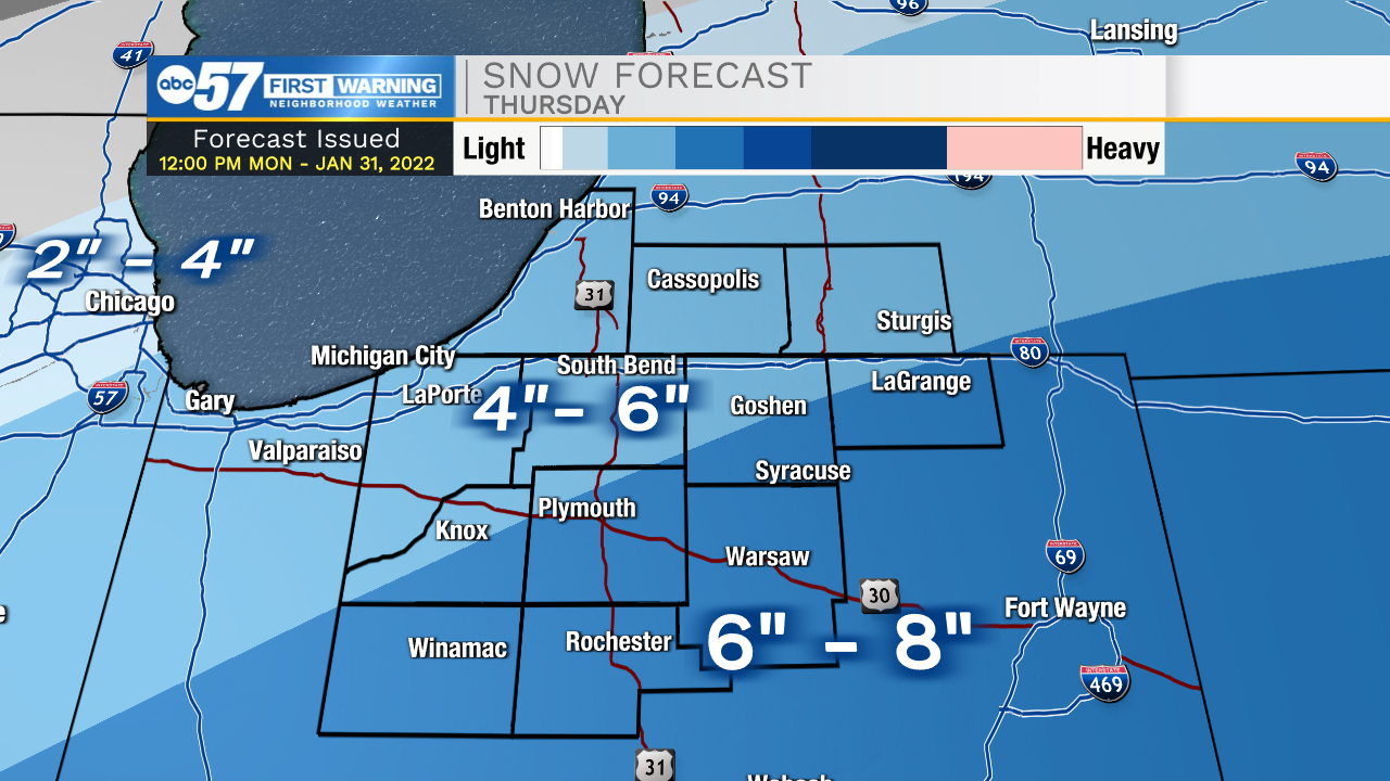
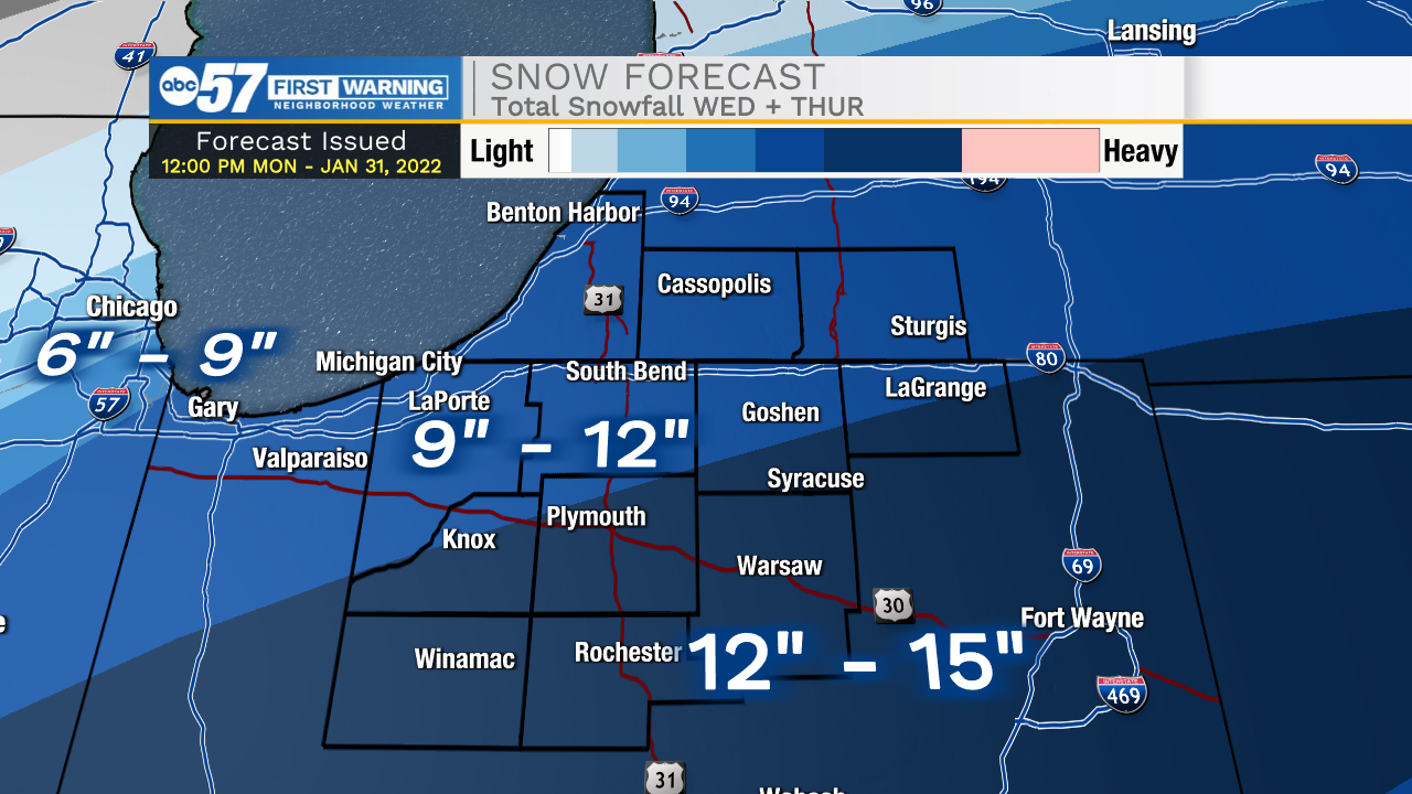
Winter Storm: Widespread heavy snow Wednesday and Thursday


A winter storm will impact the area midweek, with nearly constant snowfall Wednesday and Thursday. Two-day totals will be around one foot for the entire area. Do not overlook the start of this storm, that could be more slick than snowy Wednesday morning and rain changes to snow and temperatures drop. Once the snow starts, it does not look to end until Thursday afternoon and evening, clearing northwest to southeast. There's an added wind and cold factor Thursday that will multiply impacts. CONSIDER CHANGING PLANS TO TRAVEL THURSDAY. Snowfall is likely to tax snow crews heavily, with some rural roads likely becoming impassible. We will dig out Friday with bitter cold weather to end the week.
Tonight: Mostly cloudy. Low 26.
Tuesday: Increasing clouds. Breezy. Rain by evening. High 42.
Wednesday: Snow, all day. High 30.
Thursday: Snow & blowing snow. High