


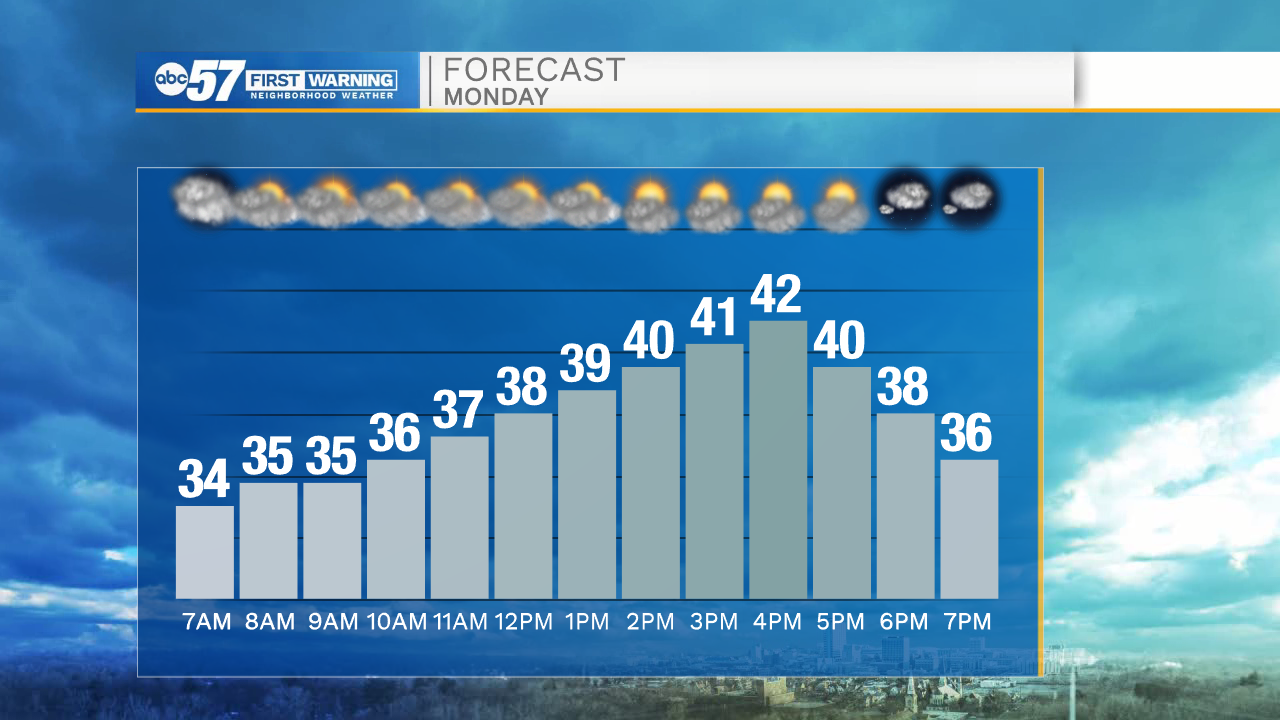
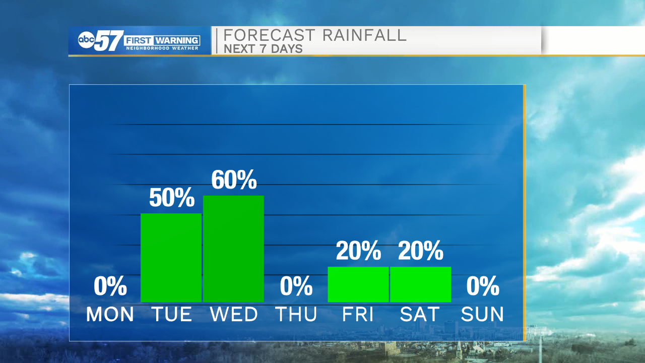
Cloudy skies will remain in place through most of the overnight. Temperatures tomorrow morning will drop into the low to mid 30s. High temperatures tomorrow afternoon will be in the lower 40s. Rain showers and snow mixed will move into Michiana by mid to late morning Tuesday. Right now counties in northwestern Michiana hold the best chance of seeing a dusting of snow. Flurries are possible into central Michiana. After lunchtime Tuesday temperatures will warm a few degrees leaving us with only rain. Showers look to stick around until early evening Wednesday.
Mostly sunny to partly cloudy skies move in just in time for Thanksgiving. Highs Thursday afternoon will be in the lower 50s. The next chance for rain will be Friday night into Saturday.
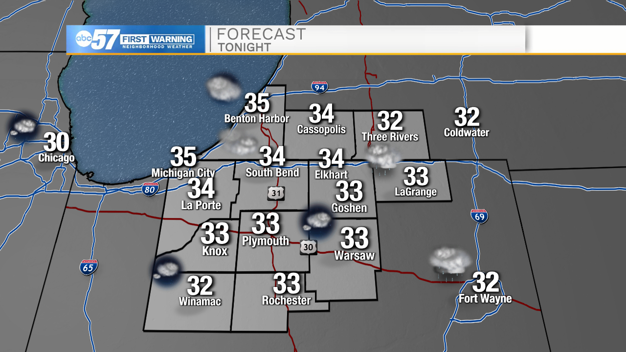
Tonight: Cloudy. Low 34.
Tomorrow: Partly cloudy. High 42.
Tuesday: Rain/snow mix. High 44.
Wednesday: Scattered showers. High 55.