
-
3:41

Present Pillars to host “Dad Strong 5K“ to support fathers...
-
1:44

Warming up through Wednesday
-
2:34

From Niles to South Bend: Jays 2 Keeps the Spirit Alive for basketball...
-
0:46

44th annual Tri Kappa Antique Show boosts charities and scholarships
-
1:48

Scattered showers this evening, Much cooler overnight
-
1:50

Showers and storms this afternoon
-
0:20

One person injured in shooting
-
0:36

Eddies Circuit Robotics holds competition Saturday
-
0:32

21st annual Nappanee Model Train Show
-
0:38

Local boys basketball team headed to IHSAA state finals
-
3:49

Midwest Meowfest brings kitten advocacy to attendees, new homes...
-
1:52

Mild tonight, showers tomorrow

Another round of showers / storms overnight, much of the rain clear before sunrise Wednesday.
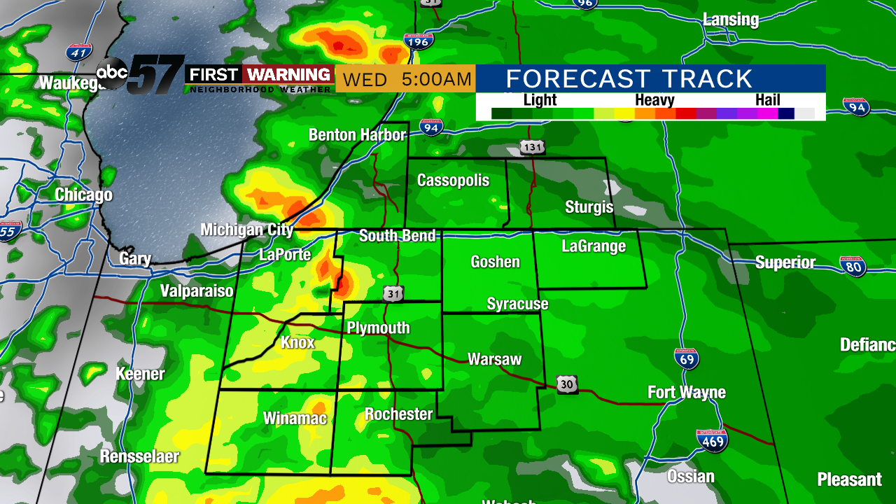
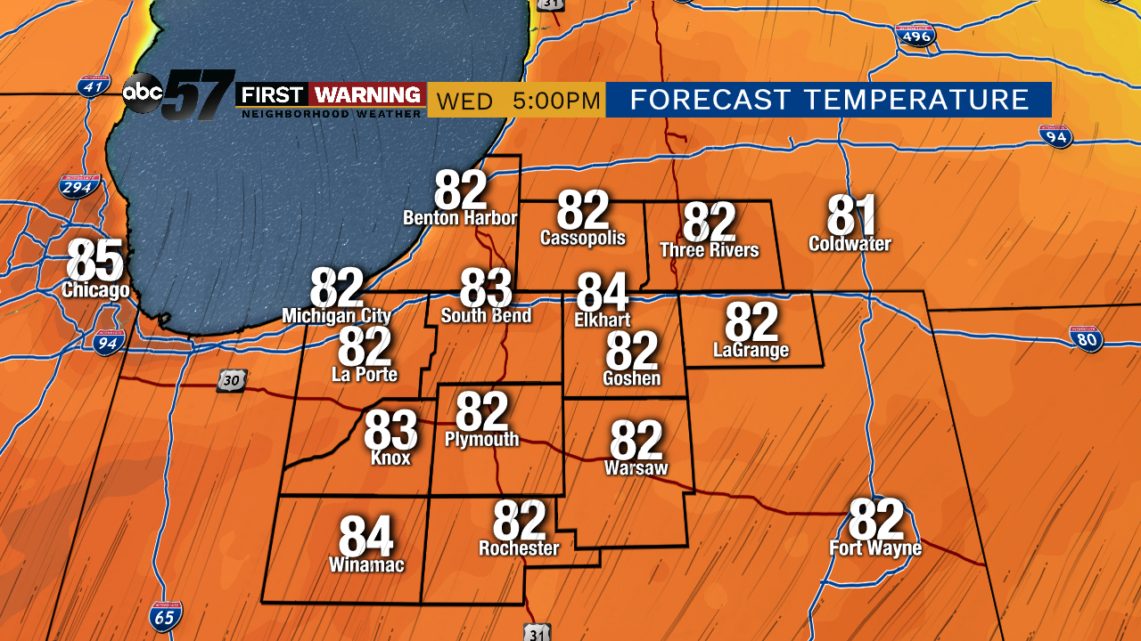
Warm weather returns starting Wednesday and temperatures surge as highs push to 80 by the afternoon and highs stay near 80 through the end of the week. The pattern stays active with at least a chance of rain every day, mostly in the morning through Friday. Scattered showers and storm may become more likely in the afternoon this weekend but overall a pretty standard summer-like pattern for the Memorial Day Weekend.
Tonight: Mostly cloudy with showers returning late. Low of 50.
Wednesday: Early morning showers/storms, then clearing. High of 80.
Thursday: Mostly cloudy with a chance of AM showers/storms, then clearing. High of 78.
Friday: Partly cloudy, high of 82.