
-
1:28

Stormy start to the week
-
0:59

Hot and cloudy today
-
1:03

Calm, warmer out the door
-
0:34

SBPD investigating shooting after walk-in gunshot victim
-
0:37

Tolson Center kicks off soccer season
-
1:37

No. 2 Notre Dame lacrosse defeats No. 1 North Carolina in 10-5...
-
0:53

South Bend celebrates Skilled Trades Day with Rebuilding Together...
-
2:32

Church hosts ‘Possibility Day’ to promote disability inclusion...
-
0:50

Springlike today, hotter tomorrow
-
0:44

A possibly frosty morning
-
1:16

Hundreds gathered at a local Michiana brewery in hopes of breaking...
-
2:45

Ag Days 2026 kicks off Friday at the St. Joseph County Fairgrounds

Temperatures warm back closer to normal by the weekend. Gardeners should still beware, even with the risk of a frost / freeze less likely, the ground/soil temperature is still cold and unfavorable for planting. It's still best to wait until after Mother's Day. There is a chance of showers and thunderstorms Saturday - Saturday night. Currently a severe threat is unlikely, but Saturday evening is the most likely period for rain. Sunday is fair with highs in the mid-60s. Next week's weather is seasonably cool still for early May.
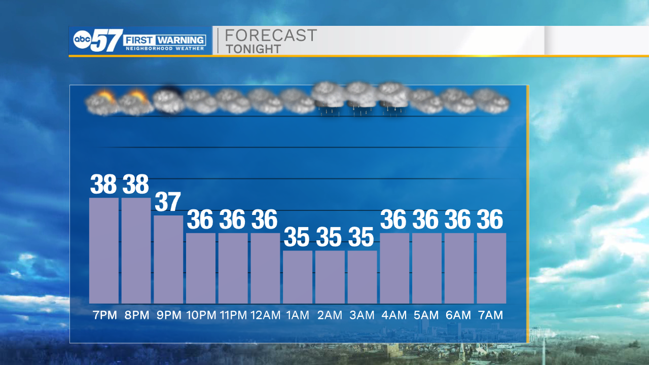
Tonight: Mostly cloudy. Drizzle possible. Low 34.
Thursday: Mostly cloudy. High 54.
Friday: Mostly cloudy. High 64.
Saturday: PM T-storms. High 66.
Sign up for the ABC 57 Newsletter