
-
1:44

Two rounds of storms Monday
-
1:07

Mini heat wave starts out the door
-
2:23

La Porte community rallies for Sammy Strong Benefit, raising...
-
1:57

The Potawatomi Zoo opens its gates to Zoo Nights Live
-
2:50

Carson Kvapil wins his first O’Reilly Auto Parts Series win...
-
1:10

William Tuffs honored as the only Indiana man who took part of...
-
0:50

Beacon Health held a Health and Wellness fair for the community
-
1:03

Warm conditions start overnight
-
1:02

Another pleasant day
-
0:42

Still cooler out the door
-
2:00

New Carlisle celebrates annual Hometown Days
-
1:40

Ross Chastain leads NASCAR O’Reilly Auto Parts Series practice...

A break from snow Friday, sunshine and highs in the 30s will help clear roadways. Saturday will be a snowy day for most. A burst of snow in the morning will bring a widespread two to three inches. Lake effect then ramps-up on the back side of this clipper, brining totals to more than six inches in the lake effect zone. A break Sunday, then another round of snow Monday and Tuesday.
Tonight: Some clearing, low 16. 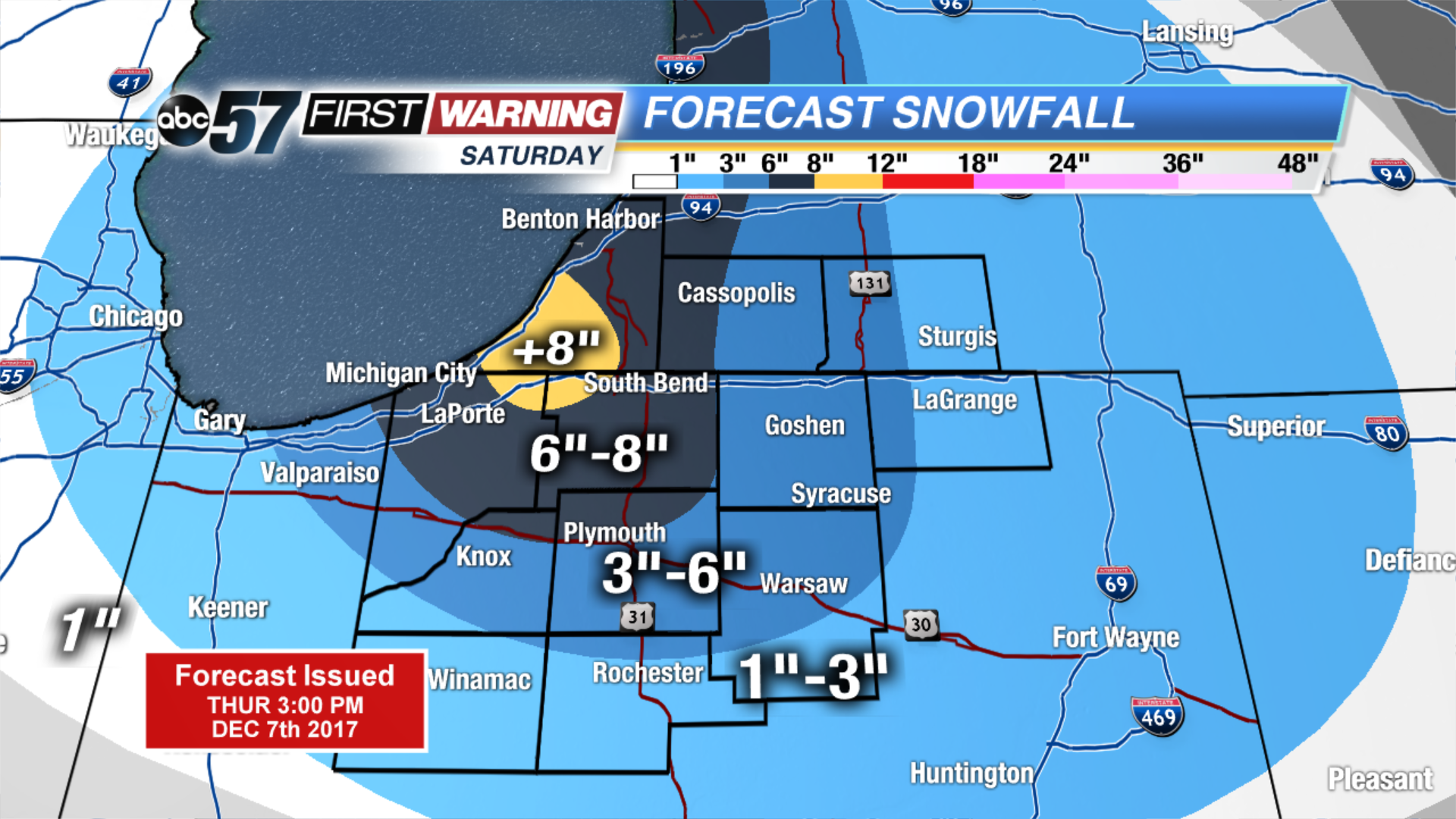 Snowfall forecast through Saturday
Friday: Mostly sunny, high of 32.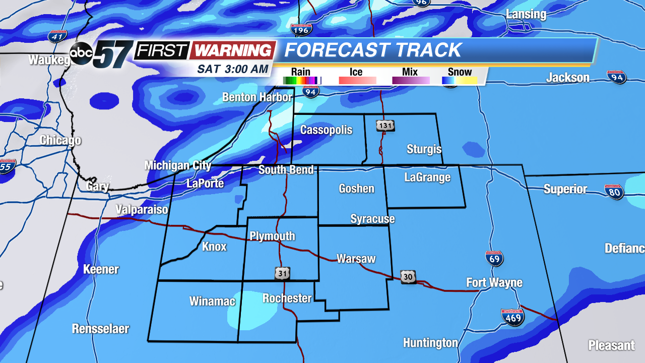 Widespread system (clipper) snow early Saturday, quick 1
Widespread system (clipper) snow early Saturday, quick 1
Widespread system (clipper) snow early Saturday, quick 1
Saturday: Snowy, high of 30.
Sunday: Partly cloudy, high near 30.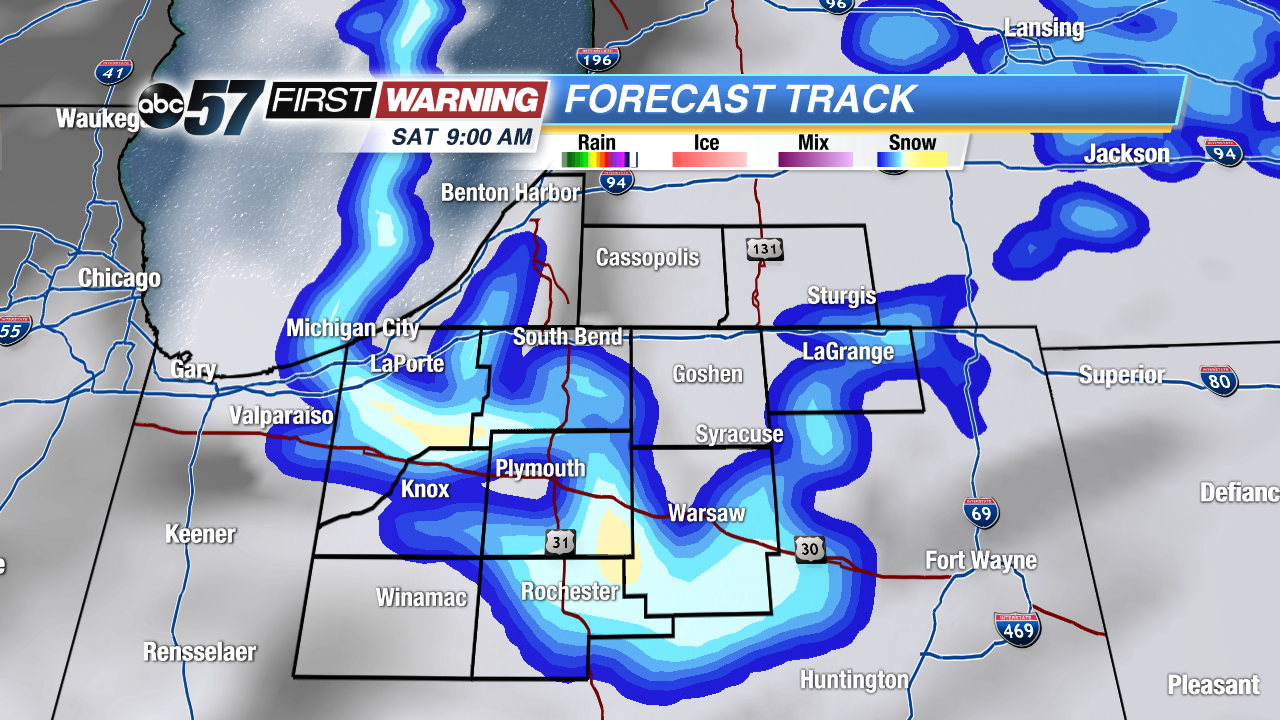 Lake effect snow band(s) set-up bring heavy localized snowfall. +3
Lake effect snow band(s) set-up bring heavy localized snowfall. +3
Lake effect snow band(s) set-up bring heavy localized snowfall. +3