A warm Thursday brings a storm threat by the evening
By:
Tom Coomes
Posted: May 15, 2019 4:36 PM EDT

-
1:33

Cool out the door, Mild by afternoon
-
1:50

Top Ten Snow Year 2025-26
-
1:17

South Bend Cubs unveil fan-focused upgrades ahead of Opening...
-
2:21

Notre Dame Fighting Irish ready for spring football
-
2:06

Fighting Irish using time off to refocus ahead of spring practice
-
2:35

What are the privacy implications of SBPD’s ’Drone as First...
-
1:22

Expert discusses Wednesday’s Fed decision
-
3:19

New legislation could make Michigan the 30th constitutional carry...
-
2:15

SBPD using drones to help improve response time
-
1:20

The March roller coaster ride continues
-
1:52

Snow today, rain tomorrow, and warm this weekend
-
0:49

Celebrating St. Patrick’s Day at Corby’s Irish Pub

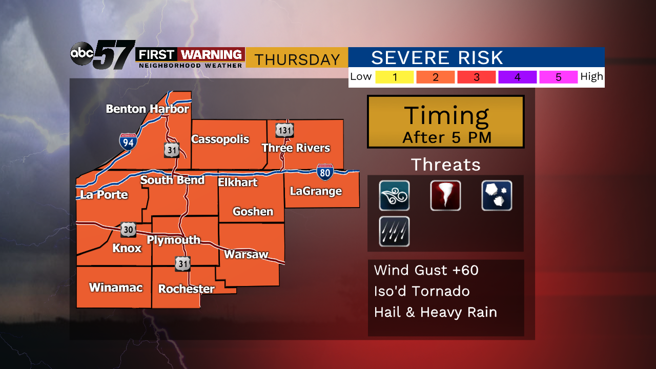
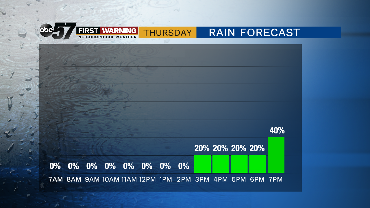
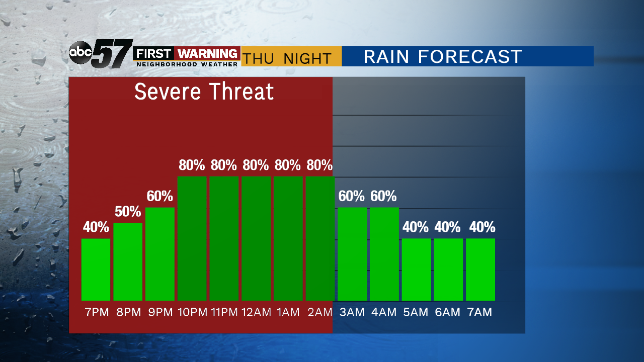
Temperatures continue to rise steadily Thursday with some added humidity, this will fuel thunderstorms Thursday evening into early Friday morning. The peak storm energy and other factors however may not align with arrival of storms from the west. There could be a few isolated severe cells in the evening leading up to heavy downpours overnight. Temperatures swing back-and-forth from mild Thursday, to cool Friday and surge back towards 80 Saturday and Sunday.
Tonight: Mostly clear, low of 52.
Thursday: Partly cloudy, chance of storms increasing, high of 78.
Friday: Morning showers, mostly cloudy, high of 66.
Saturday: Partly cloudy, high of 78.
Sign up for the ABC 57 Newsletter