


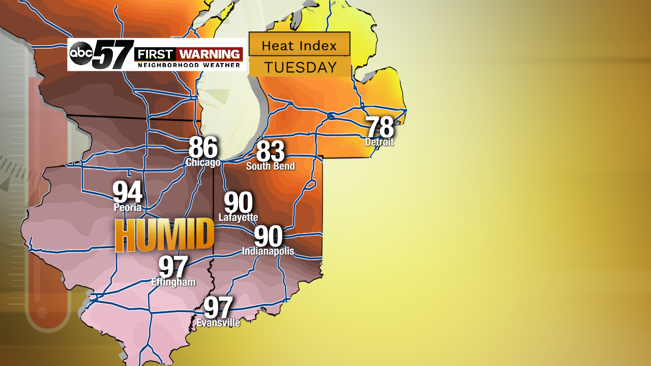
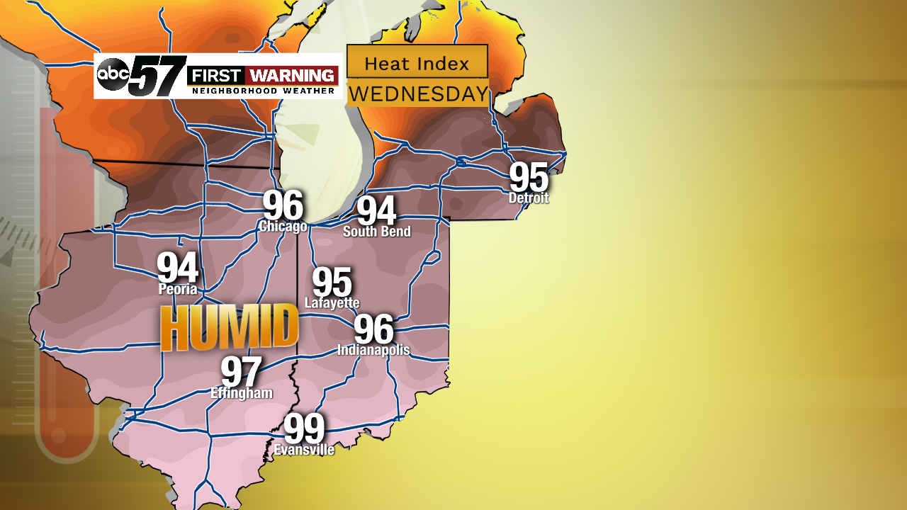
Don't put away the beach umbrella and the swim trunks just yet! There may still be beach opportunities and warm summer temperatures early next week. Another warm front will likely give a boost to our highs in the Tuesday and Wednesday time-frame, along with a uptick in humidity.
 Potential
 Potential
A few of our models are pointing towards that as well, building our feels like temps deeper into the 80s and a couple are extreme enough to go into the 90s early next week.
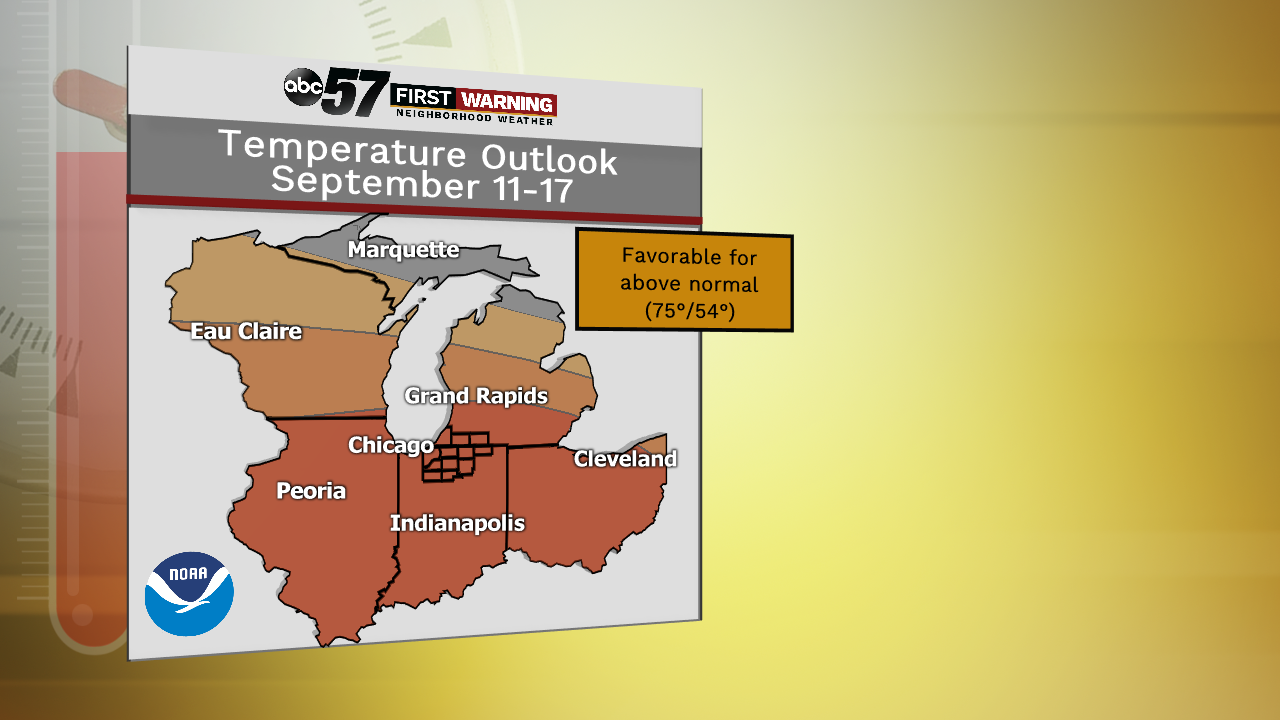 A deeper look into September shows a slightly better chance of above-normal temperatures
Even afterwards, for the rest of next week and through the 17th, temperatures will possibly be around or even slightly warmer than normal for most. So that means that conditions at this point are favorable for highs to stay in the mid to upper 70s and low 80s for the next two weeks before we ultimately start the natural dive back towards the low 70s and even upper 60s by the end of the month.