Another round of lake effect snow


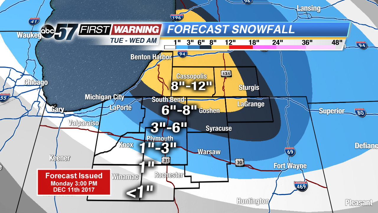
The next lake effect snow event will impact the area through Wednesday morning. In total more than six inches of snow is likely across northern Indiana and southwest lower Michigan. This will impact the morning and evening commute Tuesday and the Wednesday morning drive. Some areas could see up to a foot of snow through early Wednesday. Blowing, drifting and low visibility will add to driving hazards with these lake effect bands as a northwest gusts in excess of 20 mph.
The rest of the week stays snowy and cold with more snow in the forecast Wednesday night through Friday. The weekend we’ll finally get a break with highs above freezing.
Tonight: Lake effect snow developing, mostly cloudy, low 20.
Tuesday: Lake effect snow showers, high 22.
Wednesday: AM snow ending, a lull then more snow late, high of 25.
Thursday: Snow showers, highs in the mid-20s.