
-
1:16

No shortage of sunshine today
-
1:37

Memorial Day parade forecast
-
4:51

Local band ’The Erly’ stops by ABC57 ahead of June 3 performance
-
1:17

VERY foggy first few hours of the morning
-
1:57

A local taste brings New Carlisle community together on race...
-
0:45

Pancakes help raise funds to support the Alzheimer’s Association
-
1:03

Lighter rain expected into the afternoon
-
1:04

Non-severe storms expected
-
1:16

Showers start this morning
-
1:59

Mac & Cheese festival turns Four Winds Field into a kitchen
-
0:45

Michiana Spring Clay tour encourages people to try and take a...
-
2:56

Fresh Cuts, Fresh Starts: Re-Entry Program Gives Back in Elkhart

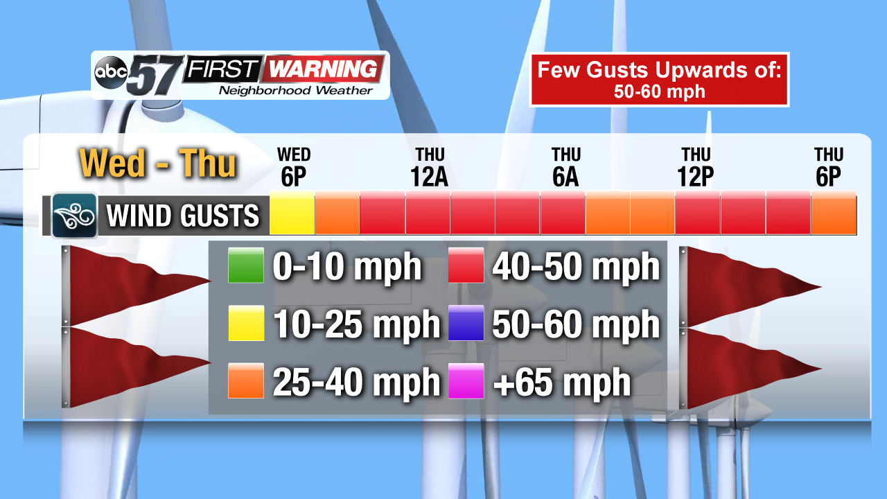
A wet and windy midweek in the forecast. Rain showers start Wednesday and will stay in the forecast off-and-on through Thursday. The wind will increase through Wednesday, with gusts as high as 30 mph and peaking in the 45 to 50 mph range Thursday. Heavier rain showers and even thunderstorms are possible Thursday. Temperatures rise from the 50s into the 60s before falling Friday. The weekend is colder but fair.
Tonight: Cloudy, chance of rain, low of 38.
Wednesday: Scattered showers, becoming breezy, high of 58.
Thursday: Windy, gusts up to 50 mph, rain likely and thunder possible, high of 66.
Friday: Mostly cloudy, chance of snow as temperatures fall from 44.
More on Why It's So Windy
Sign up for the ABC 57 Newsletter