Another storm threat Saturday, then days of sunshine
By:
Tom Coomes
Posted: May 31, 2019 4:50 PM EDT

-
1:08

Notre Dame’s Leonard Moore highlights student success and raises...
-
1:05

Mayflower Bridge set to close beginning April 6
-
0:21

Colfax Avenue eastbound lane closed for water and sewer work
-
0:46

Madison Street closed for lifestyle district project
-
4:11

Non-profit organization provides deep dive into Blackstone, a...
-
1:52

Storms possible overnight, strong storms by Tuesday evening
-
3:48

New partnership aims to help fight food insecurity across Elkhart...
-
2:00

A sunny Monday ahead, rainy almost every other day this week
-
2:59

Dusty May leads Michigan back to Final Four with dominant win...
-
0:37

Vendors and cosplayers showcase art at South Bend Anime Fest
-
3:06

Palm Sunday procession in South Bend unites faiths in call to...
-
0:48

2026 Auto Show brings crowd to Century Center Sunday

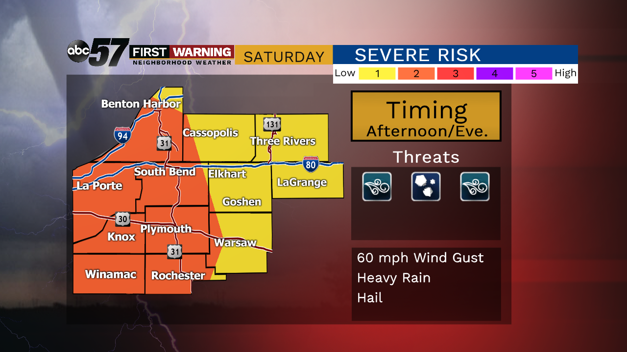
Clouds return Saturday, building along with the chance of showers and storms through the afternoon as a cold front sweeps the area. A line of storms is likely, some could be strong / severe with straight line wind being the greatest threat. Sunday is much cooler, highs in the 60s but sunny. Our first three-day stretch of dry weather since January lasts through Tuesday.
Tonight: A little muggy, fair, low of 64.
Saturday: Scattered showers and thunderstorms in the afternoon/evening. High of 78.
Sunday: Mostly sunny, high of 65.
Monday: Sunny, high of 68.
Tuesday: Mostly sunny, high of 74.
Sign up for the ABC 57 Newsletter